 Environment

Cadao Collective: a taste of heritage
1.
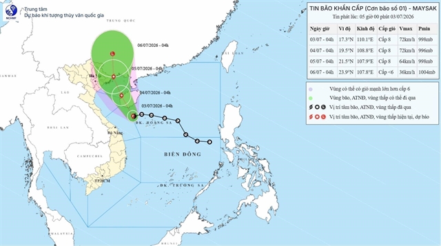 |
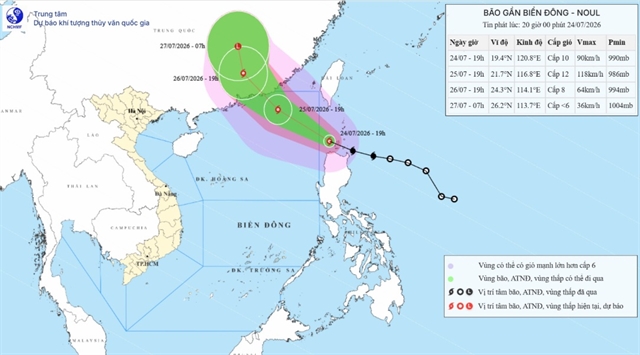
| Moving direction of the first typhoon this year, internationally designated Maysak. — Photo courtesy of the National Centre for Hydro‑Meteorological Forecasting |
HÀ NỘI — The tropical depression over the north‑western area of the Hoàng Sa (Paracel) Special Zone intensified into a typhoon early Friday morning – becoming the first one this year, internationally designated Maysak.
According to the National Centre for Hydro‑Meteorological Forecasting, at 4am on Friday the typhoon centre was about 120km south of Hainan Island (China). Maximum sustained winds near the centre were 62–74km per hour. The typhoon was moving westwards at about 10km per hour.
Forecasts indicate that by 4am on Saturday the typhoon centre will be off the western coast of Hainan Island (China). Disaster warning is at level three (out of five). Affected areas are western sector of the northern South China Sea, including the Hoàng Sa Special Zone.
By 4am the next day, the typhoon centre will be over the sea off Quảng Ninh–Hải Phòng in northern Việt Nam. Disaster warning is at level three. Area affected will be north‑western waters of the Gulf of Tonkin (including the Bạch Long Vỹ, Vân Đồn, Cô Tô, Cát Hải and Hòn Dấu special zones), and the coastal waters from Quảng Ninh to Hưng Yên provinces.
Then, the typhoon is forecast to move over the southern part of Guangxi Province (China) and weaken to a tropical depression, later degenerating into a low‑pressure area.
From Friday night, the Hoàng Sa Special Zone, the Bạch Long Vỹ, Vân Đồn, Cô Tô, Cát Hải special zones and Hòn Dấu Island will experience strong winds of about 61km per hour. Wave heights will be 2-4m, seas very rough. The hazards may capsize, sink or damage vessels and aquaculture cages.
Along the coastal areas of Quảng Ninh, Hải Phòng and Hưng Yên, from Saturday afternoon, winds at areas near the typhoon centre can reach 74km per hour.
Forecasters say the typhoon's impact carries risks of roof damage, uprooted or broken trees and localised flooding. Large waves may cause local inundation at river mouths, tidal flats and low‑lying areas, and may affect dykes, seawalls and coastal works.
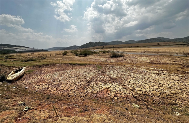
From Friday night until the end of Sunday, the northeast region and Thanh Hóa Province are likely to see heavy to very heavy rain, with totals generally 100–200mm. In the northeastern part of the northeast region 150–250mm, locally exceeding 350mm.
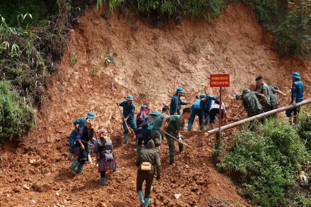
Prolonged heavy rain may cause urban and industrial flooding and inundation of low‑lying areas. It will increase the risk of flash floods on small rivers and streams, as well as landslides in mountainous areas; and will affect transport, agriculture and people’s daily lives.
Local authorities and residents should proactively implement protective measures as directed by competent agencies. — VNS
Environment
 Environment
 Environment
 Environment
 Environment
 Environment
 Environment
 Environment
 Environment
 Environment
 Environment
 Environment
 Environment
 Environment
 Environment