 Environment

NA President calls for high-quality legislation to drive national development
1.
|
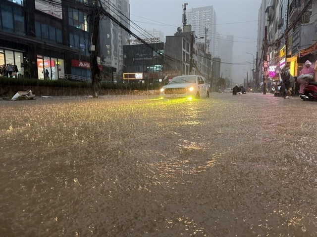
| Heavy rain floods a street in Hà Nội on July 28. — VNA/VNS Photo |
HÀ NỘI — A powerful band of rain swept across the northern region overnight into Tuesday, leaving stretches of the capital underwater and traffic at a standstill, and triggering an overnight rescue of 16 people trapped by flash flooding in the Central Highlands.
Hà Nội sat at the centre of the rain system, with rainfall in Phú Thượng Ward reaching nearly 195mm between Monday and early Tuesday – among the highest totals recorded anywhere in the country.
Other parts of the city were hit nearly as hard: Hai Bà Trưng Ward logged approximately 151mm, Phúc Lợi 114mm, and Ba Đình and Bồ Đề both topped 100mm.
The downpour flooded intersections across the city and snarled traffic through the morning commute.
Rain was just as heavy elsewhere in the north. In Thanh Hóa and Nghệ An Provinces, overnight totals reached 148.6mm in Đô Lương Commune and 122.8mm in Triệu Sơn, while Đồng Việt in Bắc Ninh Province recorded 125mm.
Farther south, the Central Highlands and southern region also saw heavy overnight rain, with a station in Bảo Lộc 3 Ward, Lâm Đồng Province recording 136.6mm and Bom Bo in Đồng Nai Province logging 61.4mm.
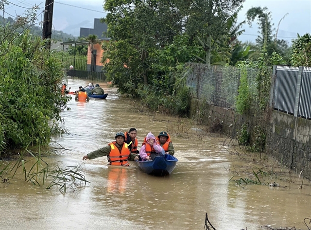
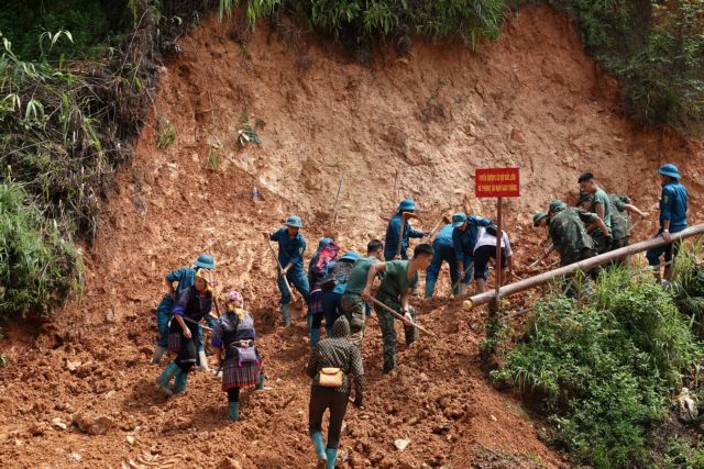
The rain turned dangerous in Bảo Lộc 3, where fast-rising floodwater near a bridge on Xuân Diệu Street trapped 16 people, including elderly residents and young children, as the current grew too swift and deep for them to escape on their own.
|
| Rescue teams wade through floodwaters to bring stranded residents to safety in Bảo Lộc, Lâm Đồng Province. — VNA/VNS Photo |
After receiving the alert, rescue teams rushed two specialised vehicles and 10 officers to the scene. They waded into the swollen current, carrying elderly and immobile residents to safety.
All 16 people were confirmed safe by 9am on Tuesday, with no casualties reported.
At the national level, the Ministry of Construction issued a directive ordering transport, maritime, aviation and railway authorities nationwide to take urgent precautions against flooding, landslides and strong winds.
The order built on earlier guidance calling for safety inspections of transport and construction infrastructure ahead of the rainy season, and directed agencies to mobilise resources to address damage from the current rain event.
Agencies were instructed to station guards at flooded roads and landslide-prone areas, and to bar people and vehicles from crossing where safety could not be guaranteed.
Officials were also urged to keep road and industrial zone drainage systems clear, inspect active construction sites and maintain round-the-clock monitoring, reporting back to the ministry's civil defence command.
Coastal authorities in the central and southern provinces and cities were separately directed to alert ship captains and vessel operators to rough seas and to maintain communication in case conditions worsen.
The ministry also called for expanded public outreach to help residents prepare for flooding, landslides and other storm-related hazards.
The National Centre for Hydrometeorological Forecasting said the northern region and Thanh Hóa could see another 40 to 90mm of rain through Tuesday night, with isolated spots exceeding 200mm.
Thunderstorms carry the risk of tornadoes, lightning and strong gusts, while daytime highs in the region are expected to reach 30 to 32 degrees Celsius, according to forecasters.
The heavy rain over the north is expected to taper off starting Wednesday.
The Central Highlands and southern region are forecast to keep receiving moderate to heavy rain through Wednesday night adding up to anywhere from 50 to 110mm, with isolated totals above 170mm, before conditions ease by Thursday.
The central provinces of Nghệ An, Hà Tĩnh, Huế and the south-central coast were forecast to see lighter, scattered showers of 10 to 30mm on Tuesday, concentrated in the evening and overnight hours, with isolated pockets topping 70mm.
At sea, forecasters warned of strong southwest winds off the coast between Khánh Hòa and HCM City and in the central and southern reaches of the East Sea (internationally known as the South China Sea), with gusts reaching gale force up to force 8 on the Beaufort scale (62-74km per hour) and waves as high as three metres.
Forecasters cautioned that the prolonged rain could cause further flooding in low-lying and urban areas, flash floods on small rivers and streams, and landslides on steep terrain.
The hydrometeorological agency is providing real-time rainfall updates at hymetnet.gov.vn, along with flash flood and landslide risk warnings at luquetsatlo.nchmf.gov.vn. — VNS
Environment
 Environment
 Environment
 Environment
 Environment
 Environment
 Environment
 Environment
 Environment
 Environment
 Environment
 Environment
 Environment
 Environment
 Environment