 Society


Việt Nam, US seek to substantially promote Comprehensive Strategic Partnership
1.
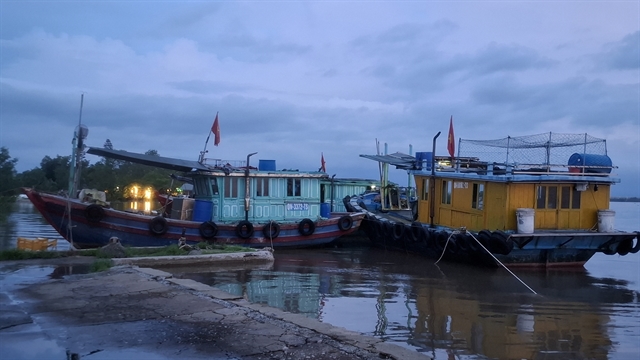 |
| Fishing boats anchor on the Chanh River in Quảng Yên Ward, Quảng Ninh Province, to shelter from the storm. — VNA/VNS Photos |
HÀ NỘI — Deputy Minister of Agriculture and Environment Nguyễn Hoàng Hiệp on Friday urged authorities not to be negligent in responding to tropical storm Maysak, the first of its kind to enter the East Sea this year, stressing that early and coordinated action is essential to minimise losses despite forecasts that the storm is unlikely to be particularly strong.
Speaking at a meeting on measures to cope with the storm and subsequent floods held in Hà Nội and connected online with eight northern provinces and cities, Hiệp instructed the National Centre for Hydro-Meteorological Forecasting to closely monitor the storm and provide timely warnings to ministries, local authorities and the public.
Hiệp, who is also a member of the National Steering Committee for Civil Defence, requested the deployment of inspection teams to Quảng Ninh Province and Hải Phòng City, and urged military, border guard and police forces to assist with evacuations and ensure the safety of vessels and coastal communities.
The official warned against underestimating the storm simply because it is forecast to be of moderate intensity. He instructed localities to ensure no people remain on aquaculture rafts or watchtowers, safeguard fishing vessels and tourists on islands, and prepare for possible flash floods and landslides, particularly in Quảng Ninh, Lạng Sơn, Cao Bằng and Tuyên Quang provinces, where recent heavy rains have saturated the ground. Authorities were also told to strictly control traffic at flooded crossings and hazardous areas.
According to the National Centre for Hydro-Meteorological Forecasting, storm No. 1 is expected to enter the Gulf of Tonkin late on Friday and make landfall between Quảng Ninh Province and China's Guangxi region on Saturday. The most likely scenario, with a probability of more than 70 per cent, is that the storm will move north-northwest across the northern Gulf of Tonkin before heading into southern Guangxi. Coastal areas of Quảng Ninh, Hải Phòng and Hưng Yên could experience winds of force 6-8 with gusts of up to level 10, while the Gulf of Tonkin may see winds of levels 8-9 and gusts of level 11.
Heavy rainfall is forecast from Friday night through Sunday, with 100-200mm expected across northeastern Việt Nam and 200-300mm, or more than 500mm in isolated areas, particularly in Lạng Sơn, Quảng Ninh, Hải Phòng and Bắc Ninh. Forecasters also warned of thunderstorms, strong winds, flash floods, landslides and urban flooding. Rough seas and waves of up to 4 metres are expected in the Gulf of Tonkin and surrounding waters.
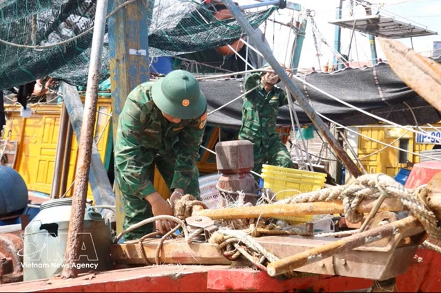
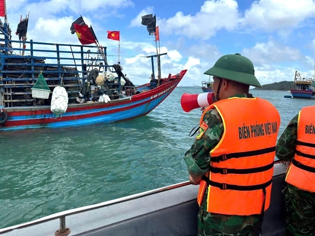
Authorities nationwide have intensified preparedness efforts. Border guard forces have notified more than 56,000 vessels carrying nearly 250,000 people of the storm's path and advised them to seek safe shelter.
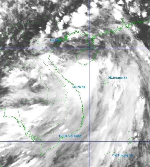 |
| Position of Typhoon No. 1 at 5pm on Friday. |
Ninh Bình and Nghệ An provinces have ordered a sea ban, prepared evacuations and mobilised emergency forces as Typhoon No. 1, Maysak, nears the Gulf of Tonkin.
In northern Ninh Bình Province, the provincial People’s Committee ordered all coastal communes, working with border guards, to halt operations at sea before 2pm on Friday and to ensure all vessels are in safe shelter by 6pm. Authorities instructed officials to relocate people living outside sea dikes and those on nearshore or offshore aquaculture cages and watch huts, prioritising the safety of the elderly, children and other vulnerable groups.
Engineers have been told to activate dyke protection plans and reinforce exposed sea-facing sections, including the Cồn Tròn, Hải Thịnh stretch and the Bình Minh sea dike.
The province directed the agriculture and environment department to coordinate with the hydro-meteorological service for continuous forecasts and warnings, and to keep 24/7 duty rosters.
Military and police units are on standby to assist with evacuations, search and rescue, and post-storm relief, while sectoral departments were tasked with securing maritime and river transport, reservoirs and irrigation works, power and telecoms, and schools, hospitals and industrial facilities.
Provincial media were ordered to push storm updates down to the commune level.
In neighbouring Nghệ An central province, the civil defence command told localities to urgently warn captains, keep boats out of danger zones and ensure safety at anchorages. Authorities are preparing to evacuate residents from areas prone to deep flooding, flash floods and landslides in inland and mountainous districts.
Rapid response teams are being deployed to clear waterways, control traffic at fords, spillways and inundated sections, and bar movement where conditions are unsafe.
Provincial authorities also ordered inspection of small irrigation and hydropower reservoirs and urged protection of agriculture, urban areas and industrial parks vulnerable to waterlogging.
The Bến Thủy coastal radio station and local media were told to intensify broadcasts on the storm’s path and post-storm rainfall to help residents and vessel owners take preventive measures.
Both provinces mandated round-the-clock operations at command centres and regular reporting to their civil defence authorities as the system approaches.
Meanwhile, Hải Phòng City has ordered more than 1,600 fishing vessels to return to port, while Lạng Sơn has activated round-the-clock emergency operations and urged farmers to harvest crops early. — VNS
Society
 Society
 Society
 Society
 Society
 Society
 Society
 Society
.jpg) Society
Society
 Society
 Society
 Society
 Society
 Society
 Society