 Society

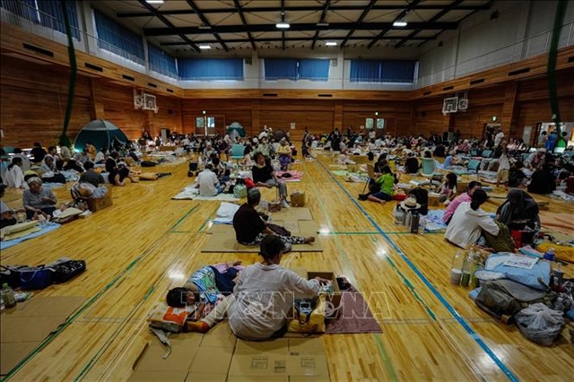
Vietnamese community in Japan gradually returns to normal after earthquake disaster
1.
|
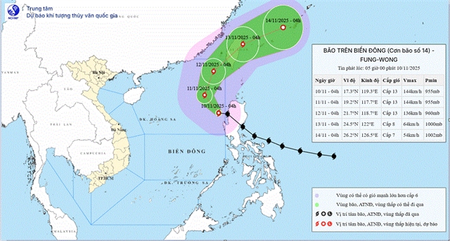
| Typhoon Fung-Wong’s track and intensity as of Monday morning. — Photo courtesy of National Centre for Hydrometeorological Forecasting |
HÀ NỘI — Typhoon Fung-Wong has entered the eastern part of the northern East Sea (internationally known as the South China Sea) early Monday, becoming Storm No.14 of the year with maximum sustained winds at level 13 and gusts reaching level 16.
However, meteorologists say current forecasts indicate it is unlikely to have any significant impact on Việt Nam’s mainland.
The National Centre for Hydrometeorological Forecasting reported that Fung-Wong weakened slightly after crossing the Luzon Peninsula (Philippines).
At 4am, the storm's centre was located over the northern East Sea, moving west-northwest at around 25km per hour.
Unusually, the subtropical high-pressure ridge to the north is weakening and shifting, altering the steering flow that typically directs late-season storms westward toward Việt Nam’s south-central coast. Instead, Fung-Wong is expected to continue tracking northwards. As it reaches higher latitudes, upper-level westerly winds are likely to pull the storm northeast and out of the East Sea.
Over the next 48 hours, Fung-Wong is forecast to maintain strong intensity while gradually curving from west-northwest to north-northeast. By Wednesday, Fung-Wong is forecast to be positioned farther northeast in the East Sea while maintaining strong intensity. It is then expected to weaken as it approaches waters east of Taiwan (China) and continue to dissipate as it moves away.
However, hazardous marine conditions are expected. The eastern part of the northern East Sea may see winds from level 8 to 10, increasing to level 11 to 13 near the storm’s centre, with waves of up to 10 metres and extremely rough seas.
The eastern central East Sea will also experience strong winds, large waves and thunderstorms, with the potential for rotating storm cells and sudden gusts. Authorities are advising all vessels in these areas to maintain communication and take preventive measures.
|
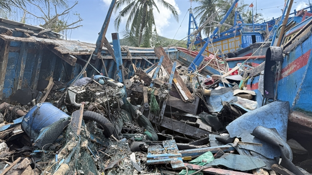
| Fishing boats in Đắk Lắk Province were heavily damaged after the Storm No 13. — VNA/VNS Photo |
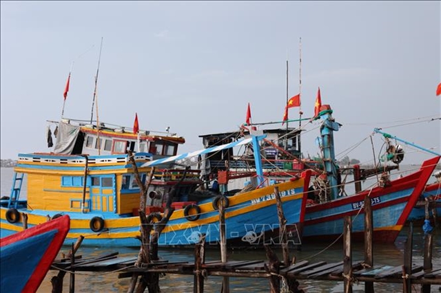
Meanwhile, provinces in the central region and Central Highlands are continuing to deal with the aftermath of Storm No 13.
As of Sunday, 179 vessels had been damaged, more than 57,000 houses were reported damaged or unroofed, and crops and aquaculture areas suffered heavy losses.
Initial economic damage nationwide is estimated at VNĐ7.805,85 trillion (nearly US$297 million).
Deputy Prime Ministers Mai Văn Chính and Hồ Quốc Dũng have travelled to affected areas to visit residents and oversee relief efforts. The Ministry of National Defence has mobilised more than thirteen thousand personnel and hundreds of vehicles to support recovery work, while other ministries have delivered essential supplies and instructed local administrations to restore homes, schools, medical facilities and transport routes as soon as possible.
Coastal provinces from Quảng Ninh to Đắk Lắk have been asked to continue monitoring weather updates, ensure maritime safety and remain prepared for emergency response. — VNS
Society
 Society
 Society
 Society
 Society
 Society
 Society
 Society
 Society
 Society
 Society
 Society
 Society
 Society
 Society