 Society

National conference maps out comprehensive diplomacy at new height
1.
|
| An inundated area in the central province of Nghệ An. — VNA/VNS Photo |
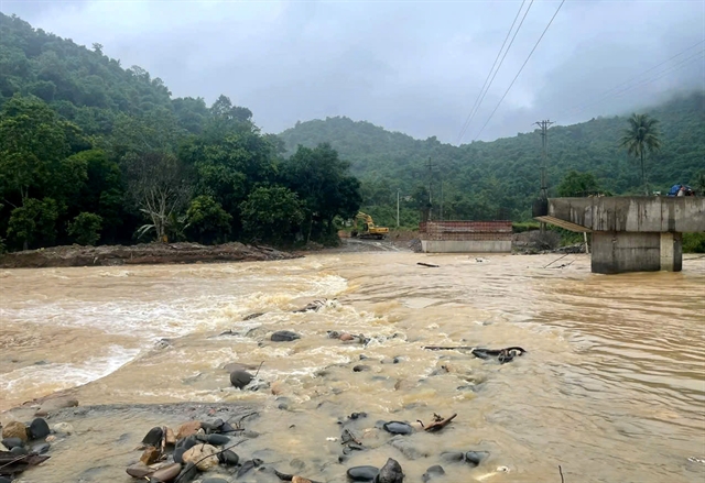
HÀ NỘI — Flooding has damaged over 1,068ha of rice and crops in provinces of Thanh Hóa, Quảng Trị, Đà Nẵng and Quảng Ngãi, while 940 homes have been inundated in Quảng Trị Province.
Flooding in three communes in the northern province of Thanh Hóa affected about 470 households.
In the central province of Nghệ An, flooding over the past three days has caused localised disruption in several areas, cutting off hundreds of households and more than 3,000 people in Tam Thái Commune.
Roads have been damaged, while schools and daily life have been disrupted.
Flooding has also affected 11 national and provincial roads in Thanh Hóa and Quảng Trị, while landslides have occurred at 53 locations in Thanh Hóa, Nghệ An and Quảng Trị.
In the meantime, local authorities and relevant forces have completed the relocation of three barges that became stranded near the Mỹ Chánh railway bridge on the North-South railway line in Nam Hải Lăng Commune in the central province of Quảng Trị.
Flash flood warning
The National Centre for Hydro-Meteorological Forecasting on Wednesday said Sơn La, Lào Cai, Phú Thọ, Quảng Ninh,Thanh Hoá and Nghệ An would continue to experience more rain, with a risk of flash floods and landslides.
Water levels on the Đồng Nai River at Tà Lài Station are forecast to fluctuate slowly over the next 24 hours while remaining above alert Level 1. Việt Nam's flood warning system has three levels, with Level 3 indicating dangerous flooding.
Flooding is also likely in low-lying areas along rivers and in the communes of Đăk Lua, Nam Cát Tiên, Tà Lài, Thanh Sơn and Phú Vinh in the southern province of Đồng Nai and neighbouring areas.
The centre warned that flash floods and landslides could threaten lives, damage infrastructure and disrupt transport and socio-economic activities.
In response to the situation, the National Civil Defence Steering Committee told affected localities to closely monitor weather forecasts and promptly inform residents of potential hazards.
Response forces have been instructed to inspect high-risk areas and proactively evacuate residents living along rivers and streams, in low-lying areas and locations that are vulnerable to flooding, flash floods and landslides.
Authorities have also been urged to clear waterways and ensure local forces are ready to provide timely assistance.
Addressing damage
The Civil Defence Command of Quảng Trị Province said many landslide sites on transport routes have been cleared, although some still require further remedial work.
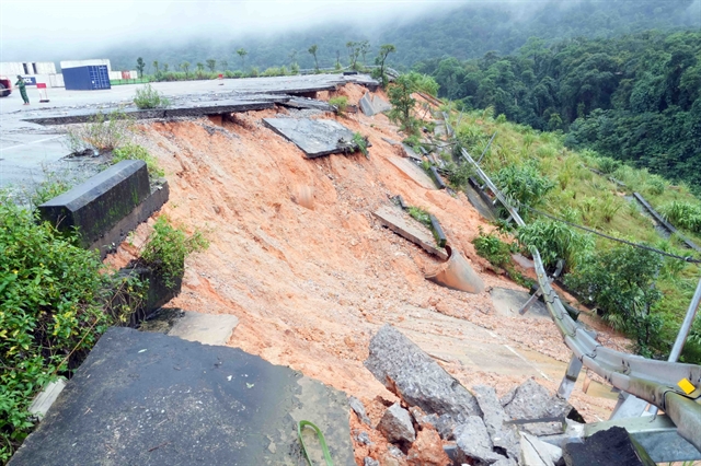
At an area of Cha Lo International Border Gate in Dân Hóa Commune, heavy rain caused about 100m of riverbank embankment to collapse, around 700m from the border gate's national landmark.
The area has limited flat land and is flanked by high mountains, making it particularly vulnerable to landslides during the rainy season.
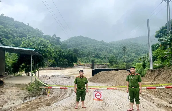
Authorities have installed warning signs and cordoned off the danger zone, while regulating activities at the border gate to ensure safety and maintain immigration and customs clearance.
Nguyễn Quốc Khánh, deputy head of the provincial Economic Zone Management Board, said the border gate's challenging terrain means landslides were a recurring risk, particularly during storm season.
Forces have worked to address landslide sites and regulate traffic through warehouses, storage yards and vehicle routes to maintain business operations. Border authorities have also worked with local businesses to repair roads and deal with landslide damage.
|
| A 100m section of the riverbank embankment near the Cha Lo International Border Gate suffers subsidence and landslides in the central province of Quảng Trị.—VNA/VNS Photo Tá Chuyên |
Prepares for possible flooding
In response to heavy to torrential rain that could trigger flooding on the Hoàng Long and Đáy rivers, the People's Committee of Ninh Bình Province has ordered departments and local authorities to take proactive measures.
Authorities were told to inspect mining facilities, construction sites, small and vulnerable irrigation reservoirs and dyke systems, while maintaining personnel to regulate reservoirs and respond to emergencies.
Inspections and patrols along vulnerable dyke sections must also be strengthened, with any incidents detected and addressed promptly.
A flood is forecast to develop on the two rivers through Thursday, with water levels expected to rise by 1.5-2.5 metres.
Peak levels on the Hoàng Long River are forecast at alert Level 1-2 at Bến Đề and Gián Khẩu hydrological stations, while the Đáy River at Phủ Lý Station is also expected to reach alert Level 1-2. — VNS
Society
 Society
 Society
 Society
 Society
 Society
 Society
 Society
 Society
 Society
 Society
 Society
 Society
 Society
 Society