 Society


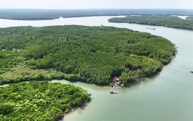
Preparing cooperatives for modern retail
1.
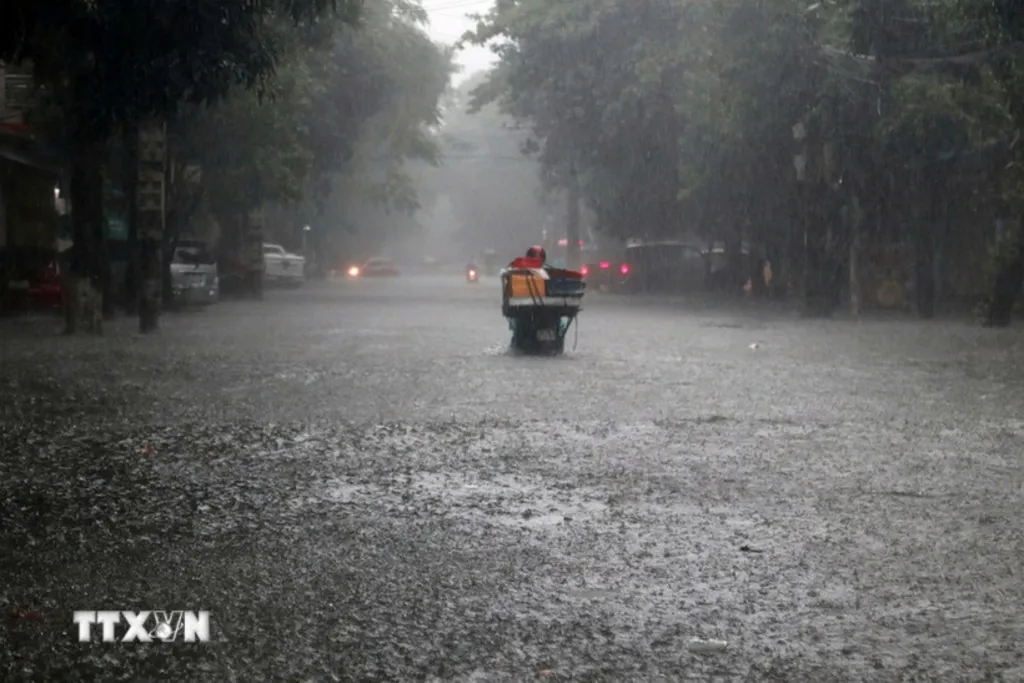 |
| Heavy rain has caused severe flooding on many roads across Nghệ An Province on November 3. VNA/VNS Photo |
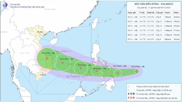
HÀ NỘI — According to the National Centre for Hydro-Meteorological Forecasting, Storm Kalmaegi has intensified and is moving towards the central East Sea.
At 1am on November 3, the storm’s centre was located at around 11.2 degrees North latitude and 129.7 degrees East longitude, over the waters east of central Philippines, with maximum sustained winds of Level 11 (103–117 km/h) and gusts up to Level 14. It is moving westward at about 30 km/h.
By 1am on November 4, the storm is expected to remain over the eastern waters of central Philippines, with winds strengthening to Level 12 and gusts up to Level 15, moving westward at around 20 km/h.
By 1am on November 5, it will be over the western waters of central Philippines with sustained winds of Level 12, gusts up to Level 15, and moving west-northwest at 20–25 km/h. The affected area will include the eastern part of the central East Sea, with a disaster risk level of 3 (extremely dangerous).
By 1am on November 6, Kalmaegi is forecast to reach the central East Sea with maximum sustained winds of Level 13, gusts up to Level 17 (highest level), and continue moving west-northwest at about 20 km/h. The affected area includes the central East Sea, including the Trường Sa (Spratly) Archipelago. The disaster risk level remains at 3.
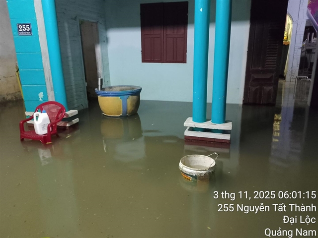 |
| Water rises again in Đại Lộc Commune, Đà Nẵng City early morning November 3. |
Over the next 72–120 hours, the storm is expected to continue moving west-northwest at 20–25 km/h and may strengthen further.
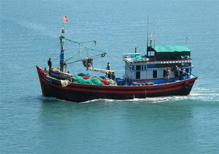
From the afternoon of November 4, strong winds of Level 6–7, later increasing to Level 8–9, are expected in the eastern part of the central East Sea. Near the storm’s centre, winds may reach Level 10–12 with gusts of Level 14–15, causing waves 5–7 metres high and very rough seas.
Between November 5 and 6, the central East Sea (including the Trường Sa Archipelago) and offshore waters from Đà Nẵng City to Khánh Hòa Province are likely to experience winds of Level 12–14, gusts above Level 17, waves 8–10 metres high, and extremely rough seas. All vessels and offshore operations in these areas will be exposed to dangerous squalls, gales, and high waves.
At sea, the Gulf of Tonkin will have northeasterly winds of Level 6–7, gusts up to Level 8, waves 2–3.5 metres high and rough seas. The northern part of the East Sea will have winds of Level 6–7, gusts up to Level 9, and waves 3–5 metres high.
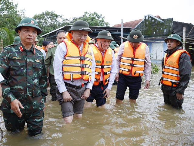
Heavy rains may cause flash floods, landslides and flooding in low-lying areas.
Heavy rain from Nghệ An Province to Quảng Ngãi Province
From early November 3 to late November 4, areas from Hà Tĩnh to Đà Nẵng and eastern Quảng Ngãi are expected to experience very heavy rainfall — 200–300mm on average, and up to 600mm in some places. Areas in Hà Tĩnh Province, the northern part of Quảng Trị Province, and eastern part of Quảng Ngãi Province may see 100–200mm of rain, with localised totals exceeding 350mm.
Floods on the Vu Gia–Thu Bồn river system continued to rise on November 3 and remained above Level 3. Meanwhile, flood levels on the Hương and Bồ rivers stayed just below Level 3 (extremely dangerous).
At 6am on November 3, water levels on major rivers in Huế City continued to rise, reaching or exceeding level 3. The Hương River at Kim Long Station measured 3.54 metres, 0.04 metres above Level 3; the Bồ River at Phú Ốc Station reached 4.50 metres, equal to Level 3; and the Ô Lâu River at Phong Bình Station stood at 2.20 metres. Authorities warned that water levels were increasing rapidly, posing a high risk of flooding and landslides in low-lying and riverside areas.
Floodwaters are expected to recede gradually over the next 12–24 hours but may rise again between November 4 and 5 across rivers in provinces of Hà Tĩnh, Quảng Trị and Quảng Ngãi, with levels reaching or exceeding Level 3 in some areas.
Authorities warn of high risks of flash floods, landslides, and severe flooding in low-lying urban and agricultural areas from Hà Tĩnh Province to Quảng Ngãi Province. — VNA
Society
 Society
 Society
 Society
 Society
 Society
 Society
 Society
 Society
 Society
 Society
 Society
 Society
 Society
 Society