 Society


Việt Nam advances deep processing with first aluminium ingot production
1.
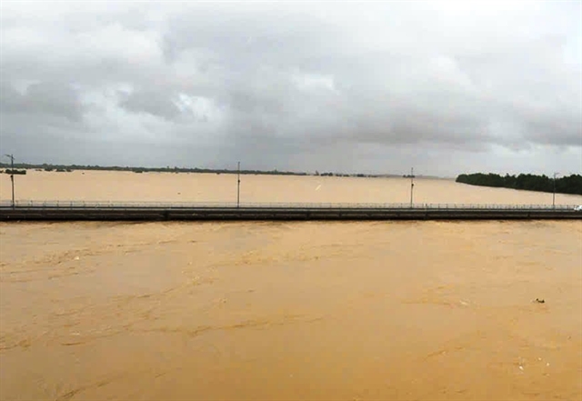 |
| An update from the Central Region Hydrometeorological Station at 3.30am confirmed that at 1am, the river stood at 5.61 metres, or 1.61 metres above the Level 3 flood alert, breaking the 1964 record by 0.13 metres. Photo chinhphu.vn |
ĐÀ NẴNG — The Thu Bồn River in central Việt Nam has reached its highest recorded level in history, surpassing the infamous 1964 flood peak, according to the Đà Nẵng IOC Centre.
At 9pm on October 29, the water level at Câu Lâu reached 5.48 metres, matching the 1964 record. By 2am on October 30, it had peaked at 5.62 metres, exceeding the historic mark by 0.14 metres before beginning a slow recession.
An update from the Central Region Hydrometeorological Station at 3.30am confirmed that at 1am, the river stood at 5.61 metres, or 1.61 metres above the Level 3 flood alert, breaking the 1964 record by 0.13 metres.
Water levels in the upper and middle reaches of the Vu Gia–Thu Bồn river system are now slowly decreasing, while the lower reaches and the Tam Kỳ River continue to rise.
At 1am on October 30, the following levels were recorded:
Over the next 6–12 hours, floodwaters in the upper Vu Gia–Thu Bồn Rivers are expected to recede gradually, while the lower sections are forecast to peak before slowly declining. The Tam Kỳ River is also expected to crest and then fall.
At Câu Lâu, the flood crest is forecast to reach 5.65–5.70 metres, about 0.22 metres higher than the 1964 record, while at Hội An, levels may peak at 3.45–3.50 metres, surpassing the 1964 mark by up to 0.10 metres.
Flooding on the Hàn River in Cẩm Lệ could reach 3.4 metres, 0.9 metres above the Level 3 alert, and the Tam Kỳ River remains above the same threshold.
Within 12–24 hours, floodwaters are expected to recede slowly but remain above Level 3 on the lower Vu Gia–Thu Bồn and above Level 2 on the Tam Kỳ River.
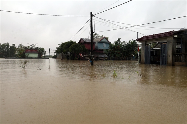
Severe and widespread flooding continues in low-lying and urban areas, including Quế Phước, Nông Sơn, Quế Sơn, Duy Xuyên, Thu Bồn, Xuân Phú, Thành Mỹ, Hội An, Nam Phước, Duy Nghĩa, Điện Bàn, Hòa Tiến, Cẩm Lệ, Hòa Vang and Hải Châu.
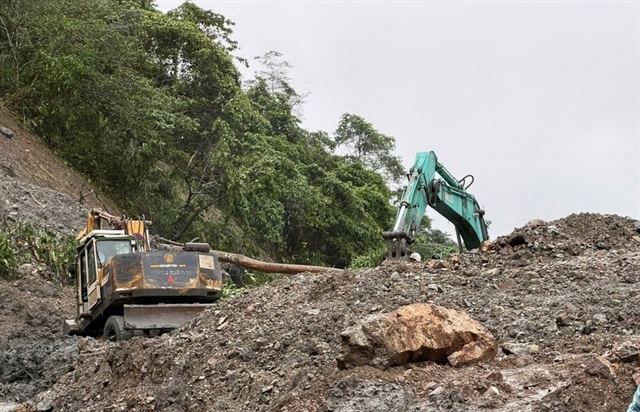
Mountainous areas around Đà Nẵng remain at very high risk of flash floods and landslides, prompting authorities to maintain emergency alerts and ongoing monitoring. — VNS
Society
 Society
 Society
 Society
 Society
 Society
 Society
 Society
 Society
 Society
 Society
 Society
 Society
 Society
 Society
.jpg)