 Life & Style


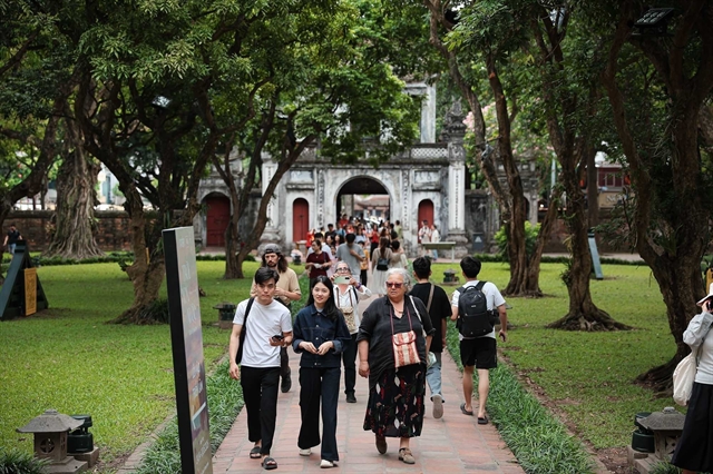
Hà Nội's path to green growth
1.
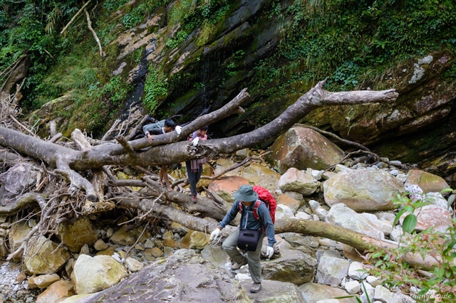
Nam Kang Ho Tao is an unusual name in Việt Nam, but it is a mountain located between the border of two provinces, Lào Cai and Lai Châu, belonging to the Hoàng Liên National Park.
|
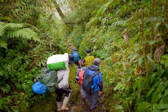
| Mt Nam Kang Ho Tao is considered the most arduous trekking route in the Northwest. — Photo phuotvivu.com |
Lâm Giang
Nam Kang Ho Tao is considered the most arduous trekking route in the northwest due to its complicated and dangerous terrain, but it is also one of the most rewarding routes in Việt Nam.
Nam Kang Ho Tao is an unusual name in Việt Nam, but it is a mountain located between the border of two provinces of Lào Cai and Lai Châu, belonging to the Hoàng Liên National Park.
Nam Kang Ho Tao has an altitude of 2,880m above sea level. It is the 12th-highest mountain in Việt Nam. Its peak belongs to sub-zone 303 A, Hoàng Tha Thầu Mountain in Tả Trung Hồ Village, Bản Hồ Commune, Sa Pa District.
This is a dream destination of adventurous backpackers because of the difficulty and wild beauty of the mountains. It is surrounded by majestic natural scenery mixed with poetic features with waterfalls and vast green forests.
|
| Mt Nam Kang Ho Tao trekking route is arduous and difficult to conquer. — Photo sgtiepthi.vn |
Since 2017, Nam Kang Ho Tao has been known to backpackers and Pu Si Lung Mountain has become the most difficult mountain to conquer in the northwest because of its long distance, many steep cliffs and fierce streams.
People who conquer Nam Kang Ho Tao usually follow the direction through Thào A village, Tân Uyên District, Lai Châu and then return to the old route or go in the direction of Lai Châu and return to Tả Van road.
Although we know that conquering Nam Kang Ho Tao is a big challenge, we are still determined to conquer to be once standing from the top of Nam Kang Ho Tao, overlooking the distant horizon, bathing in the sea of clouds and most importantly, the feeling of conquering your own limits.
|
| A tourist enjoying the moment during the journey to conquer Mt Nam Kang Ho Tao. — Photo laichau.gov.vn |
We arrived at Bản Hồ Commune at 9am to start our journey with the route going from Bản Hồ to Đá Stream. It is quite long and has about 4km with a gentle slope through many inhabited areas and thin forests.
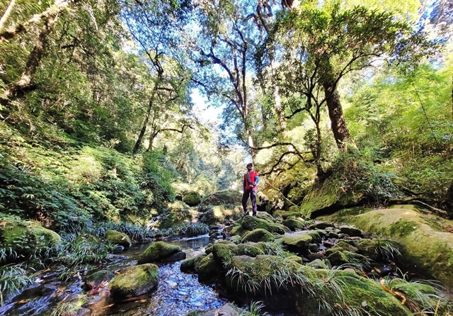
After a few hours of climbing and resting, we came to Đá Stream - the largest in the Northwest. The stream is wide, and the water current is fast. The porters guided our team to cross the stream by wearing quick-drying shoes, not barefoot, because it is easy to fall on slippery rocks.
After that, we reached Shack 1, built next to the stream and took a break for lunch.
|
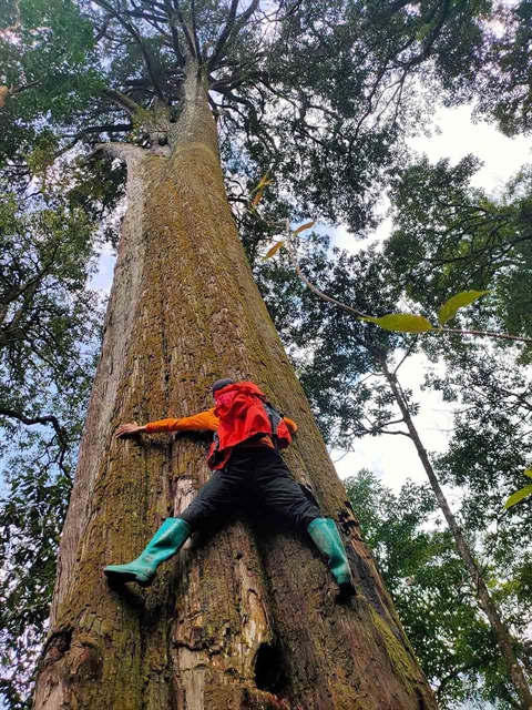
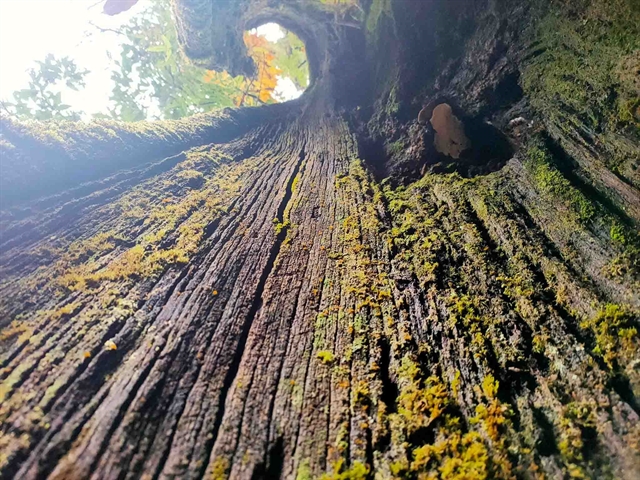
| An old tree in the forest during the journey to conquer Mt Nam Kang Ho Tao. — Photo sgtiepthi.vn |
After the lunch break, we went through two big waterfalls, including Bay Waterfalls, to reach the longest and steepest slope of the route. The slope is so long that everyone has to crawl and cling with two hands to climb. Fortunately, the weather that day was quite cool, and we trekked under the canopy of the primary forest, so it only took about two hours to cross the slope.
At around 5.30pm, we arrived at Shack 2 to rest and have dinner to prepare for the next day to conquer Mt Nam Kang Ho Tang.
While the porters prepared dinner, we took advantage of the spring bath after a hard day of trekking. Cold spring water helped our bodies recover quickly.
After dinner, everyone went to bed to save energy for the next day.
At 6.30am, we started the second day's journey. We passed through the primaeval forest, old forest, and green vegetation and enjoyed a pleasant feeling in the fresh, pure air and welcomed the sunrise on the mountain.
In this stretch, we could see azaleas, wildflowers and mosses basking in the morning sun.
We trekked slowly, walking while looking around on both sides of the route to be able to see all the beauty of this trekking route. At that time, we realized that our path turned out to be strangely poetic.
|
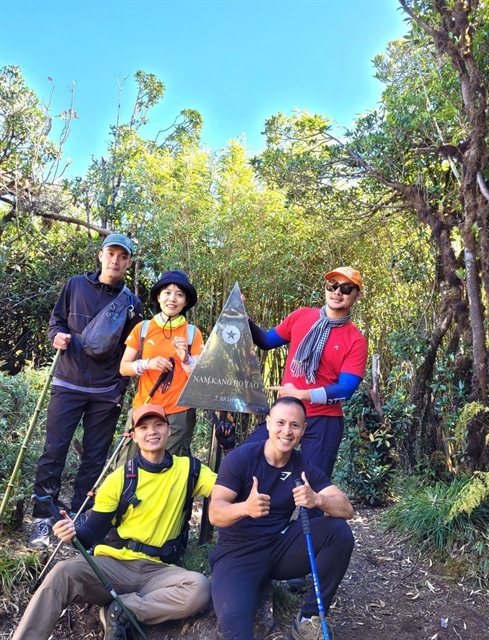
| Tourists celebrate conquering Mt Nam Kang Ho Tao. — Photo laichau.gov.vn |
After taking a break for lunch, we reached Yên Ngựa Pass - the fork to divide the way to Lào Cai and Lai Châu and Mt Nam Kang Ho Tao. Experiencing the steep slopes, we also got our hands on the stainless steel summit marker of the mountain.
Reaching the top, we hugged each other and felt extremely happy because this was the place for us to challenge ourselves, in addition to admiring the wonderful nature.
We went back to Shack 2 to pack up, then moved down to Shack 1 immediately because we were afraid it would rain, and we might get stuck because of the rising spring water. We had dinner and overnight here to go down the mountain the next morning.
Mt Nam Kang Ho Tao is a beautiful mountain trekking route with great exploitation potential, and high biodiversity, suitable for building a new eco-climbing route and tourist destination towards sustainable green tourism. VNS
|
| An old tree at Mt Nam Kang Ho Tao. — Photo sgtiepthi.vn |
Life & Style
 Life & Style
 Life & Style
 Life & Style
 Life & Style
 Life & Style
 Life & Style
Medea is one of the most popular works by playwright Euripides from the 5th century BCE. Based on a mythological background, the play focuses on the final part of Medea and Jason’s marriage, which is catastrophic for the couple alone and their families.
 Life & Style
 Life & Style
 Life & Style
 Life & Style
 Life & Style
 Life & Style
 Life & Style
 Life & Style