 Environment

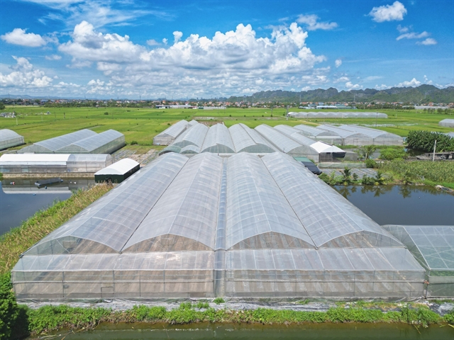
Stavian Industrial Metal supports commercial launch of Việt Nam's first primary aluminium ingots
1.
|
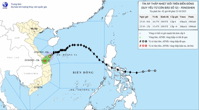
| Path of the tropical depression. — Photo courtesy of National Centre for Hydro-Meteorological Forecasting |
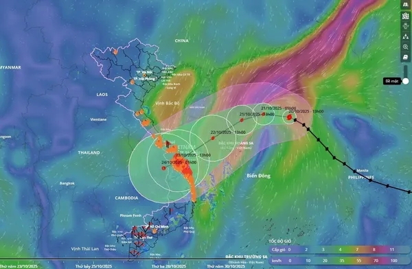
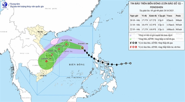
HÀ NỘI — Storm No. 12, or Typhoon Fengshen, has weakened into a tropical depression, but it will bring heavy rain, strong winds and high waves to the central region from Quảng Trị to Quảng Ngãi Province.
At 1am on Thursday, the tropical depression’s centre was located near 16.3 degrees North latitude and 109.0 degrees East longitude, about 80km east-northeast of Đà Nẵng, according to the National Centre for Hydro-Meteorological Forecasting.
Maximum sustained winds reached level 6 (39–49km per hour), with gusts up to level 8. The system is moving southwest at 10–15km per hour and is expected to make landfall between Đà Nẵng and Quảng Ngãi later on Thursday before weakening into a low-pressure zone.
Coastal waters from Quảng Trị to Quảng Ngãi, including Cồn Cỏ, Lý Sơn and Cù Lao Chàm islands, are experiencing rough seas with waves up to four metres and strong winds of level 6, gusting to level 8. Disaster risk level 3 has been issued for these areas.
Due to the combined effects of the tropical depression and a cold air mass, tides along the coast from southern Quảng Trị to Đà Nẵng may rise by 0.3 to 0.6m, increasing the risk of coastal flooding, erosion and road inundation.
Until Friday, the central region from Hà Tĩnh to Quảng Ngãi is forecast to experience heavy to very heavy rain, ranging from 100–200mm, and over 300mm in some areas.
Particularly, southern Quảng Trị to Đà Nẵng could receive 200–400mm of rain, with local totals above 700mm.
Rainfall may exceed 150mm within three hours in some areas. The downpours are expected to persist until the end of October, posing a high risk of flash floods, landslides in mountainous regions, and flooding in low-lying or urban areas.
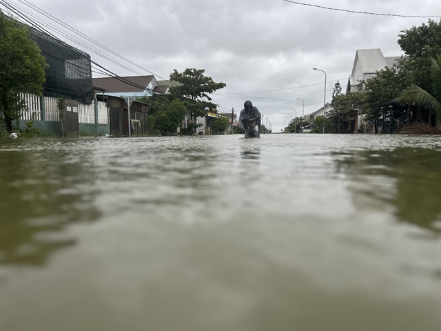
|
| Heavy rain causes flooding in many areas of Huế City. — VNA/VNS Photo |
Local authorities have been urged to ensure the safe operation of hydropower and irrigation reservoirs, and to prepare for rising river levels, which may reach alert levels 2 to 3 or higher.
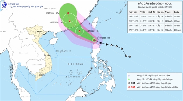
Another potential storm
A separate tropical depression has also formed near the East Sea.
As of early Thursday, it was located at 21.0 degrees North latitude and 122.4 degrees East longitude, with maximum winds of level 7 (50–61km per hour), gusting to level 9.
The system is moving south-southwest at 10–15km per hour and may enter the northern East Sea on Friday before weakening near the Hoàng Sa (Paracel) Archipelago.
Between 4:50am and 9:50am on Thursday, continuous rainfall was recorded from Hà Tĩnh to Đà Nẵng, averaging 5–20mm, with some areas exceeding 50mm.
The weather agency has warned of a high risk of flash floods and landslides in mountainous areas and along slopes.
Local authorities have been instructed to monitor flood-prone areas, reinforce weak slopes, and stay ready to respond as heavy rains continue to pound the central region. — VNS
Environment
 Environment
 Environment
 Environment
 Environment
 Environment
 Environment
 Environment
 Environment
 Environment
 Environment
 Environment
 Environment
 Environment
 Environment