 Environment
.jpg)
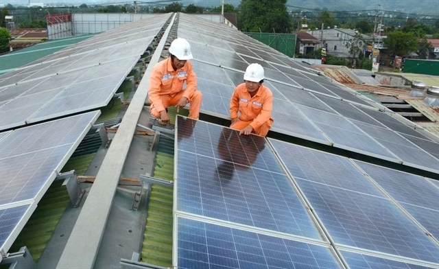
Vietnam Airlines expands forest restoration programme with 72-hectare target
1.
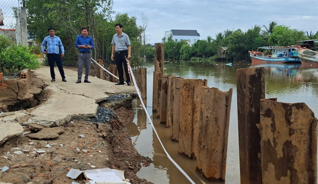 |
| An eroded site along the April 30 Canal in Bạc Liêu City’s Nhà Mát Ward in Bạc Liêu Province. — VNA/VNS Photo |
HCM CITY — Local authorities in the Cửu Long (Mekong) Delta are tightening various measures to protect residents and land from erosion, as such incidents are increasing during the ongoing rainy season.
The delta, the country’s largest producer of rice, fruit, and seafood, has faced increasing riverbank and coastal erosion in recent years, especially during the rainy season.
The primary cause of erosion in the delta is a lack of sediment and sand in riverbeds, leading to bottom scouring and destabilised banks, according to experts.
Natural factors and human activities, including illegal sand mining and the building of upstream hydropower dams on the Mekong River, have reduced sediment and sand levels in rivers and canals, they said.
Since early May, An Giang, Hậu Giang, Trà Vinh, Sóc Trăng, and Bạc Liêu provinces, as well as Cần Thơ City have recorded dozens of erosion cases that have damaged houses, property, roads and crops.
An Giang alone recorded four erosion cases in Chợ Mới and Châu Thành districts from May 18-25, seriously threatening the safety of local residents, according to its Department of Agriculture and Environment.
One case occurred at Ông Chưởng Canal along Provincial Road 946 in Long Điền B Commune in Chợ Mới District on May 18, eroding a 70-meter-long, 5-6 meter-wide section of the canal, damaging 10 houses and causing an estimated VNĐ2 billion (US$77,000) in losses.
Cù Minh Trọng, Chairman of the Chợ Mới District People’s Committee, said that after the occurrence of erosion cases, the district promptly evacuated residents and their properties from dangerous areas, installed barricades and warning signs, and conducted on-site assessments to determine the extent and risk of further erosion.
An Giang, an upstream province of the Mekong Delta, has a dense network of rivers and canals. Many of these waterways have sharp bends and weak soil foundations, making them highly vulnerable to erosion, especially during heavy rains.
The province has recorded 13 erosion cases along rivers and canals, totalling 639m in length and affecting 20 houses so far this year, according to its Department of Agriculture and Environment.
Nguyễn Thị Minh Thúy, deputy chairwoman of the An Giang People’s Committee, said the province has instructed relevant departments and agencies to conduct reviews and identify areas at risk of erosion, including extremely dangerous areas under special warning from the Department of Agriculture and Environment.
Based on the findings, the province will set up plans to evacuate people and property from dangerous areas, she said.
The province will strictly enforce regulations related to irrigation, dykes, and natural disaster prevention, she said, adding that this includes taking action against violations such as illegal sand mining in canals and rivers, the construction of houses or structures encroaching on the protected riverbank and canal zones, and activities that obstruct water flow or increase the risk of erosion.
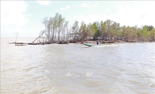 |
| Vàm Lũng estuary area in Tân An Commune in Cà Mau Province’s Ngọc Hiển District. This area was declared by the province People’s Committee to be in a state of emergency due to coastal erosion since August 2023. – VNA/VNS Photo Huỳnh Anh |
Declaring erosion emergencies
Trà Vinh and Sóc Trăng provinces have declared erosion emergencies in several areas.
Last month, the Trà Vinh People's Committee declared a state of emergency following the collapse of a dyke section along the coast of Duyên Hải Town’s Hiệp Thạnh Commune, and severe erosion at the mouth of the Trà Cú River in Trà Cú District’s Lưu Nghiệp Anh Commune.
It has instructed local authorities of Duyên Hải Town and Trà Cú District to urgently coordinate with relevant agencies to implement immediate response and recovery measures to minimise damage.
In Sóc Trăng Province, the Department of Agriculture and Environment has reported that urgent efforts are underway to address six critical erosion areas along both the left and right embankments of the Hậu River in Cù Lao Dung District.
These six erosion areas, totalling approximately 350m in length, are located in An Thạnh Đông and Đại Ân 1 communes. They are home to 255 households and pose a serious threat to more than 365ha of agricultural land.
Bạc Liêu Province has experienced incidents of erosion and land subsidence every year, particularly along rivers and the eastern coastal dykes. The situation has worsened since 2023, with riverbank and coastal erosion becoming increasingly severe.
The province’s eastern coastal areas, especially in Biển Đông A Hamlet in Bạc Liêu City’s Vĩnh Trạch Đông Commune, have become a hotspot for serious coastal erosion.
Nguyễn Văn Mến, a local resident, said: “Every year, the sea encroaches further into the land, causing many sections of the sea dyke to become dangerously eroded.”
He and many other local people live in a constant state of anxiety, worried about the fierce waves battering the dyke and the safety of their land and homes, he said.
Bạc Liêu has 77 areas affected by riverbank erosion and six areas of coastal erosion, with a total eroded length of 600km.
Ngô Nguyên Phong, deputy director of the Bạc Liêu Department of Agriculture and Environment, said the province has implemented numerous coordinated measures to prevent and effectively address violations within the protective corridor of the eastern sea dykes.
The department is working closely with local authorities to carry out regular inspections and monitor both the condition of the dykes and any breaches of regulations, he said.
Bạc Liêu has proposed that the central Government provide financial support of VNĐ3.4 trillion ($130 million) to implement projects in areas facing severe and urgent erosion, as well as to tackle tidal flooding and protect agricultural production. — VNS
Environment
 Environment
 Environment
 Environment
 Environment
 Environment
 Environment
 Environment
 Environment
 Environment
 Environment
 Environment
 Environment
 Environment
 Environment