 Society

When the unknown are known again
1.
A tropical low-pressure system has gained strength and become a tropical storm as of Tuesday morning.
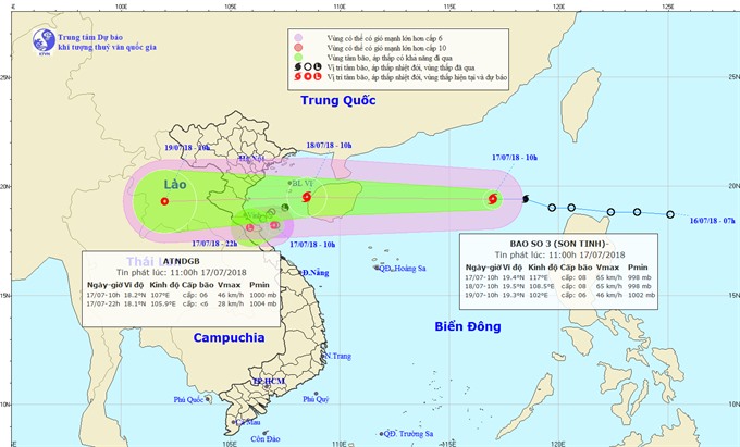 |
| The direction of storm Sơn Tinh.—Photo nchmf.gov.vn |
HÀ NỘI — A tropical low-pressure system has gained strength and become a tropical storm as of Tuesday morning.
The storm is internationally named Sơn Tinh. It is the third tropical storm to hit the East Sea this year, said the National Centre for Hydro-meteorological Forecasting.
The storm is quickly moving west at 35 km per hour. By 10am on Wednesday morning, the storm will be 270km to the east of the coast from Hải Phòng to Hà Tĩnh Province with the strongest winds near the storm’s eye reaching 75km per hour.
Due to the storm, seas were rough and thunderstorms appeared in the northern part of the East Sea, including Hoàng Sa (Paracel) Archipelago.
In response to the situation, Thanh Hóa Province’s Steering Committee for Natural Disaster Prevention and Control and Search and Rescue ordered relevant agencies to inform all offshore vessels about the storm developments so that they could find a safe shelter.
By 8am on Tuesday morning, over 7,500 vessels were told about the storm, the committee said.
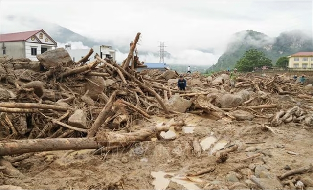
The local administration also dispatched teams to check and ensure the safety of the local dyke systems and evacuate local residents living in areas at high risk of landslides and flash floods to a safe place.
In another movement, torrential rains triggered by the influence of the inter-tropical convergence zone combined with a subtropical ridge, poured down along the coast of northern delta provinces, Hòa Bình Province and localities from Thanh Hóa to Quảng Bình late on Monday night.
By 1am on Tuesday morning, the common rainfall was measured to be about 70mm. However, the rainfall was higher in some areas, such as 97mm in Nghệ An Province’s Quỳnh Lưu District, 88mm in Nghệ An Province’s Đô Lương District and up to 134mm in Hà Tĩnh Province’s Linh Cảm District.
Torrential rains are predicted to continue hitting Hòa Bình, the northern delta provinces and localities from Thanh Hóa to Thừa Thiên Huế until Friday.
The centre warned that water levels could rise by two to five metres upstream of the Hồng (Red) – Thái Bình river system and waters could swell by three to eight metres in upstream rivers from Thanh Hóa to Quảng Trị between Tuesday and Friday.
Provinces of Hòa Bình, Sơn La, Lai Châu, Điện Biên, Lào Cai, Yên Bái, Tuyên Quang, Quảng Ninh, Thanh Hóa, Nghệ An, Hà Tĩnh and Quảng Bình are on high alert for landslides and flash floods.
In the meantime, low land areas and urban areas of provinces of Hải Dương, Hà Nam, Nam Định, Ninh Bình, Thái Bình, Hòa Bình, Hà Nội and localities from Thanh Hóa to Quảng Bình are advised to be ready for inundation, the centre said. — VNS
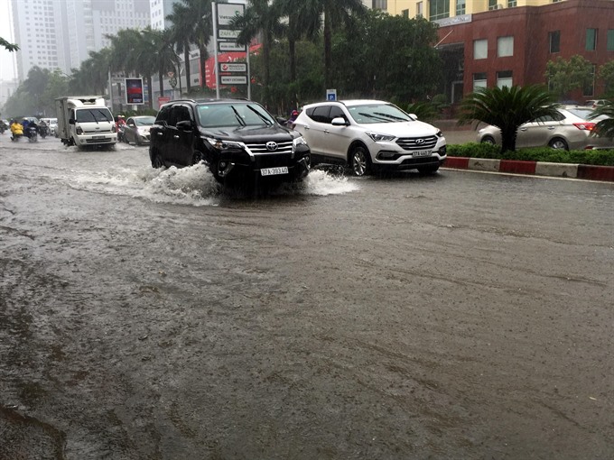 |
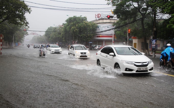
| Vehicles traverse an inundated section of a local road in Nghệ An on Tuesday morning. — VNA/VNS Photo Tá Chuyên |
Society
 Society
 Society
 Society
 Society
 Society
 Society
Taxis that calculate fares via apps like Grab would be required to place a lightbox with the words “Electronic Taxi” on their car, while contract-based cars that drive for Grab and similar companies would need a lightbox that says “Electronic Contract-based Vehicle” under a proposal by the Ministry of Transport.
 Society
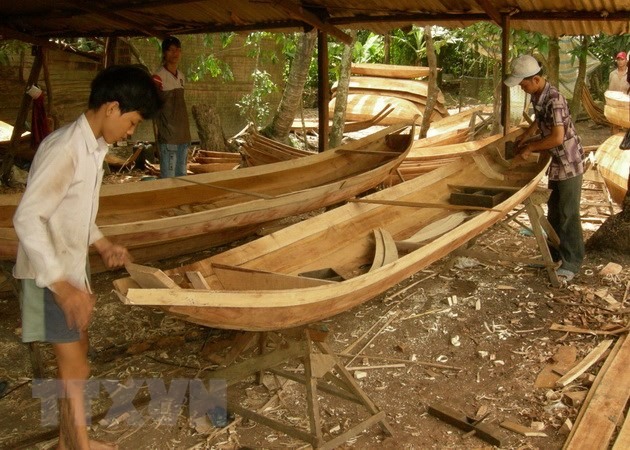
The Cửu Long (Mekong) Delta province of Đồng Tháp plans to expand the scale of six famous craft villages to serve tourism needs and preserve traditional crafts.
 Society
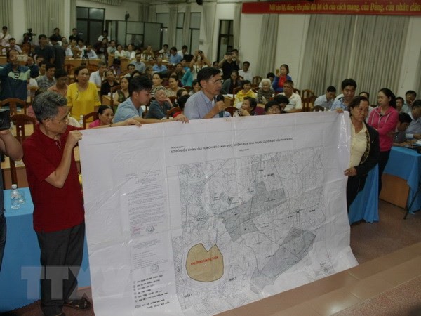
Secretary of HCM City Party Committee Nguyễn Thiện Nhân on July 16 spoke with families who have been affected by the Thủ Thiêm new urban area project, some of whom have refused to move and others who have resettled in Bình Khánh Ward.
 Society
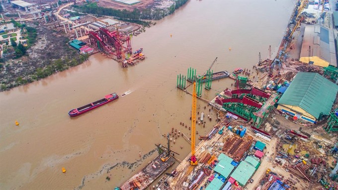
Most construction projects in northern Hải Phòng City have are running well above their initial cost estimates, with the cost hikes in some cases reaching thousands of billions of đồng, according to a recent inspection by the Government Inspectorate.
 Society
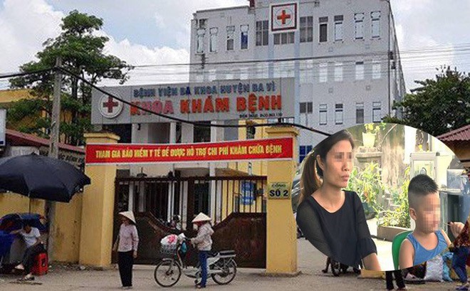
Hà Nội’s Department of Health has officially provided comprehensive information about the delivery of two new-borns to the wrong parents at Ba Vì District’s General Hospital six years ago, a case which has drawn public attention in recent days.
 Society
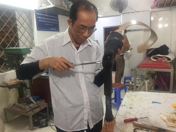
There is a house and workshop in Hà Nội’s Hai Bà Trưng District where disabled people from across the country can come for a better life.
 Society
Torrential rains with thunderstorms are predicted to blanket Hà Nội and northern mountainous provinces for the next few days.
 Society
The Việt Nam Department of Peace-keeping Operations launched a training course in Hà Nội on Monday for military experts dispatched to the United Nations peace-keeping mission.
 Society
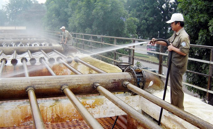
Around three million people in Phù Đổng and Trung Mầu villages in Gia Lâm District, Hà Nội will have access to the first “drinkable tap water” in Việt Nam as the factory being built there comes into operation on October 10.