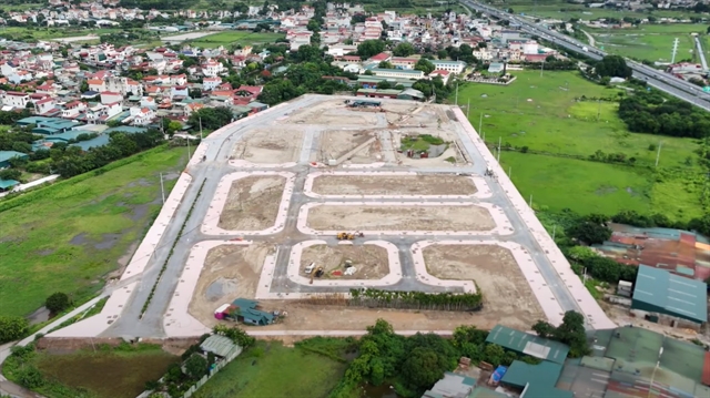
 Society


Corporate bond maturities ease in Q3, but funding pressure persists in H2
1.
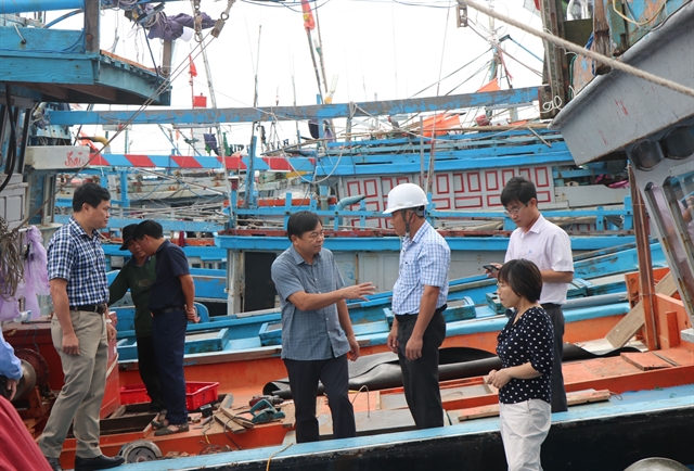 |
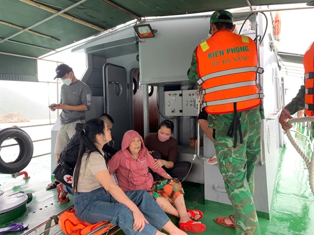
| Deputy Minister of Agriculture and Environment Nguyễn Hoàng Hiệp (centre) conducts an on-site inspection at a fish port and the Tịnh Hòa storm shelter in Đông Sơn Commune, Quảng Ngãi Province. — VNA/VNS Photo Cao Nguyên |
HÀ NỘI — Typhoon Kalmaegi, the 13th storm in the East Sea (internationally known as the South China Sea) this year, has maintained its direction and intensity but is moving faster, according to the National Centre for Hydro-Meteorological Forecasting (NCHMF).
Its centre located approximately 310km east-southeast of Quy Nhơn (Gia Lai Province).
By 7pm on Thursday, Kalmaegi is forecast to be near latitude 14.0°N and longitude 109.4°E, over coastal areas between Quảng Ngãi and Đắk Lắk, sustaining maximum winds of level 13–14 and gusting up to level 17. The disaster risk level is assessed at four for the central East Sea, waters from Quảng Ngãi to Đắk Lắk, and inland areas east of Quảng Ngãi to Gia Lai.
By 7am on Friday, the storm is expected to continue moving west-northwest, make landfall, and weaken into a tropical depression over southern Laos, with winds dropping to level 7 and gusts up to level 9. By 7pm the same day, the tropical depression will move into eastern Thailand and further abate into a low-pressure area with winds below level 6.
Over the East Sea, the central region will experience strong winds of level 8–11, increasing to 12–14 near the storm’s centre, with gusts up to level 17. Waves will reach 5–7m, and up to 8–10m near the storm’s eye, causing very rough seas.
Along the sea areas from southern Quảng Trị to Đắk Lắk, sea levels may rise by 0.4–0.8m, posing risks of flooding in low-lying zones, seawater overtopping dykes, coastal erosion, and delayed flood drainage. All vessels and aquaculture operations within the danger zone will be heavily affected by thunderstorms, whirlwinds, strong winds, and high waves.
On land, from Thursday afternoon, areas from southern Đà Nẵng to Đắk Lắk will experience strengthening winds of level 6–7, increasing to 8–9; areas near the storm’s centre (particularly eastern Quảng Ngãi – Gia Lai) will see winds of level 10–12 and gusts of 14–15, accompanied by widespread heavy rainfall.
Between Thursday and Friday, regions from Đà Nẵng to Đắk Lắk are forecast to witness very heavy rainfall, ranging from 200–400mm, with some areas exceeding 600mm. From southern Quảng Trị to Huế, as well as in Khánh Hoà and Lâm Đồng, rainfall will range from 150–300mm, with certain areas exceeding 450mm.
The centre warned of a high risk of extreme rainfall exceeding 200mm within three hours, whirlwinds, and strong gusts before and during the storm’s landfall, particularly in areas between Đà Nẵng and Khánh Hoà.
Kalmaegi is said to share several similarities with two major storms, Damrey (2017) and Molave (2020), but differs in wind intensity and higher rainfall. Areas from Đà Nẵng to Đắk Lắk are warned of exceptionally heavy rainfall, potentially exceeding 600mm per spell.
NCHMF Director Mai Văn Khiêm said compared to the previous storms, Kalmaegi is expected to cause more localised heavy rainfall than Damrey and Molave, but will likely not result in major flooding as experienced after Storm Fengshen, the 12th in the East Sea this year. — VNA/VNS
Society
 Society
 Society
 Society
 Society
 Society
 Society
 Society
 Society
 Society
 Society
 Society
.jpg) Society
Society
 Society
 Society