 Society


|
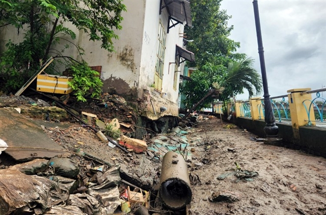
| An eroded embankment section along Thanh Đa Canal in HCM City’s Bình Thạnh District has caused many local houses to have a high risk of collapse and cracks in walls. — VNA/VNS Photo Mạnh Linh |
HCM CITY — Nearly 7,200 hectares of land in HCM City have faced subsidence, mainly in areas near rivers and canals, according to the city’s Department of Construction.
Two areas have recently suffered rapid subsidence while 40 other areas are witnessing slower subsidence.
An area of 2,440 ha is facing relatively rapid subsidence of a rate of 10-15mm a year, while an area of 4,400 ha is facing an average subsidence of a rate of 5-10mm per year.
The slow pace of infrastructure development in inner-city districts, except for the central area, has not been able to correspond to population growth and housing demand.
The rate of asphalt concrete in transport and drainage system construction in many districts has not yet reached 10 per cent.
The existing inner city centre area has an infrastructure completion rate of 85-90 per cent.
The rate of infrastructure completion according to planning in Thủ Đức city and the districts of Bình Tân, 7 and 12 is on average about 60-65 per cent while it is below 50 per cent in five suburban districts.
In addition, the development of technical and social infrastructure has not kept pace with urban development, while housing construction investment and infrastructure investment are not synchronous.
The city's urban development shows signs of being unsustainable, leading to traffic jams, flooding and environmental pollution.
According to a recent ground subsidence research by the Japan International Cooperation Agency (JICA), the city’s surface is susceptible to sinking.
The city has an average ground subsidence rate of two centimetres a year while areas with multiple high-rise buildings have sunk faster, at 6-8 cm annually.
Sinking land is blamed for frequent flash floods in the city.
The city government, in collaboration with JICA, is developing a project to research the current status and causes of subsidence and draw up subsidence response plans. — VNS


