 Life & Style
QUẢNG NINH — Authorities at the UNESCO-recognised heritage Hạ Long Bay have been conducting solutions to preserve the natural wonder of thousands limestone islands and islets, forming the spectacular seascape of the property.
However, after millions of years of formation, a multitude of limestone islands and towering limestone pillars rising from the sea now are at the risk of collapse and landslides.
According to Vice Chairman of Vạn Chài Hạ Long Tourism Service Cooperative, Vũ Văn Hùng, the landslides on the bay often occur in the rain and storm seasons. With years of experience, he and other peers in the cooperative can recognise some signs of landslides
“Whenever we pass by an island or islet, if we noticed any unusual signs, we will report to the bay’s management board and the board will have prompt handling,” he said.
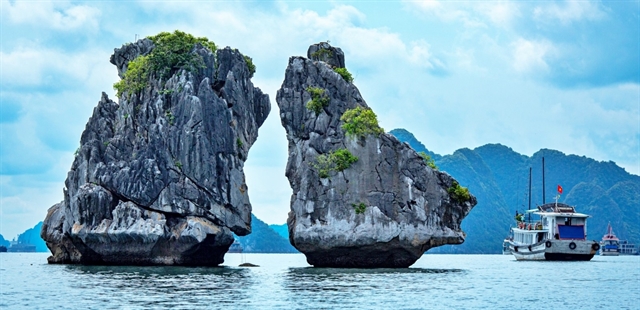 |
| The iconic Trống Mái (Rooster and Hen) Islet is among thousands of limestone islands and islets in Hạ Long Bay. — Photo vov.vn |
Phạm Quốc Tuấn, head of the Vung Viêng Area Management Team, Conservation Centre No. 3 under the Hạ Long Bay Management Board said that his unit regularly inspects all the areas where landslides occurred and others places at risk.
His unit also inform boats operating in the area, through documents and speaker system, to avoid those areas.
They also report to the Bay Management Board to put warning signs to ensure safety for any boats travelling near the the at risk places.
Currently, all the limestone islands and islets in the bay have been managed and preserved according to the Law on Cultural Heritage, the Law on Environmental Protection, the Convention on the Protection of World Cultural and Natural Heritage, and the Regulations on Management, Protection and Promotion of Hạ Long Bay World Natural Heritage’s Values.
Every year, the Hạ Long Bay Management Board has implemented synchronously several solutions to preserve the geological and geomorphological resources on the bay and the limestone islands and islets.
According to Head of Hạ Long Bay Management Board, Vũ Kiên Cường, the unit has coordinated with research institutes and scientists to carry out scientific researches to clarify the geological and geomorphological values of Hạ Long Bay, including the islands and islets.
“Thereby we will establish a database and management records, then to propose and implement proper conservation solutions,” he said.
To ensure the safety of tourists and other organisations and individuals who conduct socio-economic activities on the bay, the Management Board has notified widely about areas that are at risk. At the same time, the board also has tighten their supervision of socio-economic activities on the bay, promptly preventing acts of harming the heritage, including the islands and caves in the area.
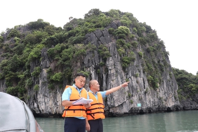 |
| Staff of the Hạ Long Bay Management Board conduct inspections on places at risk of collapse and landslides. — Photo thethaovanhoa.vn |
Regarding the conservation of Trống Mái (Rooster and Hen) Islet, where has an existential risk of collapse, the board, together with the Quảng Ninh Provincial People’s Committee, has given technical and scientific solutions.
Meanwhile, the Management Board, in collaboration with other relevant departments are calling on tourists, tour guides, and travel boat associations to work together to protect the iconic islet.
All the water vehicles operating in the area of Trống Mái Islet must maintain their speed under 10km/h and keep a minimum distance of 70m from the islet.
The formation of Hạ Long Bay dates over 500 million years and the limestone that is found in the bay began forming around 340 million years ago. Over time, the bay has gone through countless changes resulting in its today’s magnificent natural landscape.
The core area, where has been recognised by the UNESCO as a World Natural Heritage, is 434sq.km and comprises of 775 limestone islands and islets. — VNS


