 Environment

HCM City police arrest 65 in e-cigarette drug ring, including 10 foreigner
1.
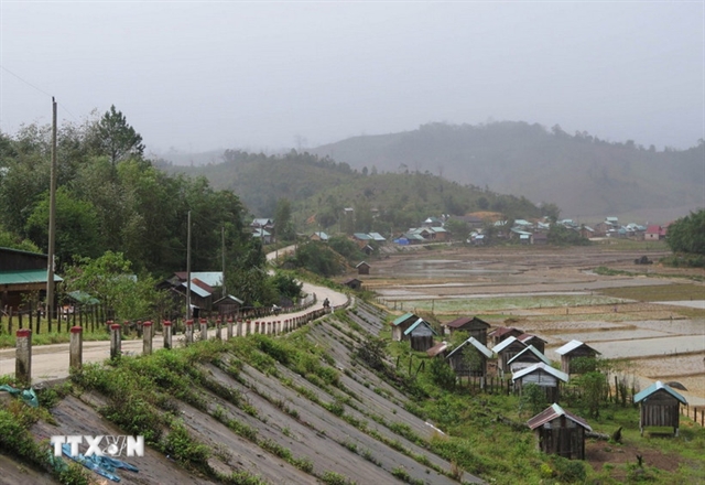 |
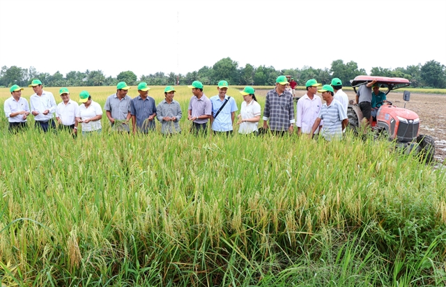
| Măng Bút Commune, Quảng Ngãi Province reported ten earthquakes from Sunday until 12am on Monday. VNA/VNS Photo |
HÀ NỘI – Twenty-five earthquakes reported from Sunday until 12am on Monday in the central province of Quảng Ngãi have been assessed to be induced earthquakes, which are of weak or moderate magnitude and rarely cause serious damage like natural tectonic earthquakes, according to the Earthquake and Tsunami Warning Centre.
The centre reported ten earthquakes in Măng Bút Commune and 15 in Măng Ri Commune in nearly two days. The biggest was a magnitude 4.9 on Sunday night.
Residents living in nearby localities like Gia Lai, Đà Nẵng and Huế could also feel the tremors.
According to scientists and geologists, induced earthquakes are a type of earthquake triggered by human activities rather than by natural tectonic processes.
The most common cause of induced earthquakes is the impoundment of water in large hydropower reservoirs.
When an enormous volume of water is stored behind a dam, it exerts immense pressure on the underlying rock layers.
Water can seep into fault zones deep underground, altering the stress state, increasing pore pressure and reducing the shear strength of rocks.
This can activate pre-existing but dormant geological faults, causing earthquakes.
Large-scale mining operations can alter geological structures, leading to subsidence and triggering earthquakes through the injection of fluids into the ground.
Underground nuclear tests also fall within the causes of induced seismicity.
In Việt Nam, induced earthquakes are often recorded in areas with large hydropower reservoirs, such as the Sông Tranh 2 in former Quảng Nam Province and Kon Plông in the former Kon Tum Province.
According to Dr Nguyễn Xuân Anh, director of the Earthquake and Tsunami Warning Centre, frequent earthquakes in Đà Nẵng (former Quảng Nam Province area) and Quảng Ngãi (former Kon Tum Province area) result from a combination of natural geological factors and human-induced seismicity.
These areas lie along active or potentially active geological fault zones. However, the main factor contributing to the recent increase in earthquake frequency is the operation of large hydropower reservoirs.
At the Sông Tranh 2 Hydropower Plant, the massive water volume in the reservoir has increased pressure on the faults, changing stress conditions and triggering seismic events. Similarly, in the former Kon Tum area, reservoirs such as Thượng Kon Tum have been identified as the cause of hundreds of small to moderate earthquakes.
Although these earthquakes typically have magnitudes below 5.5, their frequent occurrence produces noticeable tremors and somewhat affects residents’ daily lives. Seismic activity in these regions is forecast to continue for several more years, according to the centre.
Explaining how earthquakes are detected, Dr Anh said abnormal ground vibrations generate seismic waves that propagate underground.
Việt Nam’s nationwide network of seismic monitoring stations from north to south records these vibrations and transmits the data via the internet to the Earthquake and Tsunami Warning Centre, according to Anh.
At the centre’s monitoring room, the seismic wave signal suddenly spikes and turns red on the screen. The on-duty staff immediately downloads the waveform and analyses it within about five minutes to determine details such as the date, time, location, magnitude and risk level of the earthquake.
This information is then sent to the centre’s leadership before an official earthquake bulletin is issued. For quakes of magnitude 3.5 or higher, alerts are sent immediately to national agencies responsible for communication and emergency response, while smaller events are posted directly on the centre’s website.
Earthquake data are recorded not only within Việt Nam but also from regional and global networks. For earthquakes occurring abroad, the data collection process is similar.
Việt Nam currently operates 40 national seismic monitoring stations, all functioning stably and continuously. The distance between stations ranges from 200 to 300 kilometres, allowing the detection of earthquakes with magnitudes as low as 3.5. VNS
Environment
 Environment
 Environment
 Environment
 Environment
 Environment
 Environment
 Environment
 Environment
 Environment
 Environment
 Environment
 Environment
 Environment
 Environment