 Society
Typhoon Yagi weakens to a tropical depression, heavy rain warnings issued
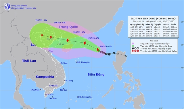
Affected areas include the western part of the Gulf of Tonkin and northern Việt Nam, with a risk level of 3.
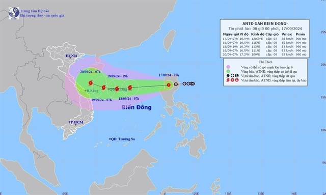 |
| The direction of the tropical depression. — VNA/VNS Photo |
HÀ NỘI — The National Centre for Hydro-Meteorological Forecasting reported that a tropical depression over the East Sea (known internationally as the South China Sea) is moving westward and is forecast to intensify into a typhoon.
As of 1am on Tuesday, the depression was situated east of Luzon Island in the Philippines with wind speeds of 50-61km per hour.
It is expected to strengthen into a storm by Wednesday as it heads towards the northern East Sea, about 420km east of the Hoàng Sa (Paracel Islands) of Việt Nam.
By Thursday, the storm would intensify further, with wind speeds of up to 89km per hour. Disaster risk warnings remain at level three.
In the next 48-72 hours, the storm may shift west-northwest, bringing strong winds of up to 74km per hour and rough seas, particularly in the eastern waters of the northern East Sea.
Waves are expected to reach 3-5 metres, posing a significant threat to vessels in the region.
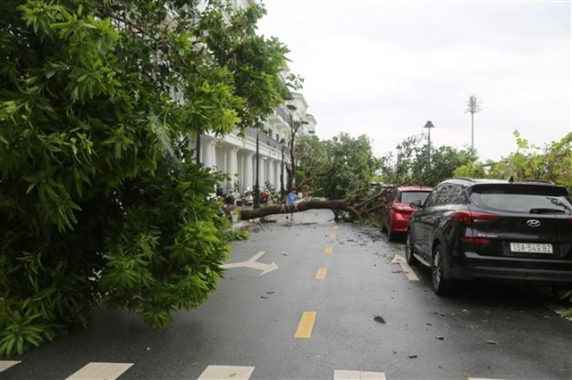
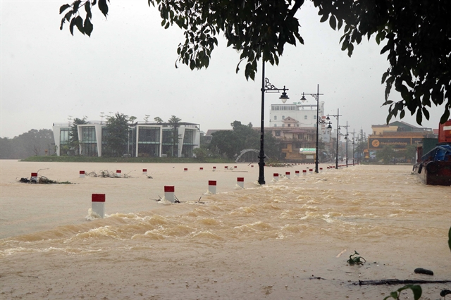
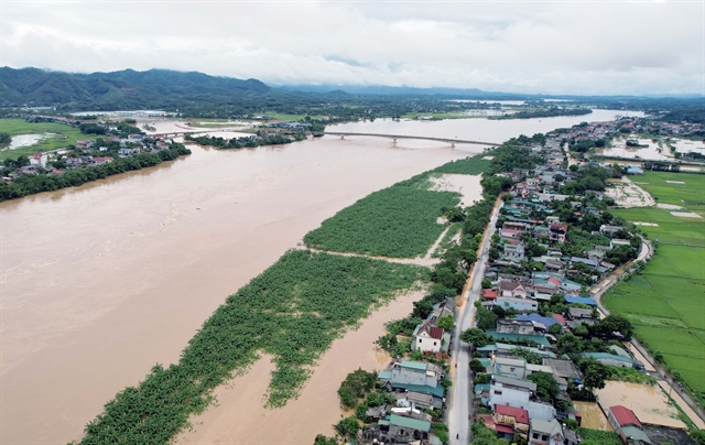
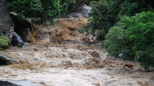
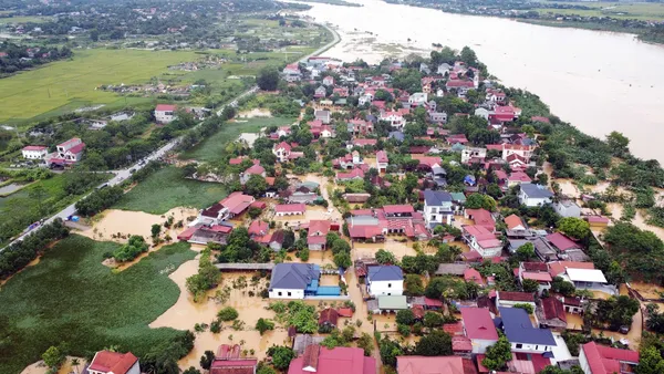
Heavy rain has already affected Thanh Hóa and Đắk Nông provinces, with some areas recording up to 50mm of rain.
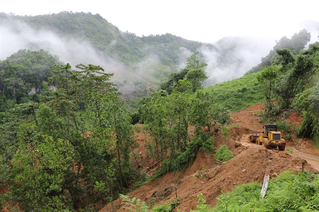
The risk of flash floods and landslides is high, particularly in steep areas.
A disaster warning is in place for these provinces, with continued rain expected on Tuesday, and rainfall reaching up to 70mm in some locations.
Residents are urged to be cautious, as flash floods and landslides could disrupt traffic and damage infrastructure.
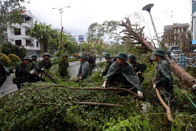
Việt Nam is still reeling from the aftermath of the super typhoon Yagi, the country's third storm this year, as well as the fatal landslides and flooding that followed. To date, the disaster has cost Việt Nam over $1.6 billion in damages, while 329 people were killed or gone missing. — VNS
Society
 Society
 Society
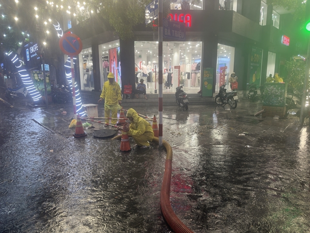
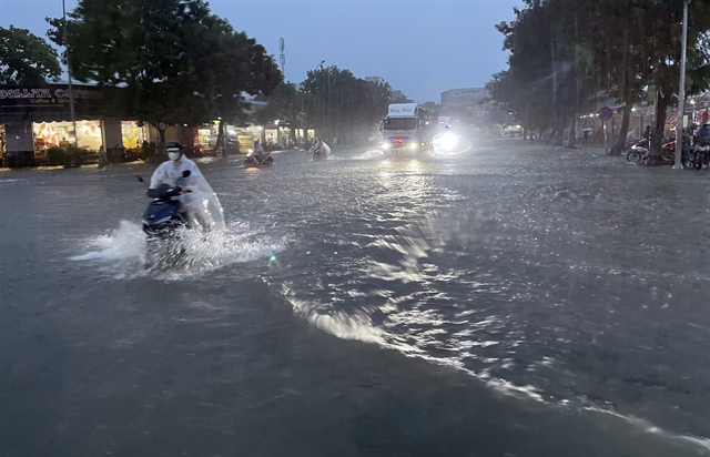
Heavy rains that began on Thursday evening were triggered by a tropical low-pressure system that formed in the East Sea earlier Thursday, said the National Centre for Hydro-meteorological Forecasting.
 Society
 Society
 Society
 Environment
 Environment
 Environment
 Environment
 Environment
 Environment
 Environment
 Environment
 Environment
 Environment
 Environment
 Environment
 Environment
 Environment
 Environment