 Environment
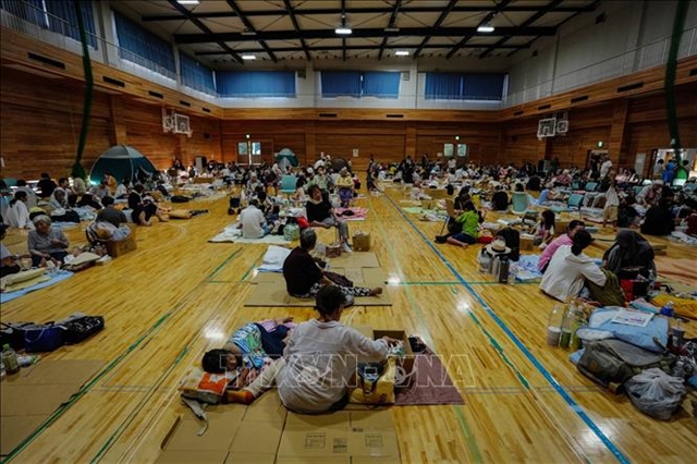
Vietnamese community in Japan gradually returns to normal after earthquake disaster
1.
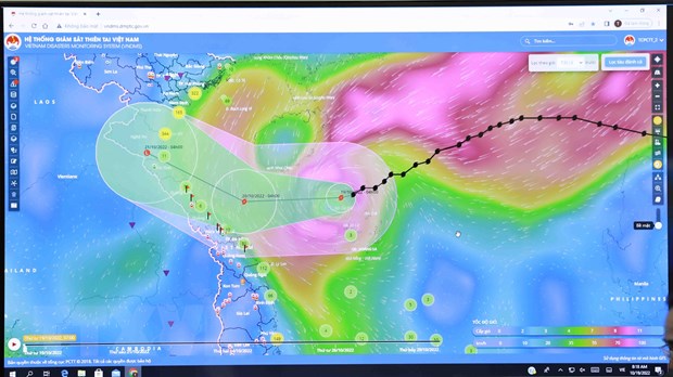 |
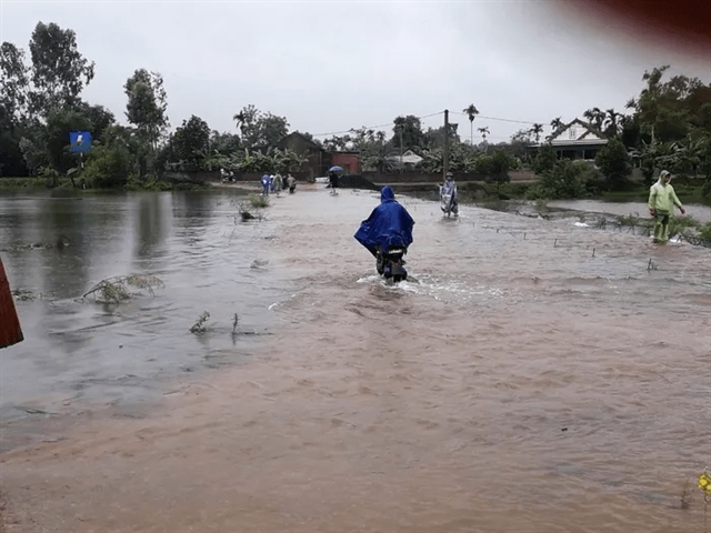
| The path of Typhoon Nesat via satellite images. VNA/VNS Photo |
HÀ NỘI — The National Centre for Hydro-Meteorological Forecasting reported that in the next 24-48 hours, Typhoon Nesat, the sixth to enter Việt Nam's East Sea this year, will gradually lose strength and may weaken into a tropical depression and low-pressure area on Thursday.
The news was announced at a meeting on Wednesday morning organised by the Standing Office of the National Steering Committee for Natural Disaster Prevention and Control.
Vũ Xuân Thanh, the General Department of Natural Disaster Prevention and Control's Deputy Director, who is also Deputy Chief of the Office of the National Steering Committee for Natural Disaster Prevention and Control, asked ministries, agencies and localities to continue updating forecasts and warnings about severe weather systems.
The Border Guard Command is also asked to continue coordinating with the Directorate of Fisheries and local authorities to monitor the storm's development closely; notify owners of ships and boats operating at sea about the location and direction of storms so they can react accordingly.
The Directorate of Fisheries must coordinate with localities to bring people from watchtowers and aquaculture ponds.
Deputy Director of the National Centre for Hydrometeorological Forecasting, Hoàng Phúc Lâm, said that at 7 am on Wednesday, the location of the storm's centre was to the northwest of the Việt Nam's Spratlys.
The strongest winds near the storm's centre are at level 9-10 (75-102km/h), moving in the west-southwest direction at a speed of 10-15km/h.
By 7 am on Thursday, the storm is forecasted to move mainly westward at a speed of 10-15km/h, from Quảng Bình to Thừa Thiên-Huế, with winds of 6-7 level.
He said from the afternoon and night of Wednesday to Thursday, the area from Thanh Hóa Province to Quảng Bình Province is likely to have moderate to heavy rain with a total rainfall of 30-50mm. Thanh Hóa and Nghệ An should expect 50-100mm of rainfall and up to 130mm in places.
Nguyễn Đình Hưng, Head of the Rescue Department of Border Guard Command, said that by 6:30 am on Wednesday, more than 270,500 people onboard around 59,700 ships and boats had been informed about the storm and were guided to move to shelter.
All 15 coastal provinces from Quảng Ninh to Bình Định have received the dispatch on implementing measures to respond.
Seven provinces have banned fishermen from going to sea.
So far, 4,000 soldiers, 85 rescue ships and more than 50 vehicles in provinces from Quảng Ninh to Khánh Hoà have been deployed to participate in relief efforts.
Due to the combined cold spell and storm's impact, northeastern provinces and Red River Delta, Thanh Hóa to Hà Tĩnh will have 30-50 mm of rain, reaching 100 mm in some areas.
"From Wednesday night, the temperature in Hà Nội drops sharply to 14-16 degree Celsius," Lâm said.
"After the storm, rain caused by the cold spell will cause rain, but it will not be too heavy," Lâm said. — VNS
Environment
 Environment
 Environment
 Environment
 Environment
 Environment
 Environment
 Environment
 Environment
 Environment
 Environment
 Environment
 Environment
 Environment
 Environment