 Economy

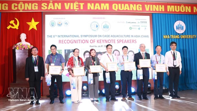
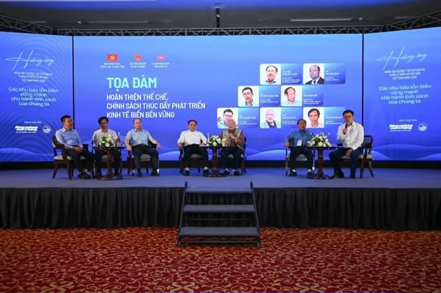
Việt Nam joins Asian partners in promoting green, smart cage aquaculture
1.
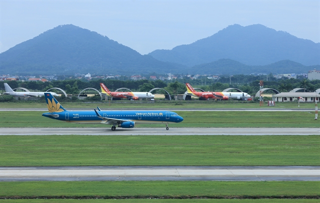 |
| Aircraft at Nội Bài International Airport. Hà Nội is planning to build a second airport in Ứng Hòa Commune. — VNA/VNS Photo Quốc Khánh |
HÀ NỘI — Aviation is set to reshape Hà Nội’s future growth map as the capital unveils an ambitious century-long master plan centred on a second international airport, new urban corridors and the rise of a next-generation “sky economy”.
Under the master plan, the proposed airport, which would be built in Ứng Hòa in Commune, is expected to cover around 1,500ha and handle between 30 and 50 million passengers annually. It would be constructed between 2031 and 2045.
The project forms part of a wider shift in Hà Nội’s urban planning strategy, as the city moves toward a multi-centred development model designed to reduce pressure on the historic core and expand economic growth space toward surrounding areas.
Officials and experts say the second airport is intended not only to ease growing pressure on Nội Bài International Airport, currently the main aviation gateway for northern Việt Nam, but also to anchor a new southern economic zone linked with neighbouring provinces through highways, railways and logistics networks.
The second airport is envisioned as the core component of the southern development corridor, connecting the capital with Ninh Bình, Thanh Hóa and other provinces south of the capital through the national railway network, the North-South Expressway and National Highway 1A.
New mindset
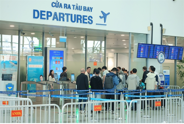 |
| Passengers at the Nội Bài International Airport departures gate. Hà Nội has placed aviation infrastructure at the centre of economic development rather than treating airports solely as transport hubs. — VNA/VNS Photo Quốc Khánh |
The master plan reflects a broader shift in thinking that places aviation infrastructure at the centre of economic development rather than treating airports solely as transport hubs.
According to the plan, Hà Nội aims to use its airport network to support logistics, innovation, science and technology industries and the emerging low-altitude economy involving drones, autonomous aircraft and urban air mobility systems.
The southern economic zone anchored by the new airport, the northern growth pole centred around Nội Bài International Airport and the eastern growth pole linked to Gia Bình International Airport are expected to become three of Hà Nội’s nine major long-term growth engines.
Experts said implementation of the plan would require a practical and forward-looking approach to maximise investment efficiency while preserving long-term development potential.
Trần Ngọc Chính, president of the Vietnam Urban Planning and Development Association, said Hà Nội’s airport network development strategy would be aligned with the capital city’s development requirements in the years to come.
He said identifying the final location of the second airport as early as possible would be necessary to ensure consistency with sectoral planning and land use management, while minimising future land clearance and compensation costs.
Under the master plan, Nội Bài International Airport will also be expanded southward by around 1,500 hectares, to increase annual capacity to roughly 50 million passengers.
Hà Nội also plans to convert Gia Lâm and Hòa Lạc military airfields into dual-use airports serving both civilian and defence purposes.
City authorities have proposed establishing takeoff and landing points for drones and air taxis in Hòa Lạc, Sóc Sơn and on high-rise buildings and other suitable urban areas as part of efforts to develop a low-altitude transport network integrated with the broader urban transport system.
Hòa Lạc Airport, which will be linked with Hòa Lạc Hi-tech Park, is being positioned as a national hub for low-altitude aerospace research and production.
Low-altitude future
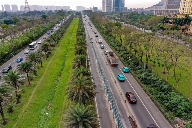 |
| A highway where a section of Hà Nội’s Metro Line 5 will be built. The line will stretch about 40km and include 20 stations and two depots in Sơn Đồng and Hòa Lạc. — VNA/VNS Photo Trung Nguyên |
The master plan identifies the low-altitude economy as a future growth sector, reflecting a broader shift in urban and aviation planning as cities worldwide explore the commercial use of drones, air taxis and other emerging aviation technologies.
Chính said the low-altitude economy was becoming an irreversible global trend, with applications ranging from passenger and cargo transport to high-tech agriculture, tourism and urban management.
In its master plan, Hà Nội had identified this as an important new economic model and incorporated strategic calculations for developing the low-altitude economy, from research and development to spatial planning and urban structure, he said.
Noting that low-altitude airspace would require strict State oversight, Chính said Hà Nội’s plan to develop dual-use airports at Gia Lâm and Hòa Lạc as centres for research, testing and operations represented a cautious and scientific approach.
More importantly, the development of the low-altitude economy could also accelerate growth in related technologies including artificial intelligence, big data, semiconductors, cybernetics and advanced materials.
He pointed out that China had seen rapid expansion of the low-altitude economy since the concept was first introduced in 2010, with an estimated value of around US$214 billion and projections exceeding $500 billion by 2035.
As a sandbox for the low-altitude economy, Hà Nội could study international experiences in building regulatory frameworks and leveraging science and technology cooperation to strengthen domestic capabilities.
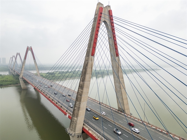 |
| Nhật Tân Bridge, Hà Nội. The airport network strategy could reshape Hà Nội’s broader economic landscape by creating new urban and logistics clusters around major aviation hubs. — VNA/VNS Photo Lê Đông |
Urban expansion
In addition, the airport network strategy could reshape Hà Nội’s broader economic landscape by creating new urban and logistics clusters around major aviation hubs.
Trần Quang Phú, vice rector of HCM City University of Transport, said the planned airport system could become a major catalyst for commercial and service-sector growth linked to airports.
Under the master plan, airport urban models are expected to be developed around both the proposed southern airport area and Nội Bài International Airport.
An integrated airport city combines synchronised transport infrastructure, including highways, railways, metro systems and logistics facilities, with commercial, industrial, residential and service zones designed to develop alongside airport operations, according to Phú.
In this model, aviation infrastructure stimulates economic activity and urban expansion, while the surrounding urban ecosystem increases the airport’s strategic value.
Hà Nội could learn from international aviation and logistics hubs such as Busan in South Korea and Hong Kong (China) by developing integrated multimodal transport systems connecting airports with urban centres and industrial zones through expressways, high-speed rail, rapid bus systems and potentially metro lines in the future. — VNS
Economy
 Economy
 Economy
 Economy
 Economy
 Economy
 Economy
 Economy
 Economy
 Economy
 Economy
 Economy
 Economy
 Economy
 Economy


