 Society


Talented contestants cook of in Top Chef Việt Nam 2026
1.
|
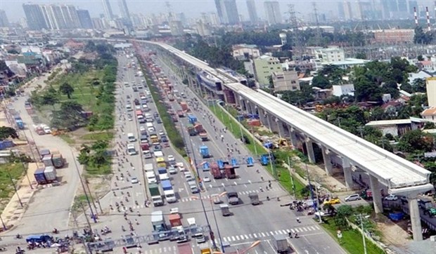
| HCM City’s first metro line that is coming up along the Hà Nội Highway. City authorities are developing urban plans along the length of the route. VNA/VNS Photo Mạnh Linh |
HCM CITY — HCM City authorities are drafting design and construction plans for urban areas along the first metro route, which is slated to become operational at the end of 2021.
The People’s Committee has set up a team to study policies to exploit public lands along the line, which runs between Bến Thành Market in District 1 and Suối Tiên Theme Park in District 9.
The Departments of Natural Resources and Environment and Planning and Investment are working with authorities in the districts through which the line will run to carry out the studies.
Lương Thu Anh, head of the city Department of Planning and Architecture’s central planning management department, said the city plans to link public transport with urban development to save land and ensure public transportation develops sustainably.
The metro is expected to become the main mode of transport, and there would be hundreds of bus routes connecting its stations with residential areas, industrial parks, universities, and research institutes, she said.
People would be able to walk conveniently and safely on sidewalks, which would be designed with the hot, rainy climate of the south in mind, she added.
Experts said the city should earmark more public lands along the metro route for urban beautification in line with the plan to develop the new Thủ Đức City, and public transport should be predominant.
It should also use the river landscapes to create public spaces, they said.
The city also aims to develop high-rise apartments and other residential complexes along the metro route, especially in the city’s eastern part comprising districts 2, 9 and Thủ Đức.
These projects must tackle city issues such as flooding and congestion and improve its landscapes and residents’ quality of life.
Low-rises will gradually make way for high-rise housing along the metro line to ensure there is land for building new parks, parking lots and other public facilities.
Underground space
City authorities are also developing a plan for design and construction of underground spaces around metro stations.
Lý Khánh Tâm Thảo, head of the Department of Planning and Architecture’s technical infrastructure management department, said underground spaces full of state-of-the-art public facilities would be created, especially near the stations and the Bến Thành Central Station.
They would be developed into commercial centres over a period of years, she said.
Museums and other cultural spaces and drainage and flood prevention works would also be built in them, she added.
The Bến Thành Central Station will be the hub of the city’s metro network with all the lines converging there.
The underground complex will be built on an area of 45,000sq.m between the station and the Opera House.
According to District 2 authorities, within a radius of 800m from Thảo Điền and An Phú stations are six high-rise apartments, land plots and numerous low-rise houses.
There are also public areas such as the Thảo Điền market spreading over 1,700sq.m and the An Phú Swimming Club covering 3,674sq.m managed by the District Sports Centre.
There are two public lands measuring 3,600sq.m managed by the People’s Committee of Thảo Điền Ward.
There are two more measuring 1,344sq.m managed by the People’s Committee of An Phú Ward.
Thủ Đức District will have five metro stations: Phước Long, Bình Thái, Thủ Đức, High-Tech Park, and Suối Tiên.
In Bình Thạnh District, there will be two stations, Văn Thánh and Tân Cảng, within 500-800m of which will be housings, factory lands and public lands. — VNS
Society
 Society
 Society
 Society
 Society
 Society
 Society
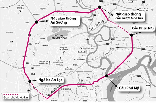
The HCM City Department of Transport has asked the municipal People's Committee to give priority to the early implementation of seven major traffic projects at the city's main gateways.
 Society
 Society
 Society
 Society
 Society
 Society
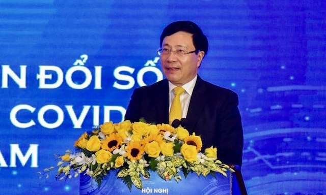
Việt Nam aims to become a digital society by 2030. The country has been praised internationally for taking the lead in digital transformation in the education sector, especially after the COVID-19 outbreak. Việt Nam News speaks with Phạm Thế Trường general manager of Microsoft Vietnam, about the importance of digital education.
 Society
 Society