 Society

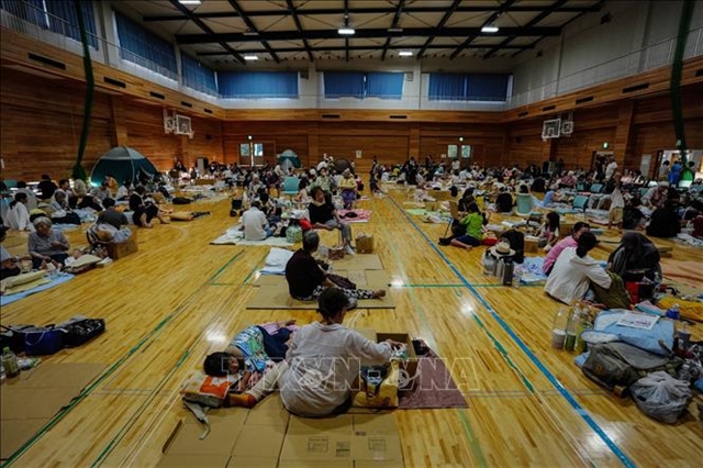
Vietnamese community in Japan gradually returns to normal after earthquake disaster
1.
Cold air from China is approaching Việt Nam and is likely to have a direct impact on the northern and central provinces, the Central Hydro-Meteorological Forecast Centre has reported.
 |
| Thunderstorm and rainfall are predicted in Hà Nội. — Photo thanhnien.vn |
HÀ NỘI — Cold air from China is approaching Việt Nam and is likely to have a direct impact on the northern and central provinces, the Central Hydro-Meteorological Forecast Centre has reported.
The cold wave is predicted to set in from today evening.
According to the centre, the cold air will have relatively strong intensity, causing the weather to turn chilly with widespread rainfall.
Influenced by the onset of the cold air, rainfall and thunderstorms occurred on Monday evening in the north. Starting today, central provinces also witnessed rainfall and scattered thunderstorms. The thunderstorm is likely to be accompanied by whirlwinds and hailstorm.
The northern and north central provinces experienced chilly weather on Monday night, with the lowest temperature of 16-19 degree Celsius. The mountainous region recorded a temperature of 13-15 degree Celsius, with some areas reporting below 12 degrees.
The centre also warned of natural disasters, thunderstorms and heavy rain of level 1 in the north. Hà Nội is likely to experience rainfall and thunderstorms, along with cyclones and strong winds.
The cold air has also caused bad weather on the sea. In Tonkin Gulf, wind is expected to move north-east at level 6 today evening and tonight.
The northern part of the East Sea area, including the Hoàng Sa (Paracel) Islands, experienced winds of levels 6-7 on Monday. The strong winds are expected to persist tonight.
There is a possibility of strong north-eastern winds of levels 5-6 off the coast of central and south Việt Nam from Wednesday. — VNS
Society
 Society
 Society
 Society
 Society
 Society
 Society
The Ministry of Health has asked the Department of Health in central Nghệ An Province to quickly clarify the details surrounding the death of a pregnant woman.
 Society
The People’s Committee of northern Quảng Ninh Province has allowed cars driven by Chinese nationals to enter Hạ Long City through Móng Cái border gate for tourism purposes.
 Society
Ten former Nam Việt Commercial Joint Stock Bank (Navibank) officials, who were indicted for “deliberately violating State regulations on economic management, causing serious consequences”, were sentenced to seven to 13 years in jail by the HCM City People’s Court yesterday.
 Society
The People’s Court of Hòa Bình Province has released charges against three accused for the death of eight persons after undergoing kidney dialysis at the provincial General Hospital.
 Society
The Quảng Nam Province authorities and a local gold mining company are probing if a rupture in the wastewater dam triggered the massive fish deaths in two rivers some days ago.
13595912PM.jpg) Society
Society
Receiving billions of đồng in compensation, several residents in Nước Trong water reservoir project area, Tây Trà District’s Trà Thọ Commune, thought they’d be able to escape debts they had accrued through high interest loans.
 Society
HCM City will increase automobile parking fees on some sidewalks and roadsides in the city centre to VNĐ20,000-40,000 (US$0.9-1.8) per hour from June 1.
 Society
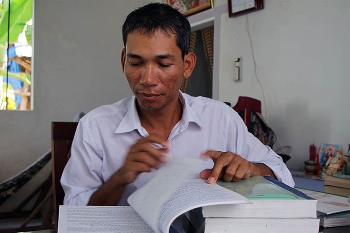
Kim Thái, 37, a Khmer man living in the Mekong Delta province of Sóc Trăng, wears a broad-brim hat to walk the streets of Long Phú Town, selling lottery tickets to earn a living as he has for the past 13 years.
 Society
A concert last Saturday in southern Cần Thơ Province was abruptly interrupted when a woman and several of her friends jumped on the stage claiming her gold bar (37.5gr which is worth approximately US$1,500) was stolen.