 Society


Việt Nam Film week to take place this month
1.
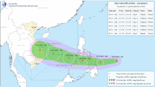 |
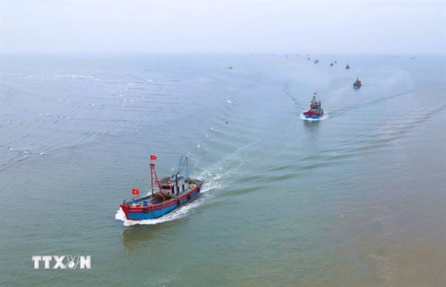
| Projected development of Storm Kalmaegi. Photo courtesy of the National Centre for Hydro-Meteorological Forecasting. |
HUẾ — The National Centre for Hydro-Meteorological Forecasting has warned that between November 5 and 6, the central East Sea (including the Trường Sa Archipelago) and offshore waters from Đà Nẵng City to Khánh Hòa Province may be affected by Storm Kalmaegi, with strong winds and very rough seas.
At 4pm on November 2, the centre of Tropical Storm Kalmaegi was located at around 11.2 degrees North latitude and 132.5 degrees East longitude, over the waters east of central Philippines, with maximum sustained winds near the centre reaching Level 9 (75–88km per hour) and gusts up to Level 11 (103 to 117 kilometers/hour), which is very dangerous for ships and coastal residents.
According to the National Centre for Hydro-Meteorological Forecasting, the storm is moving westward at a speed of about 25km per hour.
By 4pm on November 3, the storm is expected to remain over the waters east of central Philippines, strengthening to Level 11–12, with gusts of Level 15–16 (very strong storm or super typhoon), and continuing westward at about 20km per hour.
By 4pm on November 4, it will move across the central Philippines, with sustained winds of Level 12 and gusts of Level 15, heading west-northwest at 20–25km per hour and likely to intensify further. The affected area will be the eastern part of the central East Sea. The disaster risk level is 3.
By 4pm on November 5, the storm is forecast to be over the central East Sea, with maximum sustained winds of Level 13 and gusts of Level 16 or 17 (the highest level), moving west-northwest at around 15km per hour and continuing to strengthen. The affected area includes the central East Sea, including the Trường Sa (Spratly) Archipelago. The disaster risk level remains at 3 (extremely dangerous).
In the following 72 to 120 hours, the storm is expected to move mainly west-northwest at about 25km per hour and continue to intensify.
Due to the storm’s influence, from the afternoon and night of November 4, the eastern part of the central East Sea will experience increasingly strong winds of Level 6–7, later strengthening to Level 8–9. Areas near the storm’s centre may see winds of Level 10–12 with gusts of Level 14–15, waves 5–7 metres high, and very rough seas.
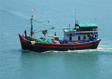
All vessels operating in these dangerous areas are advised to take shelter as they may be affected by thunderstorms, strong winds, and rough seas.
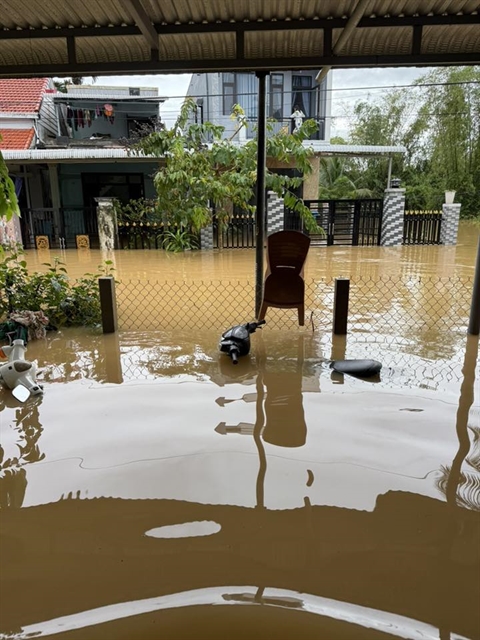
Meanwhile, the Civil Defence Command of Huế City reported that on the afternoon and night of November 2, water levels on the Hương River at Kim Long and the Bồ River at Phú Ốc were expected to gradually rise to around Level 3 (extremely dangerous).
The volume of water flowing into major rivers is expected to continue rising. As of 4pm today, the water level of the Hương River at Kim Long stood at 2.26m, 0.26m above Level 2, while the Bồ River at Phú Ốc measured 3.86m, 0.64m below Level 3 (extremely dangerous).
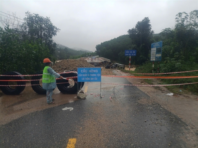
Water levels on the Truồi, Ô Lâu and other rivers remained high, causing flooding, flash floods and landslides.
In the past six hours, heavy to extremely heavy rain fell across several communes, including Long Quảng, Nam Đông, Khe Tre, Lộc An, Phú Lộc and Thượng Nhật, as well as the upper reaches of Tả Trạch Reservoir, with total rainfall ranging from 200 to 300mm.
Rain is forecast to spread across the entire Huế City area tonight, with particularly heavy rain expected to persist in the aforementioned communes.
Huế City’s Department of Education and Training has announced that all schools and educational institutions in the city will remain closed on Monday, November 3, due to rising floodwaters and complex weather conditions.
The decision follows directions from the Huế City People’s Committee to ensure the safety of teachers and students, as river levels continue to rise across the region. — VNS
Society
 Society
 Society
 Society
 Society
 Society
 Society
 Society
 Society
 Society
 Society
 Society
 Society
 Society
 Society