 Environment

Exhibition event spotlights AI, digital tech in healthcare
1.
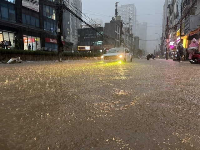
A pair of maps indicating areas at risk of flooding along 28 coastal provinces and cities in Việt Nam has been officially put into use.
| ||
The Vietnam Disaster Management Authority (VDMA) under the Ministry of Agriculture and Rural Development, in co-ordination with the Office of the National Committee for Disaster Response, Search and Rescue, handed over copies of the two maps to relevant agencies on Friday. — Photo hanoimoi.com.vn |
HÀ NỘI – A pair of maps indicating areas at risk of flooding along 28 coastal provinces and cities in Việt Nam has been officially put into use.
The Vietnam Disaster Management Authority (VDMA) under the Ministry of Agriculture and Rural Development, in co-ordination with the Office of the National Committee for Disaster Response, Search and Rescue, handed over copies of the two maps to relevant agencies on Friday.
At the handover ceremony in Hà Nội, Vũ Xuân Thành, Deputy General Director of VDMA, said the first map was designed to cover five scenarios corresponding to the strength of storms hitting the country’s coastal areas.
The other map corresponded to reservoirs along inter-provincial river basins in the case of high discharges and dam failures of six rivers – Hồng (Red), Mã, Thu Bồn-Vu Gia, Ba, Srepok and Sê San.
Thành said the maps would help the central disaster prevention committee, city and province-level climate offices and central relevant agencies plan for climate change.
After receiving the maps, Colonel Nguyễn Hữu Hùng, Deputy Director of the National Committee for Disaster Response, Search and Rescue, also Deputy Director of the Ministry of Defense’s Rescue Department, said they would help the unit co-ordinate and carry out of search and rescue operations.
At the event, experts from agencies, including the Việt Nam Institute of Water Resources Research, Institute of Hydrometeorology and Climate Change and the University of Water Resources presented their work in researching, drafting and building the maps.
Facing the increased threat of natural disasters, the Prime Minister assigned the Central Steering Committee for Natural Disaster Prevention and Control to develop flood maps.
The maps will help the steering committees for natural disaster prevention and local authorities prepare for natural disasters.
The 24th conference of parties to the United Nations Framework Convention on Climate Change (COP 24) listed 10 countries most severely affected by climate change, of which Việt Nam ranked 6th.
Natural disasters are a big threat to the nation’s sustainable development.
Over the past 20 years, the country has suffered most types of natural disasters (except tsunamis), causing heavy losses to human life, property, infrastructure and production.
On average, about 400 people die or go missing each year due to natural disasters. Economic losses due to natural disasters impact about 1-1.5 per cent of GDP per year, of which the most serious damage is from strong storms and flooding.
The Ministry of Natural Resources and Environment says coastal provinces are particularly at risk of strong storms and super typhoons. River basins are at high risk of flooding.
Resilience
In Hà Nội, a workshop co-organised by the Asian Disaster Prevention Center (ADPC) and the VDMA discussed resilience for urban areas towards disasters and extreme climate issues in Southeast Asia.
Đòan Thị Tuyết Nga, director of the Department of Science, Technology and International Cooperation under the VDMA, said the goal of the workshop was to help participants understand the needs and issues of disaster prevention in Southeast Asia’s urban areas to propose plans in Việt Nam.
At the workshop, participants discussed issues related to resilience for urban areas against extreme climate issues and proposed solutions to be implemented in Việt Nam.
This was a unique initiative aiming to find useful solutions and solving problems arising from climate change adversely affecting urban areas. Attendees sought to connect and call for the participation of relevant agencies, local authorities and partners, according to Hans Guttman, Executive Director of ADPC.
Asian countries were at risk of natural disasters in urban areas that threaten economic growth and development in the region.
The level of disaster risk was increasing rapidly due to complex changes in climate and demographics, the impact of socio-economic development, as well as environmental degradation and urban expansion. This was reflected in the issues of poverty, inequality and social problems.
The workshop will enhance the ability to share information and coordinate with coastal provinces, including two cities of Nam Định and Mỹ Tho City - where ADPC chose to implement this programme.
An on-going five-year programme on recovery of urban areas against extreme climate issues in Southeast Asia was jointly implemented by the VDMA and ADPC, with support from the Norwegian Agency for Development Cooperation.— VNS
Environment
 Environment
 Environment
 Environment
 Environment
 Environment
 Environment
Việt Nam had been recognised by the international community for its biodiversity and rich ecosystems, said Trần Thế Liên, head of the Special Protected Forest Department.
 Environment
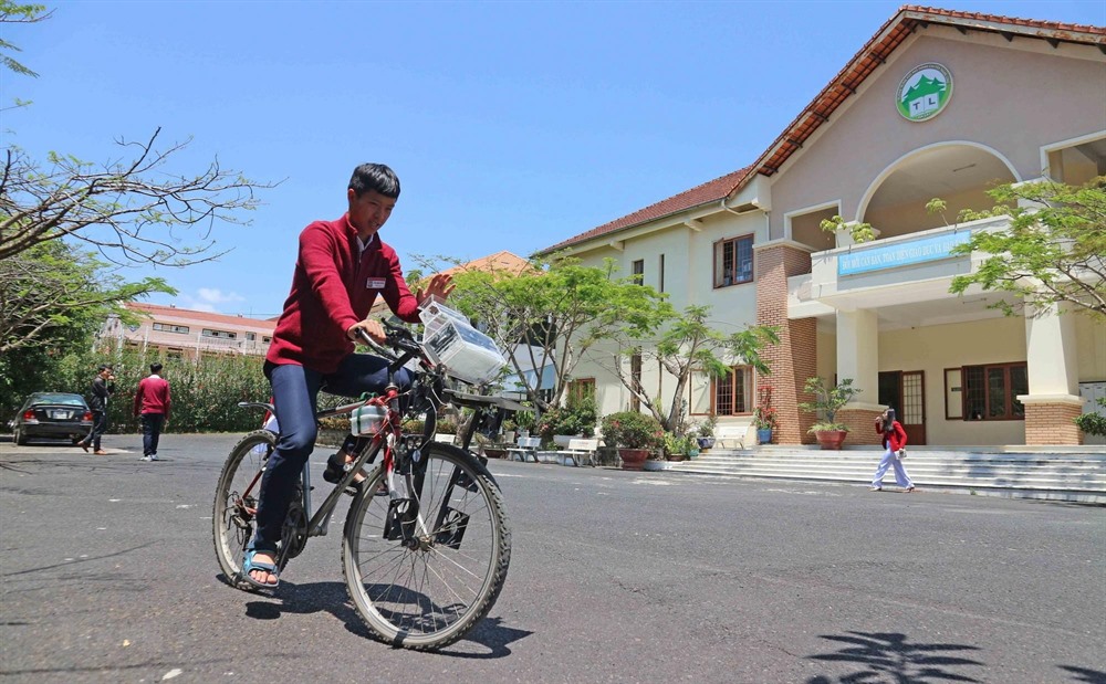
Unlike normal cyclists, the kid in Lâm Đồng Province’s Đà Lạt City doesn’t have to wear a mask to avoid inhaling dirty air, instead his bike cleans the air for him.
 Environment
In 2017, Lê Thị Khởi took a bold step and quit her stable job as a sales manager in Hà Nội to start her own business.
 Environment
Since the establishment of Cúc Phương National Park in 1962, Việt Nam’s Government has devoted huge efforts to developing a system of protected and conserved areas, experts from the International Union for Conservation of Nature (IUCN) announced at a workshop on Tuesday in Hà Nội.
 Environment
More than VNĐ28.5 trillion (US$1.23 billion) has been earmarked for a project to protect, restore and sustainably develop forests in the Central Highlands until 2030.
 Environment
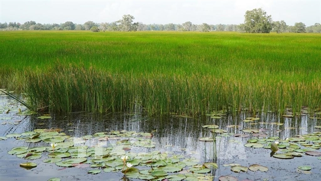
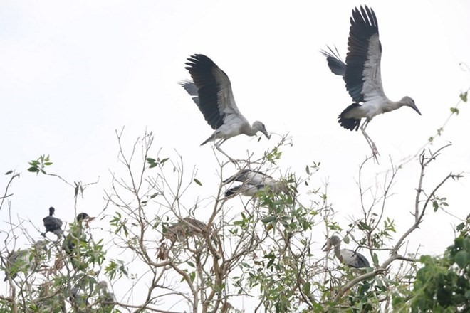
About 200 Asian openbill storks, listed in the rare bird category in the Việt Nam Red Data Book, have been seen in Bạc Liêu Bird Sanctuary in the Mekong Delta province of Bạc Liêu since the beginning of the year.
 Environment
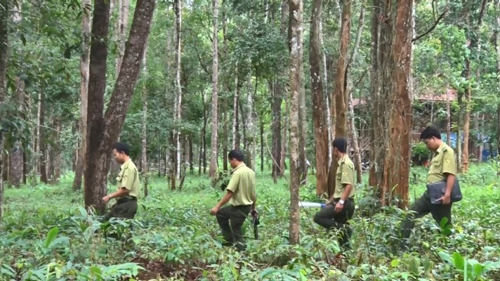
Police in Bình Thuận Province have started criminal proceedings against four leader and officials from the Là Ngà Protective Forest Management Board for violating regulations on the exploitation and protection of forests.
 Environment
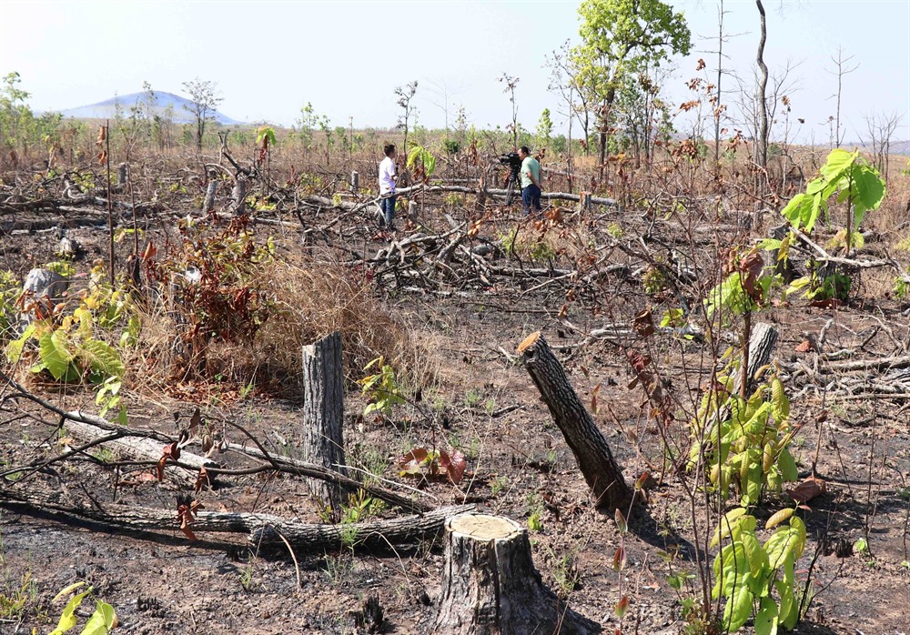
Dozens of hectares of forest were illegally cut down and private properties were constructed along National Road 29 in the area between Ea Súp and Buôn Đôn districts as authorities admitted they were struggling to stop the encroachment.
 Environment
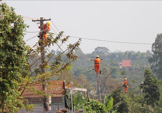
Provinces in the southern region and the Central Highlands have taken measures to prepare for drought and ensure a stable supply of power as weather forecasts say that the region could face a prolonged heat wave this year.