 Environment


|
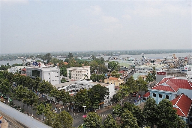
| Vĩnh Long City. — Photo from the Việt Nam Government Portal |
HÀ NỘI — The Vietnamese Government and the World Bank (WB) have signed a US$126.9 million financing agreement to improve infrastructure, connectivity and reduce flood risks in the urban core of Vĩnh Long City in the Mekong Delta province of Vĩnh Long.
The $126.9 million credit is provided through the WB’s International Development Association. The project is being co-financed by a $19.5 million grant from the Development Related Infrastructure Investment Vehicle, a facility provided by the Dutch Ministry of Foreign Affairs. The balance of the cost will be funded by the Vietnamese Government.
Vĩnh Long City is strategically located along the economic corridor that connects HCM City with the Mekong Delta, and has great potential to become a regional hub for agribusiness, trade, and tourism. However, flooding and poor environmental sanitation are major impediments holding back the city’s development. Located at a low elevation on the Tiền River plain, about 60 per cent of the city is prone to flooding.
The Vĩnh Long City Urban Development and Enhanced Climate Resilience Project, at a total cost of $202.2 million, will help remove physical constraints to development in the urban core area through the development of flood control systems, drainage, wastewater collection and treatment, and investment in key urban roads.
“Strengthening urban infrastructure is key to a city’s ability to unlock its potential, safeguard its gains and withstand multiple shocks,” said World Bank Acting Country Director for Vietnam Rahul Kitchlu. “Our support will empower Vĩnh Long City to pursue ambitious investments to build greater resilience to climate and disaster risks.”
According to the WB, nearly half of the project’s funding will be used to develop flood risk mitigation measures, including embankments and tidal sluice gates, rehabilitation and upgrades of the canal and drainage system, and investments in green infrastructure to retain and infiltrate rainwater.
The project will also support the building of three strategic roads that will improve inter-city connectivity and enhance the city’s flood protection capacity.
This project will improve urban management and planning through investments in data, information and communication technology.
Key components will include an integrated flood risk management information system, a geospatial data sharing platform, information, education, communication campaigns and improved transportation management. — VNS


