 Society

Developing remote sensing technology is crucial for socio-economic development and the natural resources sector.

|
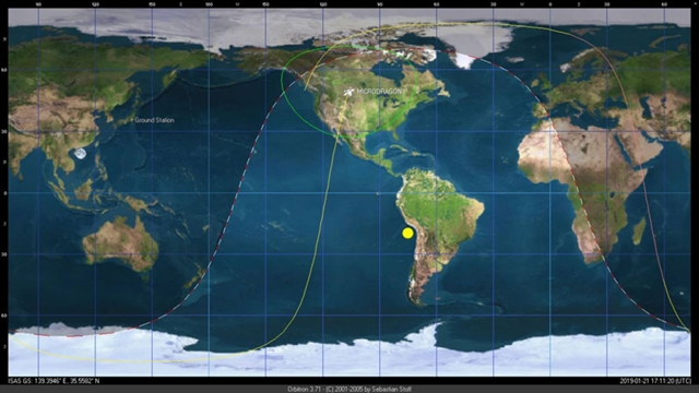
| Image shows the location of Việt Nam’s MicroDragon satellite location when it performed the first test shoot at an altitude of about 512km. — Photo Courtesy of the Vietnam National Space Centre |
HÀ NỘI — Developing remote sensing technology is crucial for socio-economic development and the natural resources sector. Remote sensing involves the scanning of the earth using satellites to gather data, with important applications in various sectors and industries.
Deputy Minister of Natural Resources and Environment Lê Công Thành called for the development of the technology at a conference held yesterday in Hà Nội.
The conference discussed the implementation of a national strategy on remote sensing by 2030.
Speaking at the conference, Thành urged the Department of National Remote Sensing (DNRS) to work with concerned ministries, sectors, localities and other departments under the Ministry of Natural Resources and Environment (MoNRE) to complete a detailed plan to implement the strategy.
The DNRS should involve different organisations in the project’s compilation to ensure it is practical and suitable with socio-economic and environmental circumstances.
Thành said the foundation of the strategy’s steering committee and assistance team should be considered carefully to ensure their effectiveness.
The project’s management board should consider fund allocation for “buying updated high-resolution remote sensing image data every year, and super high-resolution remote sensing image data every five years covering Vietnamese territory and annually for urban areas.”
A data system for remote sensing should also be set up, he said.
By the beginning of February this year, Prime Minister Nguyễn Xuân Phúc released Decision 149/QĐ-TTg to approve the national strategy to develop remote sensing.
The MoNRE on March 27 this year sent a letter to concerned ministries, sectors and localities to set up a plan to conduct the national strategy. — VNS


