
Việt Nam–Laos trade fair to open
1.
Provincial and city authorities plan to evacuate people from dangerous areas before typhoon 4 is expected to enter the Gulf of Tonkin and bring heavy rain to northern and north central provinces in the coming days.
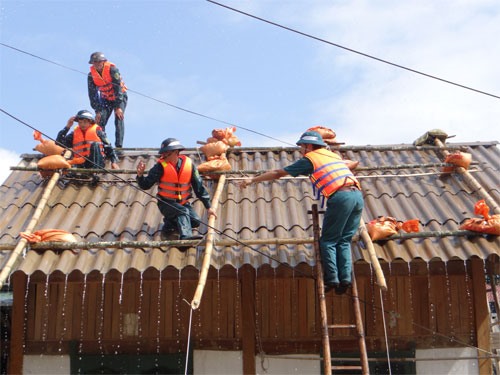 |
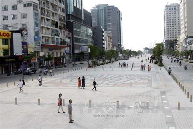
| Provincial and city authorities plan to evacuate people from dangerous areas before Typhoon 4 is expected to enter the Gulf of Tonkin and bring heavy rain to northern and north central provinces in the coming days.— Photo sxd.danang.gov.vn |
HÀ NỘI — Provincial and city authorities plan to evacuate people from dangerous areas before Typhoon 4 is expected to enter the Gulf of Tonkin and bring heavy rain to northern and north central provinces in the coming days.
The Central Steering Committee for Disaster Prevention and Control on Monday asked northern and north central provinces to prepare emergency measures to cope with upcoming storms.
Typhoon 4, or Bebinca, is likely to cause heavy rain, the committee warned, and this threatens to worsen the situation in areas recovering from recent storms. Authorities should prepare for further flash floods, landslides and damage to dykes.
The provinces need to closely monitor the path of the storm, inform and instruct owners of vessels and cruise ships operating at sea in the direction of the storm and prepare escape routes.
The provinces should closely manage offshore fishing vessels, economic production on the sea, islands and coastal areas (aquaculture and shipping), to ensure the safety of people and property, especially tourists.
Mainland provinces were required to closely monitor flooding, actively prevent urban floods and ensure agricultural production, especially in Hà Nội.
To ensure the safety of dykes, reservoirs and construction work, concerned provinces should inspect, guide and review evacuation measures in low-lying areas along rivers, coastal or dangerous areas with a high risk of landslides and flash floods.
The National Centre for Hydro-meteorological Forecasting reported at 10am on Monday that Typhoon 4 was located in the southern waters of Guangdong Province (China), with gusts of level 8 (62-74km/h).
It was forecasted that in the next 24 hours, the typhoon would move eastward, with speeds of 5km/hour.
After that, the typhoon will swing to the northwest, then southwest to Leizhou Peninsula and the Gulf of Tonkin.
At 10am on Wednesday, the typhoon’s eye will be at the southern coastal area of Guangdong (China). The strongest winds near the eye of typhoon are predicted at level 8-9 (60-90km/hour).
At 10am on Thursday, the storm’s eye is forecast to be over the northern part of the Gulf of Tonkin, about 100-130 km from the coast of Việt Nam’s Quảng Ninh Province to Nam Định Province. The strongest wind near the centre of the storm is forecast at level 8 (62-74km/h).
On the mainland, on Tuesday and Wednesday, there will be scattered rain in the north. From Wednesday night to Friday, the north and north central provinces will experience heavy rain, with rainfall predicted at 250-350mm.
There is a high risk of landslides and flash floods in northern mountainous provinces, especially Lai Châu, Sơn La, Hòa Bình, Yên Bái, Phú Thọ, Quảng Ninh, Lạng Sơn and Cao Bằng. — VNS
 Society
 Society
 Society
 Society
 Society
 Society
Minister of Health Nguyễn Thị Kim Tiến has asked large hospitals in HCM City to take drastic measures to reduce patient overload by focusing on satellite clinics at district-level hospitals and applying information technology.
 Society
The central province of Quảng Nam has agreed a pre-feasibility study for the development of an International Education City in Nam Hội An with proposed investment of VNĐ1.5 trillion (US$66.4 million).
 Society
Dozens of residents of a mountainous commune in the northern province of Phú Thọ fear they might have contracted HIV after receiving from a local doctor injections that were allegedly contaminated.
 Society
The People’s Committee of HCM City plans to make District 2 a central district of the city.
 Society
The HCM City school system faces a shortage of facilities and teachers for physical education classes for the upcoming school year.
 Society
 Society
Chairman of the Bình Phước Province People’s Committee Nguyễn Văn Trăm on Sunday asked for an inspection on the work of supporting cashew nut farmers who suffered losses in the period 2016-17.
 Society
A doctor in Hà Nội has raised concerns about the high number of children hospitalised with high fevers and rashes, suspecting that measles is to blame because many kids have not been vaccinated.
 Society
A suspension bridge was damaged after being hit by a truck, seriously affecting the lives of residents in Chiềng Khoong Commune in the northern mountainous province of Sơn La.