 Society


Vietnamese Party official visits China’s Chongqing, seeking to enhance bilateral cooperation
1.
Hà Nội authorities have asked three construction giants to devise planning schemes to develop the areas along the iconic Hồng (Red) River that flows past the capital city.
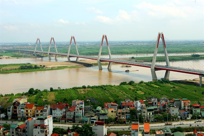 |
| Potential investors are asked to devise planning schemes to develop the areas along the iconic Hồng (Red) River that flows past the capital city. — VNA/VNS Photo Huy Hùng |
HÀ NỘI – Hà Nội authorities have asked three construction giants to devise planning schemes to develop the areas along the iconic Hồng (Red) River that flows past the capital city.
According to the decision of the municipal authority, three investors - Sun Group, Vingroup and Geleximco, will each devise plans and submit them to the municipal authority for selection. They can invite designing consultancy units to collaborate in the project. The final design ideas will be selected by March 30.
Chairman of the municipal People’s Committee Nguyễn Đức Chung asked them to develop a scheme which ensures the city’s flood-resistant capability, effectively makes use of land funds and creates a modern urban area along the river, at a meeting with investors interested in the project.
Additionally, the scheme should give priority to on-site resettlement for local residents and develop waterway transportation and tourism.
The city has suggested two options for the scheme.
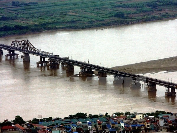 |
| The Red River, originated from China, flows past Hà Nội and several provinces in the north of Việt Nam before emptying into the Gulf of Tonkin. — VNA/VNS Photo |
Option one is to build a new system comprising roads and dykes to replace the current dyke system. This will serve to protect the city from flood alarm level 3+, or emergency flood condition, which sees general and wide spread uncontrollable flooding and severe damage to infrastructure.
Option two is to build a new system of roads and dykes which can protect the city from flood alarm level 2, or dangerous flood condition, which means flood plane inundation expected, bridge foundations at risk but infrastructure generally safe. In addition, water reservoirs and canals will also be built to support the current dyke system, which is located further inland, to protect the city from flood alarm level 3+.
The planning scheme will be divided into two phases, with the first one covering the areas on the banks of the river from Thăng Long Bridge to Thanh Trì Bridge and the second one covering the rest.
The Red River, originating in China, flows past Hà Nội and several provinces in the north of Việt Nam before emptying into the Gulf of Tonkin. Besides being one of the main river systems that plays a crucial role in irrigation and waterway traffic, the river is also seen as a symbol of the capital city. – VNS
Society
 Society
 Society
 Society
 Society
 Society
 Society
More than 280 blood-pressure screening spots have been set up in HCM City under the Communities for Healthy Hearts programme.
 Society
The Ministry of Health (MoH) on Wednesday urged residents to give children the complete four doses of the diphtheria vaccine.
 Society
Two Laotians were arrested on Wednesday for smuggling some 41,000 pills of synthetic drugs into Việt Nam, according to the border force of the central province of Quảng Bình.
 Society
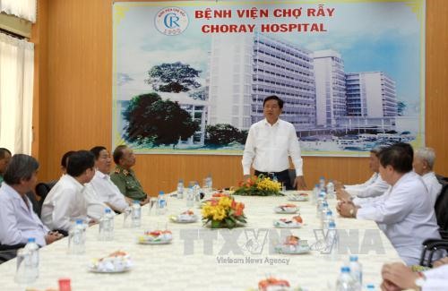
HCM City authorities have asked Chợ Rẫy Hospital, the major hospital in the southern region, to build new medical facilities and satellite hospitals to reduce severe patient overloading at city hospitals.
 Society
The Cần Thơ City Police on Wednesday asked the municipal People’s Procuracy to prosecute nine traffic inspectors for receiving bribes.
 Society
The Việt Nam Fatherland Front Committee, Youth Union and Student Support Centre have gifted bus tickets to 5,000 disadvantaged students and workers for returning home for Tết (Lunar New Year).
 Society
Inspectors from the Ministry of Health discovered 244 cases related to the trade and manufacture of unsafe dietary supplements and pharmaceutical products last year.
 Society
Deputy Prime Minister Vũ Đức Đam called on ministries to review their databases and means of information delivery to improve and offer more online public services.
 Society
External information work and dissemination of information on sea, islands, border demarcation and landmark planting must be stepped up in 2017, focusing on the Party and State’s guidelines and foreign policies, said Phạm Văn Linh, deputy head of Central Committee’s Commission for Communication and Education.