 Society

The HCM City Department of Health plans to use geographic information system (GIS) technology for infectious disease surveillance in all 24 city districts.
 |
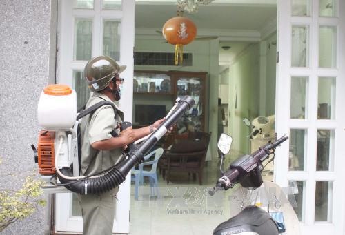
| A health official sprays chemicals to kill mosquitoes and larvae. Photo Phương Vy |
HCM CITY— The HCM City Department of Health plans to use geographic information system (GIS) technology for infectious disease surveillance in all 24 city districts.
The GIS plan was first piloted in District 8, Thủ Đức and Tân Phú, said Nguyễn Hữu Hưng, deputy director of the department.
This year, medical stations at all wards and communes would adopt GIS technology, Hưng said at a meeting held on Monday.
The city’s Preventive Medicine Centre would collect information on infectious disease cases, track the spread of disease, and respond effectively to disease outbreaks, he said.
Outbreaks of dengue fever and the Zika virus remain the top concern of the preventive medicine sector, he added.
More than 11,000 areas in the city are at risk of dengue fever, with 34 per cent of areas located in Bình Chánh District, 17 per cent in Thủ Đức District and 15 per cent in Hóc Môn District, according to a report from the city’s Preventive Medicine Centre.
Last year, the city recorded 190 Zika virus infection cases in 23 of 24 districts, including cases affecting 38 pregnant women. Only District 8 had no Zika virus case.
A total of 22,098 cases of dengue fever were reported in the city last year, including six deaths compared to 22,150 cases and seven deaths in 2015. —VNS