 Society

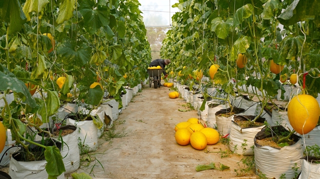
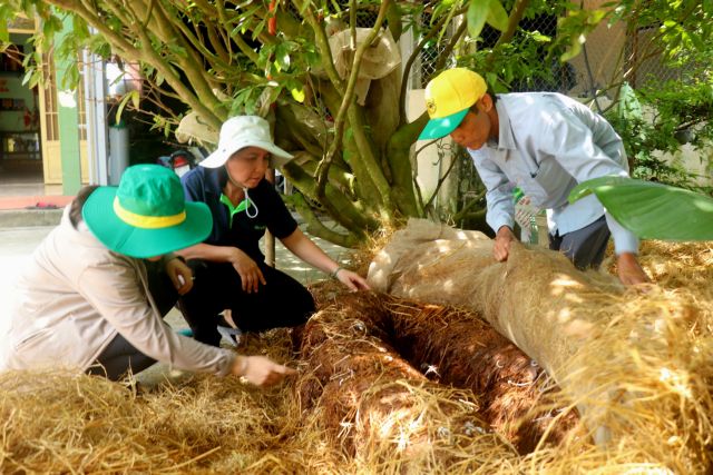
Tây Ninh advances digital transformation in agriculture
1.
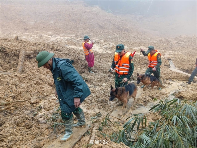 |
| Rescue teams search for missing victims after a landslide in Hùng Sơn, a border commune of Đà Nẵng, in mid-November. — VNA/VNS Photo |
HÀ NỘI — After a year of punishing storms, floods and landslides, scientists are urging sharper forecasting and village-level alerts to save lives and prepare communities for a harsher climate era.
Over the past two decades, natural disasters have killed or left missing roughly 314 people annually. In just the first 11 months of 2025, the toll climbed to 409, with economic losses reaching an estimated VNĐ86 trillion (US$3.3 billion).
Researchers say the figures point to increasingly intense natural disasters and gaps in how quickly warnings reach vulnerable communities.
"Early warning for natural disasters, especially flash floods and landslides, must be more accurate and must reach every household. Only then can we reduce the scale of the damage," said Đỗ Minh Đức of the VNU University of Science.
Việt Nam’s steep mountains make it especially prone to landslides. Đức says nearly any hillside can slip once excavated for housing, particularly when slopes exceed 45 degrees, or cuts reach more than six metres.
He identifies two major types of risk. The first is small to medium slides triggered by heavy rain.
"These can be forecast more effectively with dense rain-gauge networks and new modelling techniques," he said.
The second, and far deadlier, are large, deep-seated earth and rock slides tied to geological structures rather than rainfall. Although they account for only around 15 per cent of incidents, they cause more than 85 per cent of the damage.
The stretch from Đà Nẵng to Lâm Đồng, where construction and road-building have boomed, faces particularly high danger.
Warning signs – long cracks, subsiding terraces, tilted houses or streams that bend unnaturally – are often visible, Đức noted, but identifying them correctly requires geological training that many local officials and residents do not have.
To close that gap, Đức’s research team has developed a set of 20 simple indicators and a new early-warning platform that grades every village by risk level.
Using years of rainfall data and a Random Forest model, each village receives daily forecasts and real-time hourly alerts. The system also generates household-specific evacuation scenarios and identifies safe escape routes.
When rainfall crosses danger thresholds, the software automatically emails disaster-response committees and sends Zalo messages to village leaders and residents – as frequently as every 20 minutes during rapidly escalating conditions.
"In recent heavy-rain events, combining risk maps with Zalo alerts and local sirens helped many households evacuate early, significantly reducing losses compared with 2017," Đức said.
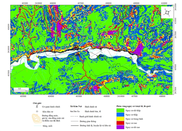 |
| The Random Forest–based map outlining areas at risk of landslides and flash floods. |
Cao Đức Phát, Chair of the Natural Disaster Prevention Fund, warned that Việt Nam has endured a series of severe, historically significant storms and floods in recent years.
He called for deeper investment in scientific modelling to predict flooding levels under different rainfall scenarios, especially in situations where electricity and communications may fail.
Advances in digital technology are reshaping what is possible. Satellite imagery, automated rain gauges, radar and sensors that measure water levels, wind and flow velocity are now feeding high-resolution models that can generate faster, more localised warnings.
Lê Viết Xê, Deputy Director of the Water Resources Technical Development and Consulting JSC (WATEC), said digital transformation and the rise of smart-city planning have accelerated the development of systems like VFASS, an automated flood-monitoring network already deployed nationwide.
The system uses solar-powered radar sensors to track flood depth, sends real-time data via 3G/4G and issues automatic alerts when thresholds are breached.
All data are processed on WATEC’s cloud platform, enabling national-scale analysis and API-based data sharing.
VFASS can also link with rain gauges, water-level stations and all-in-one flood-warning towers to broadcast multi-channel alerts. More than 140 towers and over 70 monitoring stations are currently operating across Việt Nam, with units exported to the Philippines.
Beyond forecasting, digital tools are also changing how communities respond. JCI Việt Nam has launched CuuTro.JCI.vn, a real-time platform connecting people needing help with volunteers and donors.
Users can send 'need help' signals, while individuals and businesses can register 'want to give.' A live map shows rescue progress, shelters, warehouses and unassisted households.
In recent deployments, the platform logged nearly 1,500 help requests, confirmed the safety of 449 households, mobilised more than 70 benefactors and coordinated over 80 tonnes of goods from multiple provinces and cities.
"We commit not to charge fees or commercialise the platform," said JCI Việt Nam Chairman Nguyễn Tiến Dũng.
"The goal is simple: ensure people who need help are seen and people who want to help can reach the right place at the right time."
Despite the growing use of technology, officials say structural challenges remain. Commune-level authorities, once focused mostly on implementing district-level instructions, are now expected to issue commands and lead on-the-ground response.
"The workload is becoming heavier and coordination between communes and provinces is increasingly complex," said Bùi Quang Huy, Deputy Director of the Disaster Prevention Policy and Technical Centre.
He warned that some localities still confuse basic IT applications with full digital transformation.
"Technology alone is not enough. People must change the way they think and operate," he said.
"The goal is not just sending information; it is ensuring people receive it, understand it, know what to do and can actually do it."
The centre is piloting a provincial-level monitoring platform in the central province of Hà Tĩnh that integrates real-time data from national to community levels, tracks evacuation progress and replaces static paper maps with dynamic scenario-based planning.
"All these tools serve one purpose – to protect lives and property and to help people stay truly proactive in the face of natural disasters," Huy underlined. — VNS
Society
 Society
 Society
 Society
 Society
 Society
 Society
.jpg) Society
Society
 Society
 Society
 Society
 Society
 Society
 Society
 Society