 |
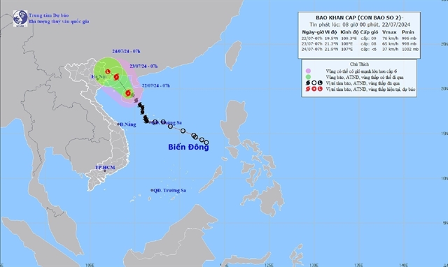
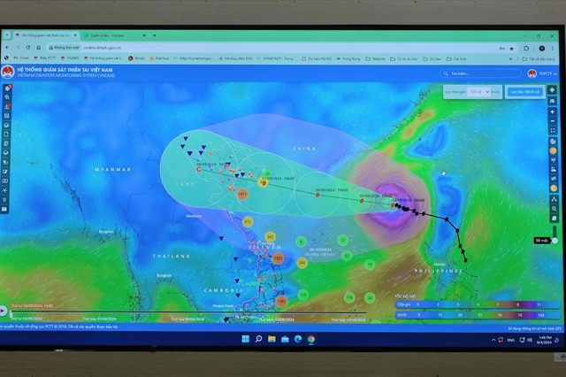
| A map expresses the Typhoon Yagi’s direction. — VNA/VNS Photo Hoàng Hiếu |
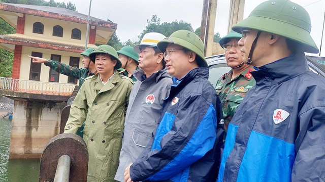
HÀ NỘI — The Civil Aviation Authority of Việt Nam (CAAV) has taken proactive steps to address the potential impact of Typhoon Yagi, the third typhoon of the year, which is forecast to affect six airports in the country.
On Wednesday, the CAAV issued an official dispatch to relevant aviation units, urging them to prepare for the typhoon. The affected airports include Vân Đồn, Cát Bi, and Nội Bài International Airports, as well as Vinh, Thọ Xuân, and Điện Biên Airports.
The CAAV has instructed agencies to organise around-the-clock duty shifts and to strictly follow typhoon and tropical depression response procedures within the civil aviation sector.
The Việt Nam Air Traffic Management Corporation directs aviation meteorological service providers to ensure the meteorological information quality, continuously monitor the weather situation and update forecasts and warnings.
Airports, airlines and flight operations service providers should strengthen coordination and keep close watch on the typhoon's direction so that they can adjust flight plans or change flight schedules.
They must fully update meteorological information from aviation meteorological agencies and, based on the actual situation, deploy necessary response actions to ensure flight safety and protect people and assets.
In addition, they need to deploy plans to prevent flooding in airports, protect vehicles and flight equipment to minimise damage caused by heavy rains and quickly stabilise all aviation activities to serve the passengers’ needs.
According to the National Centre for Hydro-Meteorological Forecasting and the World Meteorological Organisation, at around 7am on Friday, the typhoon will be about 180km east of Hainan Island (China), with a level of 14-17.
At 7am on the next day, it will move at a speed of about 15-20 km per hour in a west-northwest direction with an increased level of 13-16.
It will continue to head mainly in the west-northwest direction, travelling 15-20km per hour with intensity continuing to decrease. — VNS
 Society