 Society

Đà Nẵng's iconic Chăm sculpture museum works to digitise its offerings
1.
A group of Vietnamese researchers has created an unmanned vehicle that can be used to create maps of the ocean floor and collect environmental data.
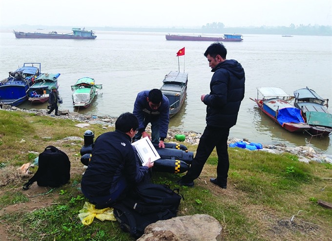 |
| Researchers from the Việt Nam Institute of Geodesy and Cartography prepare to test their seafloor mapping vehicle by the Hồng (Red) River. The unmanned surface vehicles, developed in Việt Nam, can gather data from areas of the ocean floor and river beds inaccessible to humans. — Photo baotainguyenmoitruong.vn |
HÀ NỘI — A group of Vietnamese researchers has created an unmanned vehicle that can be used to create maps of the ocean floor and collect environmental data.
The 60kg vehicle has a composite shell and can collect data from 1-1,000 metres below the surface. It sends data to an analysis centre via radio signal and the General Packet Radio Service (GPRS).
Equipped with data recording software, a camera, a satellite locator, an antenna and an echo sounding device, the vehicle runs on two batteries and can operate for eight to 10 hours straight.
It performed well when tested in fast-flowing areas of the Lô and Đà rivers and near the island district of Vân Đồn in the coastal province of Quảng Ninh, Tài nguyên Môi trường(Natural Resources) online newspaper reported.
The vehicle was created by researchers from the Việt Nam Institute of Geodesy and Cartography under the Ministry of Natural Resources and Environment (MONRE) as a result of a project that is running from January 2018 to June 2020.
It operates with two systems that have never been successfully assembled in Việt Nam before, according to Lưu Hải Âu, director of the institute’s Centre for Informatics and Geodesy.
They include a satellite positioning system running with virtual reference station (VRS) technology attached to an unmanned aerial vehicle and a software system that integrates echo sounding devices via an internal measurement unit, he said.
“The theories of operation of these two systems were thoroughly studied by MONRE and were proven effective after being put into production,” Âu said.
"Mapping the topography of the ocean floor and river beds with echo sounding devices attached to unmanned surface vehicles is new to Việt Nam, though the technique is practised worldwide," he said.
The unmanned surface vehicle would help create large-scale topographic maps of areas with dangerous terrain inaccessible to humans and those that are polluted, he said.
“It can also gather water pollution data and help to detect factories that release untreated waste into the environment,” said Âu. — VNS
Society
 Society
 Society
 Society
 Society
 Society
 Society
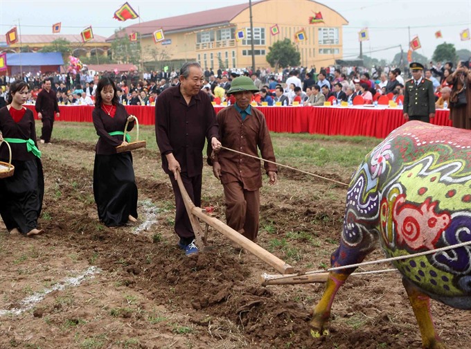
Deputy Prime Minister Trương Hoà Bình took part in a traditional ploughing festival to pray for a year of abundant harvests and prosperity yesterday at the annual Tịch Điền (Ploughing) festival in Đọi Sơn Commune, Duy Tiên District, the Hồng (Red) River Delta province of Hà Nam.
 Society
National Assembly Chairwoman Nguyễn Thị Kim Ngân and other leaders visited and extended Tết (Lunar New Year) greetings to the Commercial Bank for Foreign Trade of Việt Nam (Vietcombank – VCB) and Việt Nam Customs on the first working day of the Year of the Pig yesterday.
 Society
Many universities plan to offer new courses to attract more students and meet the market demand for human resources.
 Society
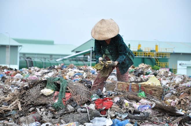
The Cà Mau City Waste Treatment Plant reopened after six months of maintenance, said Nguyễn Đức Thánh, chief of the Cà Mau Province People’s Committee secretariat on Sunday.
 Society
As many as 313 people were hospitalised due to incidents involving firecracker during the nine days of Tết (Lunar New Year), nearly doubling last year’s figure, according to health authorities.
 Society
No epidemics broke out during the Tết (Vietnamese Lunar New Year) Holiday from February 2 to 10, according to the Ministry of Health.
 Society
Police in central province of Thanh Hoá on Sunday announced that they successfully stopped a group of 11 men from illegally crossing border for work in China.
 Society
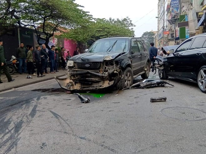
As many as 22 people were killed and 19 others injured in 22 traffic accidents that occurred nationwide on Sunday (the sixth day of the Lunar New Year).
 Society
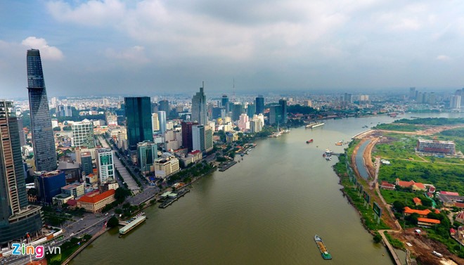
Hà Nội and HCM City are among the top ten most dynamic growing cities in the world, according to a study by a leading international property and investment management company.