 Society


Deputy PM urges swift completion of dossier for Ninh Thuận nuclear power project
1.
The levelling of land for construction purposes, as well as the effects of climate change and rising sea levels, has contributed to a dramatic increase in water levels of the Sài Gòn River.
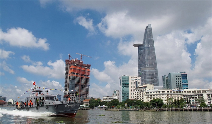 |
| The levelling of land for construction purposes has caused the Sài Gòn River’s water levels to rise. — VNA/VNS Photo Thế Anh |
HCM CITY — The levelling of land for construction purposes, as well as the effects of climate change and rising sea levels, has contributed to a dramatic increase in water levels of the Sài Gòn River.
Bùi Việt Hưng, of the Environment Department at the University of Natural Sciences at Việt Nam National University, said that if 1,000 hectares of land along the Soài Rạp River were levelled for construction of new buildings, the water levels near the mouth of the Sài Gòn River would rise by one centimetre.
The larger the levelled area, the higher the water would rise, Hưng said, adding that Sài Gòn River’s rising water levels have worsened flooding in HCM City.
According to HCM City’s Steering Centre for Flood Control, when the tide rises more than 1.5 metres, nine streets in the city are submerged under water.
High tides combined with heavy rain flood several areas in districts 2, 4, 5, 6, 7, 8, and Bình Thạnh, Bình Chánh and Nhà Bè.
Hưng was quoted in Tuổi Trẻ (Youth) newspaper as saying if the low-lying areas along the Soài Rạp River do not change, the water level on the Sài Gòn River would remain low and help to reduce floods in the city.
When additional low-lying land is levelled, the tides on the Sài Gòn River will rise between 6cm and 10cm, as the areas play an important role in not only reserving bio-diversity but also regulating tides in the river, according to Hưng.
However, the demand for development of new urban areas and industrial parks along the Soài Rạp River is high, reducing the amount of low-lying land area and creating rising water levels on the river.
Dr. Hưng said the city should preserve an 80,000-ha area of low-lying land in Gành Hào Bay near Soài Rạp River. Because the city now has only 40,000 protected hectares (a mangrove forest in Cần Giờ District), an additional 40,000 hectares should be preserved.
Building sluice gates and a dyke system would not be enough to control flooding, he said.
Funds for anti-flooding
Due to its limited resources, HCM City needs to be selective and only go ahead with the most urgent flood-prevention works, Trương Trung Kiên, head of the Urban Committee, has said.
On Wednesday the city Finance and Budget Committee and Urban Committee held a discussion with the Anti-Flooding Programme Operation Centre on capital allocation for upcoming anti-flooding projects.
Kiên advised the centre to be selective since it cannot concurrently implement all projects envisaged under two major anti-flooding programmes due to a lack of funds.
Phan Thanh Bình, vice chairman of the Finance and Budget Committee, said co-ordination between relevant agencies was not effective and the progress of flood-prevention projects was slow.
"The centre is placing too much emphasis on flood prevention while ignoring water drainage solutions," he said.
Nguyễn Ngọc Công, director of the centre, said more funds would be needed since more anti-flooding projects are planned in Districts 8, 2, Tân Phú, and Bình Thạnh this year.
Kiên said though multiple flood-prevention works had been carried out, people were not aware of them since many places continued to suffer from flooding.
"The centre needs to inform the public about its plans so that their lives and businesses are not disrupted," he said.
It should also apprise the city Department of Natural Resources and Environment of flood-prone areas and how high the waters would rise, he added. — VNS
Society
 Society
 Society
 Society
 Society
 Society
 Society
Vietnamese students won two gold medals and one silver and bronze at the 28th International Olympiad in Informatics in Russia.
 Society
Building a digital economy will be very important for Việt Nam to keep pace with rapid technology developments across the globe, a senior Australian scientist has said.
 Society
Phạm Văn Cường, 23, can never forget the days when he toiled at low-paid work in the southern Bình Dương Province to earn money to help his mother. This came to an end when he caught a lucky break.
 Society
The People’s Committee of the central Phú Yên Province has sought the transport ministry’s approval to build Đà Rằng and Sông Chùa bridges on National Highway 1.
 Society
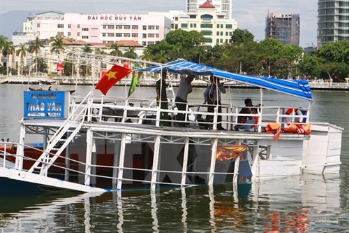
Đà Nẵng City People’s Procuracy will prosecute the Đà Nẵng Port Authority of Inland Waterways’ former director for irresponsibility that led to the fatal tourist boat sinking on June 4.
 Society
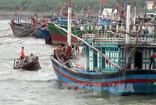
Storm Dianmu has made landfall from the northern Hải Phòng port city to the northern Ninh Bình province this afternoon, the National Hydrometeorological Forecast Centre said.
 Society
Hà Nội will use electronic school records instead of hard copies to manage 1.7 million students in the city from September 5, People’s Committee Chairman Nguyễn Đức Chung said.
 Society
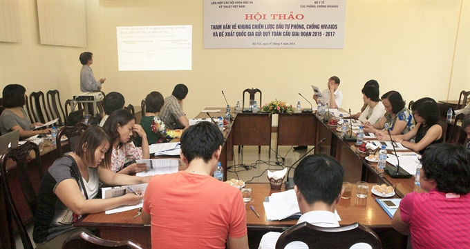
The United States Agency for International Development has provided a five-year grant to Việt Nam’s Centre for Promotion of Quality of Life to strengthen community-led approaches to HIV prevention, care and treatment.
 Society
Public hospital services and products in 16 provinces and cities have become 18 per cent more expensive since the middle of August, as patients pay for health staff’s basic salaries.