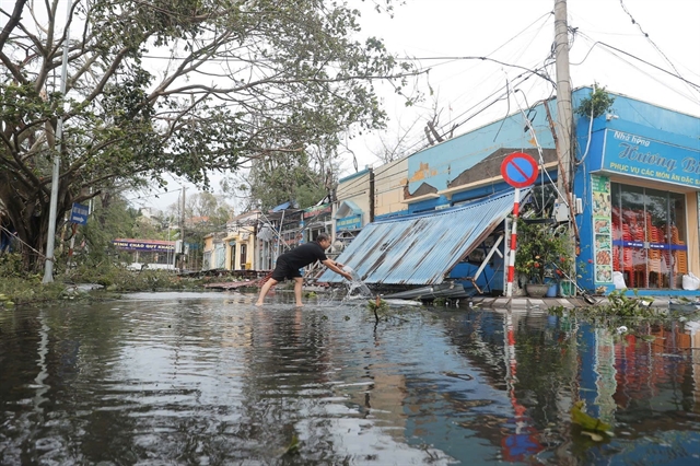
HÀ NỘI — Torrential rain from Typhoon Yagi across the northern region and the release of water from hydropower reservoirs further upstream have caused the Hồng (Red) River to rise rapidly, flooding residential areas along the riverbanks in the capital city of Hà Nội.
On September 10, Hà Nội Department of Transport announced that passenger coach buses with over 9 seats and freight vehicles heavier than 0.5 tonnes are banned from traveling on Chương Dương Bridge (completed in 1983) in the wake of the bridge collapse that killed eight people in Phú Thọ Province. The decision has come into effect since 8.30am.
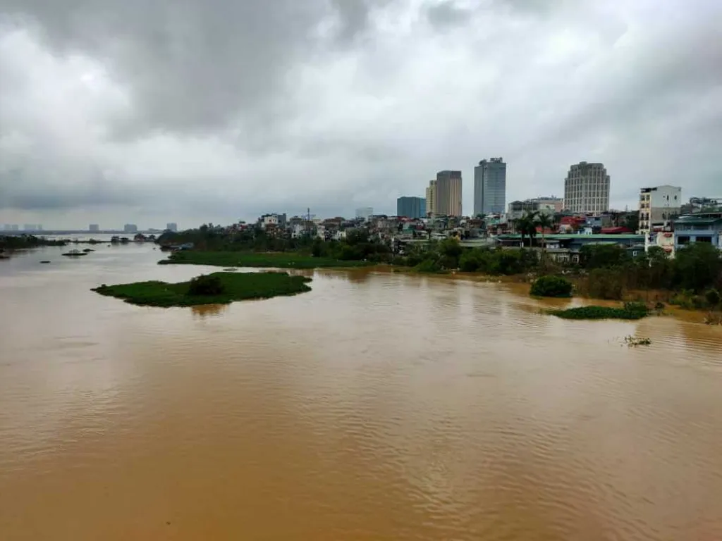 |
| View from Chương Dương Bridge showing an overflowing Red River. VNS Photo Đoàn Tùng |
 |
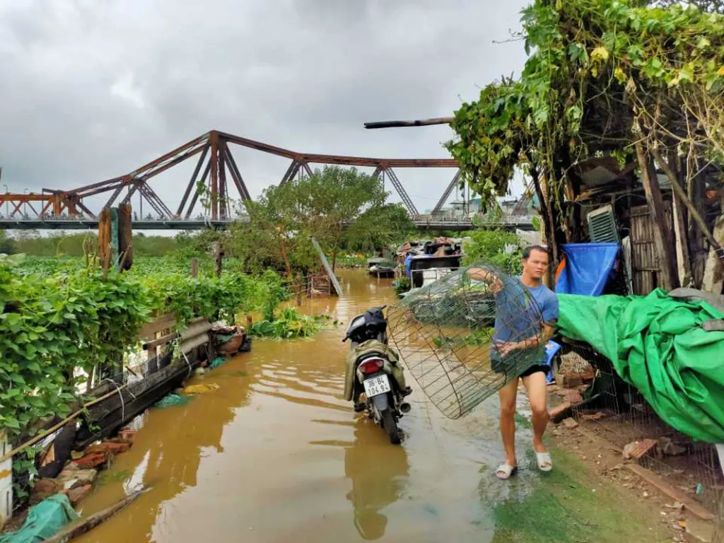
| Rising water levels of the Hồng (Red) River have started to flood the Phúc Xá area in Hoàn Kiếm District on Tuesday morning. — VNA/VNS Photos |
 |
| As of 7am on Tuesday, the water level of the Hồng River reached 9.2 metres, exceeding the Alert Level 1 by 0.7m. |
 |
| For the first time in decades, the Hồng River has risen to this level. |
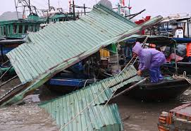
On Monday night, the National Centre for Hydrometeorological Forecasting reported rising floodwaters over the past 12 hours in the Thao River (Lào Cai, Yên Bái, Phú Thọ), Lô River (Tuyên Quang, Phú Thọ), Cầu River (Thái Nguyên, Bắc Ninh), Thương River (Bắc Giang), Thái Bình River (Hải Dương), and Hồng River (Hà Nội).
Warnings were issued for severe flooding, flash floods, and landslides in northern Việt Nam.
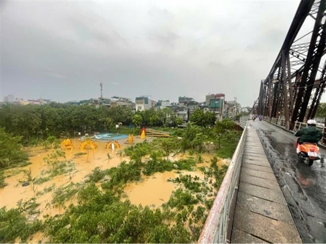 |
| The water level of the Hồng River has risen, coming within about 1 metre of Long Biên Bridge. |
On Monday night, the rapidly rising Hồng River caused flooding in several areas near the river. Water levels surged at the Chương Dương Độ parking area in Hoàn Kiếm District, prompting authorities to block the roads and warn residents to avoid dangerous areas.
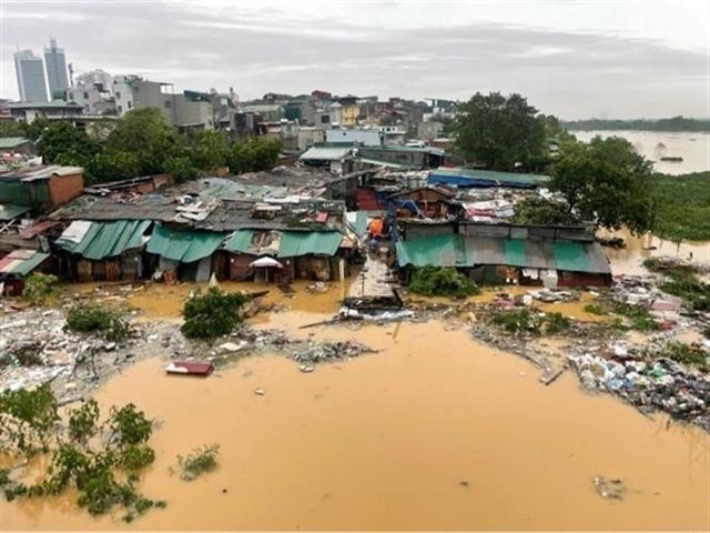 |
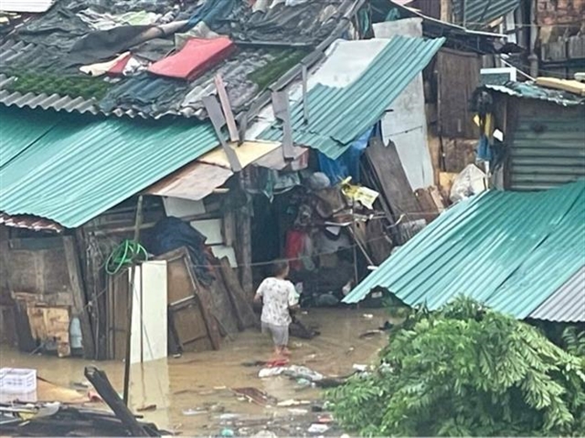
| Flooding has begun in the Phúc Xá area of Hoàn Kiếm District, impacting residents' daily lives |
Flooding also occurred at the end of Alley 76 An Dương in Tây Hồ District, where the water rose above waist level. As residents moved deeper into the alley, the water levels continued to rise.
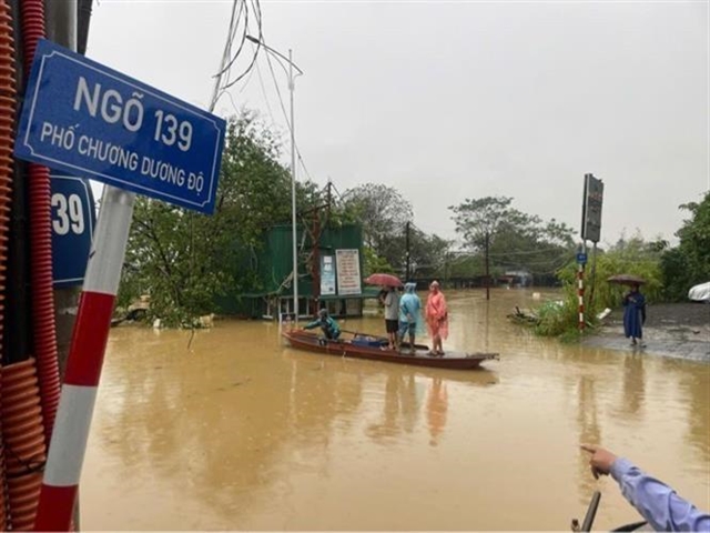 |
| Residents in the Phúc Xá area are using boats to travel. |
In the Tứ Liên area, water flooded fields, causing concern among residents as crops, particularly ornamental kumquat trees, were submerged.
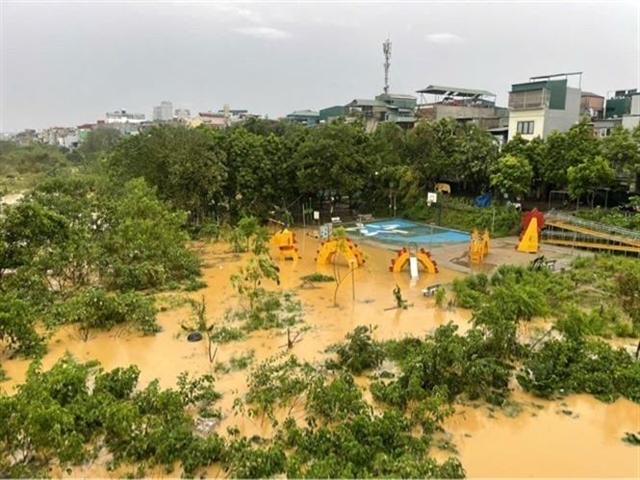 |
| The water levels continued to rise. |
 |
| The fast overnight flooding left people unprepared. |
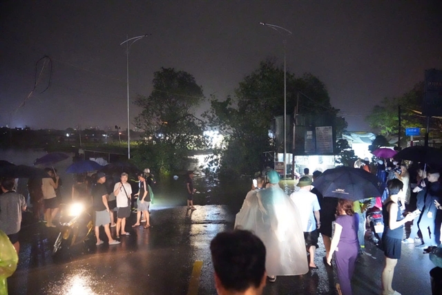 |
| People in Chương Dương Độ area were up all night as water level rises. |
Given the rising Hồng River and the risk of flooding, the Hà Nội Department of Agriculture and Rural Development has requested that the People's Committees of Tây Hồ, Ba Đình, and Long Biên districts be ready to evacuate residents living on the midstream islands of the Hồng River. — VNS
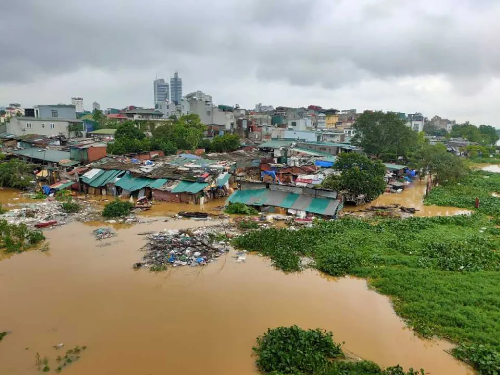 |
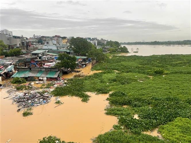
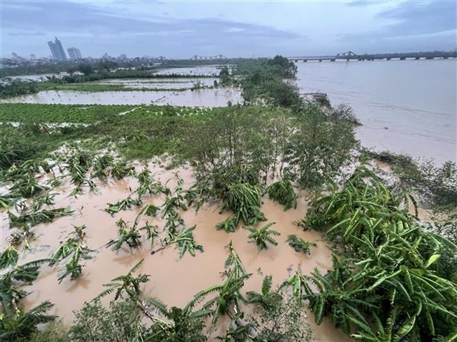
| The 'middle plain' in Red River was completely submerged. VNS Photo Đoàn Tùng |
 |
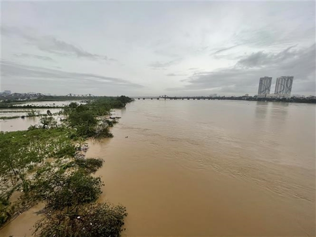
| An inundated area near Red River. VNS Photo Đoàn Tùng |
 Society

 Society
 Society
 Society
 Society
 Society
 Society
 Society
 Society
 Society
 Society
 Society
 Society
 Society
 Society