 Environment

|
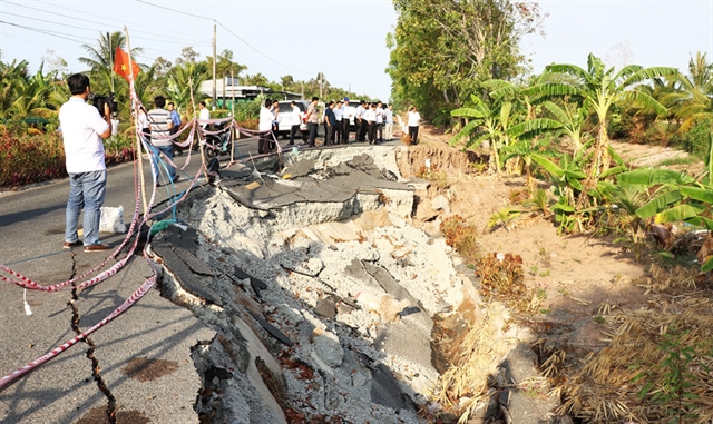
| A landslide in Tắc Thủ-Vàm Đá Bạc area in Khánh Bình Tây Commune in Cà Mau Province. Photo hanoimoi.com.vn |
CÀ MAU — Landslides and high tides are living nightmares for residents in the Mekong Delta province of Cà Mau, who are relying on agriculture for their livelihoods.
Trần Thanh, a fisherwoman in Khánh Bình Tây Commune, Trần Văn Thời District, said she could never forget the time when she was on the brink of life and death during a recent high tide.
“Strong winds followed by big waves hit the embankment. The waves were so strong it swept people into the sea,” Thanh said.
Fortunately, it lasted only about 5 minutes, so Thanh managed to escape and stay safe.
The tide caused great damage to people's property, especially those living on the dyke.
“Almost all of their assets have been lost, and some people collected a bit of their damaged property to sell for money," she said.
The Western sea (Biển Tây) dyke which was formed in 1997 covers a length of 108km and passes through three districts: U Minh, Trần Văn Thời and Phú Tân with a total of 10 communes and two towns.
It helps to protect more than 26,000 households and nearly 129,000 hectares of agricultural and aquaculture production land.
Constant landslides and high tides during the rainy and stormy seasons have been a threat to the lives and properties of local people.
In July 2022, the province announced an emergency situation on natural disasters as there was erosion due to the influence of tropical depressions. At many sections of the West sea dyke, there were serious landslides with a high risk of dyke breaking.
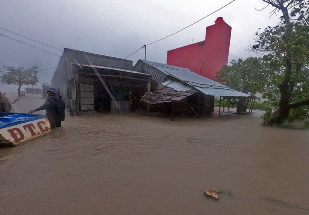
Many local houses and agricultural areas were flooded.
Residents in Khánh Bình Tây Commune have been growing rice and other crops to make ends meet. In recent years, their livelihoods have been severely affected by the adverse effects of landslides and rising sea levels triggered by climate change.
Đỗ Viết Thảo in Thời Hưng Hamlet, Khánh Bình Tây Commune, said that in recent years, the concerns of flooding in rice fields would rise during the rainy season.
“People here mostly cultivate rice for two crops. Rising sea levels push salt water into rice fields, which causes damage to the rice crop and salinity to the land. This would have huge impacts on the cultivation of the following crops,” he said.
According to Deputy Director of Cà Mau’s Department of Agriculture and Rural Development Tô Quốc Nam, the average high tide is from 2.5 to 2.6 m and even higher, in recent years.
“The Western sea area has been built with dykes, however in the East sea area, the landslides are more serious,” he said.
|
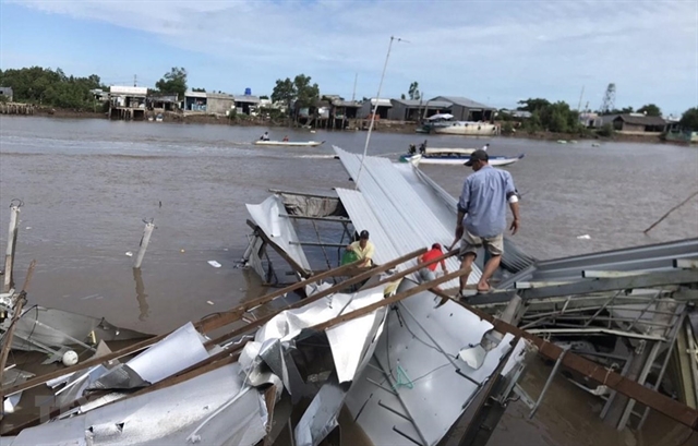
| Houses are damaged due to landslides in Cà Mau Province. VNA/VNS Photo |
On average, landslides encroach 30-40 metres a year. In some areas, including Hố Gùi, the landslides encroached 80 m area within just a month.
“In this area, there is no infrastructure or population living so it will lose land wherever it falls," Nam said.
It is very concerning that in the Eastern sea area, there are no dykes and embankments, so waves encroach day and night, leading to land and forest losses.
According to statistics, along 142km of the Eastern sea area, over 80km is in a state of erosion with varying degrees of severity.
Nguyễn Văn Tẻo, a resident of Tam Giang Tây Commune, Ngọc Hiển District, and his family have lived here for 18 years.
Recently, his family has had to move three times because of landslides.
His family used to have 3.6 hectares of production land, but due to landslides, it decreased to only 1.6 hectares, putting his family’s livelihoods in a very precarious situation.
Climate change risk and response
As the southernmost province of the country, Cà Mau is considered one of the localities most vulnerable to climate change. The province is suffering about 17 out of 22 types of natural disasters.
According to its People's Committee, the coastal and riverbank erosion alone has damaged nearly 26km of roads and over 230 houses, with a total loss of more than VNĐ1 trillion.
In particular, this also occurs at a greater scale and frequency. In the last 10 years, landslides have lost more than 5,200 hectares of coastal forests, equivalent to the size of a commune.
|
| Local homes are flooded. VNA/VNS Photo |
The current landslides are not only happening in coastal areas, but also along about 365km of riverbanks, of which about 114km of riverbanks are eroded at a very dangerous level.
Vice Chairman of Cà Mau Provincial People's Committee Lê Văn Sử said that with the current rate of landslides, if there is no immediate solution, landslides will cause more forest loss and damage to coastal households. If landslides go deep into the mainland, not only will they destroy land and forests, but also threaten many built-in infrastructure and coastal residential areas, then the construction of landslide prevention works will not be effective. It is not only costly but also makes it very difficult to restore the lost land and forests, he said.
Cà Mau has developed a plan to prevent and control riverbank and coastal erosion until 2030.
“Despite efforts of the locality, impacts of climate change are very complicated and are occurring faster than its capacity to respond,” Sử said.
With effort and support from the central Government, the province has built nearly 57km of embankment protection with a total cost of more than VNĐ1,800 billion.
The province is building embankments stretching nearly 31.2km, with a cost of over VNĐ1,200 billion, to protect areas at very high risk of landslides. — VNS

