 Society

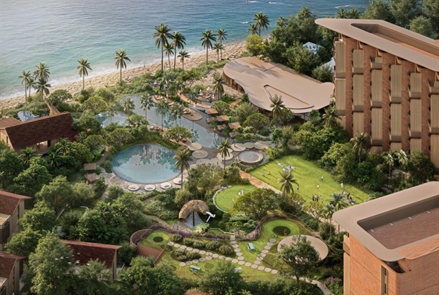
Meliá Hotels International announces new beachfront sanctuary in Mũi Né
1.
|
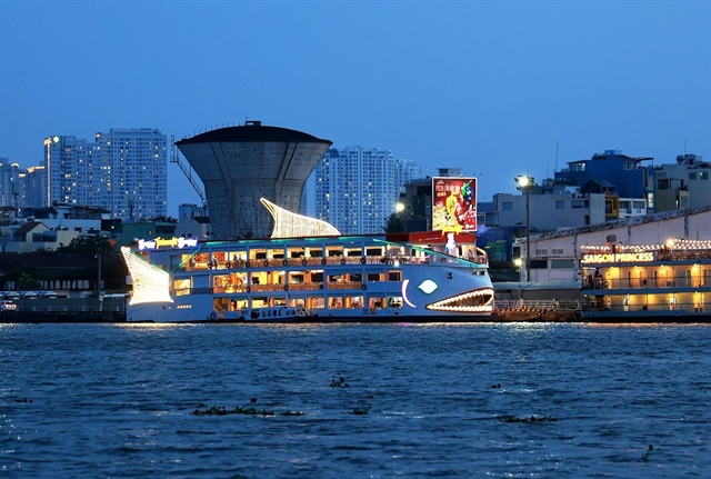
| A tourism ship runs on the Sài Gòn River. — VNA/VNS Photo Hồng Đạt |
HCM CITY — Hồ Chí Minh City identified the Sài Gòn River as central to its general planning, a consensus reached by experts during a conference held on Saturday.
During the conference titled "Developing space along the Sài Gòn River corridor following the French experience on the Seine River," organised by the HCM City People’s Committee, Chairman of the Committee, Phan Văn Mãi, stated that the city is currently implementing three plans.
These plans include the HCM City planning for the period 2021-2030, with a vision towards 2050; a review and adjustment of the city's general planning until 2040, with a vision extending to 2060; and the development of a comprehensive plan for Thủ Đức City during the same period as the general planning for HCM City.
Mãi emphasised the paramount importance of these plans for the city's development in the foreseeable future.
Research aimed at preserving and promoting the value of the Sài Gòn River in the general planning of HCM City and Thủ Đức City is highly significant.
He noted that HCM City was facing numerous impacts and challenges due to climate change. Therefore, the issue involves not only preserving natural and cultural values but also exploiting them reasonably during the development process.
Nguyễn Thu Trà, Director of the Sài Gòn River Corridor Development Strategic Planning Project under the Association of Vietnamese Scientists and Experts (AVSE Global), highlighted the river's noble mission and its role in facilitating HCM City's transformation.
The river corridor, with its distinctive characteristics, serves as the spiritual and natural backbone of the city.
It holds a special historical significance for Việt Nam, epitomised by the Nhà Rồng Wharf where the late President HCM embarked on his journey to save the country, she said.
It reflects the emotions of the southern region and serves as a physical boundary line connecting Bình Phước, Tây Ninh, and Bình Dương provinces.
Trà emphasised that the river harbors unique assets with world-class biodiversity ecosystems.
Therefore, she asserted that the planning and development of the Sài Gòn River must truly be the centerpiece and backbone of HCM City's general planning to realise the city's development vision.
Recognising the river's importance to the city's development is pivotal for unlocking development opportunities over the next 30 years.
During the conference, experts underscored the economic potential along the Sài Gòn River, including river tourism, culture, entertainment, and the night economy.
They also highlighted sectors such as trade, business services, and logistics, alongside the green and digital economy, leveraging digital solutions to enhance efficiency and resource optimisation for businesses and cities. Additionally, they emphasised the importance of developing transport infrastructure and real estate.
In the report titled "Comprehensive Development of the Sài Gòn River Corridor in HCM City: Orientation in the Master Plan" by AVSE Global and the Institute Paris Region (IPR), the research team proposed the development of the Sài Gòn River corridor across four distinct areas.
Area 1 spans 48km, from Thủ Dầu Mội Town in Bình Dương Province to the border of HCM City and Tây Ninh Province. It is earmarked for the creation of a new natural park aimed at preserving and enhancing suburban agriculture, landscape, and heritage.
Area 2, measuring 25km in length from the railway bridge to the Thủ Dầu Một Bridge, is envisioned to establish a new intersection space between urban and rural areas by delineating a clearer boundary between the two zones.
Area 3 covers 13.5km and includes the Thanh Đa Peninsula and its surrounding vicinity, extending from National Highway 52 to the HCM City-Hà Nội railway. This area is designated for urban development and a 300-hectare agricultural-recreational park.
Area 4, stretching 16km from the Đồng Nai-Nhà Bè rivers T-junction to Highway 52, is proposed for the development of a multifunctional complex.— VNS
Society
 Society
 Society
 Society
 Society
 Society
 Society
 Society
 Society
 Society
 Society
 Society
 Society
 Society
 Society