 Society

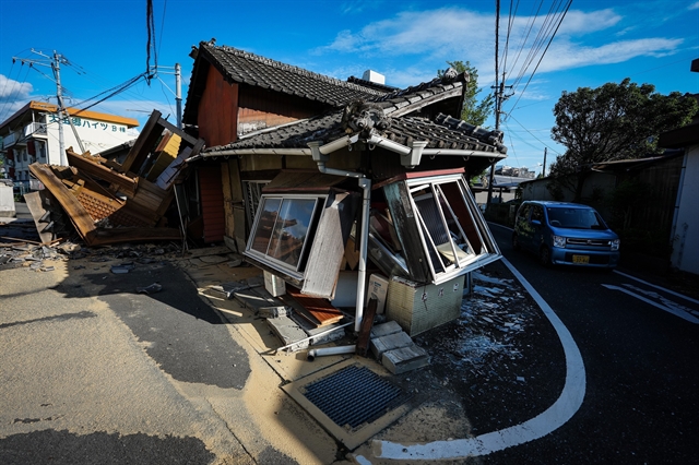
Việt Nam sends condolences to Japan over earthquake losses
1.
|
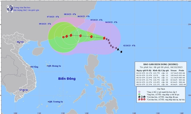
| The forecast trajectory of Typhoon Koinu as of 7am Wednesday. —VNA/VNS Photo |
HÀ NỘI — High winds and rough seas are forecast for the northern area of the East Sea (internationally known as the South China Sea) as Typhoon Koinu is expected to hit the area late Wednesday.
As of 1am Wednesday, the eye of the storm was at about 330km to the east-southeast of Taiwan (China), according to the National Centre for Hydrometeorological Forecasting (NCHMF).
The strongest winds recorded were at level 14 (150-166km/h). The typhoon is heading northwest at about 10km/h.
It is expected to weaken as it enters the waters 270km to the south-southeast of Fujian Province (China) and then the East Sea on Friday.
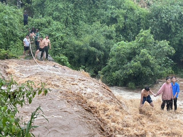
The areas from Quảng Trị to Bình Thuận provinces, the Central Highlands and the southern region will see moderate to heavy showers in the evening with rainfall of between 10-30mm, and over 50mm in several locations.
There are also chances of whirlwinds, lightning and high winds during the downpours. The warning for natural disaster risks remains at level 1, the lowest, said the NCHMF.
The NCHMF warns that heavy rain can also cause inundation in low-lying areas and risks of landslides and flash floods in the mountainous region. — VNS
Society
 Society
 Society
 Society
 Society
 Society
 Society
 Society
 Society
 Society
 Society
 Society
 Society
 Society
 Society