 Society


Tà Xùa sets sights on sustainable tourism
1.
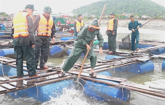 |
| Nghệ An border guard soldiers assist fish cage owners in harvesting their catch to minimize damage ahead of Storm No. 3’s landfall. — VNA/VNS Photos |
HÀ NỘI — Tropical Storm Wipha (Storm No. 3) is closing in on northern Việt Nam after entering mainland southern China early on July 20, bringing heavy rains, strong winds, and heightened risks of flash floods and landslides across large parts of the country.
According to the National Center for Hydro-Meteorological Forecasting, as of 4am on July 21, the storm's center was located at 21.5 degree North latitude and 110.4 degree East longitude, just over northern China’s Leizhou Peninsula, about 275km east of the Quảng Ninh–Hải Phòng coast.
The storm is moving west-southwest at speeds of 15-20km/h, packing maximum sustained winds of level 9 (75-88km/h) and gusts reaching level 11 (up to 117km/h).
By early July 22, Wipha is expected to strengthen, with winds reaching level 10-11 and gusts up to level 14 as it moves west-southwest at around 15km/h. Areas most affected will include the northwestern Gulf of Tonkin and the coastline from Quảng Ninh to Hưng Yên. The national disaster risk level is set at Level 3.
The storm is forecast to weaken into a tropical depression over inland areas from Hưng Yên to Thanh Hóa by early July 23, producing wind levels of 6-7 and gusts up to level 9.
By July 24, the system is expected to continue west-southwest and weaken into a low-pressure area over northern Laos.
Coastal provinces from Quảng Ninh to Nghệ An are expected to see wind speeds of 7-9 from the evening of July 21, with gusts near the storm’s center reaching 10-11 or even 14 in some locations. Inland areas may experience winds of level 6, gusting up to level 8.
The northern Gulf of Tonkin, including Bạch Long Vĩ, Cô Tô, and Cát Hải islands, is under severe storm conditions, with wind levels up to 12 and gusts as high as 15. Waves in these areas are forecast to reach 4-5 meters. Conditions in the southern Gulf of Tonkin and the northern East Sea (internationally known as the South China Sea) are also highly dangerous.
Scattered thunderstorms and rough seas are affecting much of Việt Nam’s southern coast and island regions, with strong southwest winds reported in locations including Phú Quý, Song Tử Tây, and Huyền Trân.
 |
| Farmers in Quỳnh Phụ commune, Hưng Yên province cover their crops to brace for the incoming storm. |
From July 21 to the night of July 22, heavy to very heavy rain is expected across the northeast, Red River Delta, Thanh Hóa, and Nghê An, with some areas seeing over 450mm. Other northern provinces and Hà Tĩnh may also see up to 250mm.
The intense rainfall brings a high risk of flash floods and landslides, especially in mountainous areas. Overnight, severe rain caused localised flooding in Điện Biên, Sơn La and Quảng Trị.
Emergency orders
On July 20, Prime Minister Phạm Minh Chính issued an emergency directive urging ministries and local authorities to prepare urgently for Storm No. 3. The order emphasises swift action to protect lives and property.
Authorities are instructed to evacuate people from unsafe areas, suspend fishing, tourism, and marine transport in affected zones, reinforce key infrastructure like power and communications, and deploy rescue teams and supplies under the four on the spot principle.
Local authoritiess must ban vessels from going to sea and ensure no one remains on board during the storm.
Deputy PM Trần Hồng Hà is overseeing the national response. Ministries have dispatched teams to high-risk provinces, while media agencies are boosting public alerts.
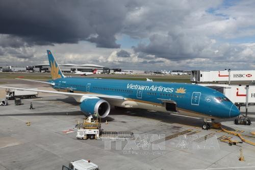
The Civil Aviation Authority of Vietnam has also issued an urgent directive for airports and airlines to prepare for storm Wipha, prioritising safety and minimising flight disruptions.
Airports in affected areas, including Vân Đồn in Quảng Ninh Province, are ordered to inspect infrastructure, prevent flooding, and maintain 24/7 operations. Airlines must monitor weather updates, adjust flight schedules, and coordinate closely to ensure safety for passengers and crews.
The aviation sector warns that flight times may change as the storm develops, with safety as the top priority. — VNS
Society
 Society
 Society
 Society
 Society
 Society
 Society
 Society
 Society
 Society
 Society
 Society
 Society
 Society
.jpg) Society
Society