 Environment

.jpg) |
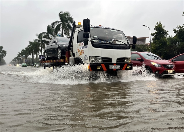
| Deep flooding on Mạc Thị Bưởi Street significantly impacts residents' lives. VNA/VNS Photo Phạm Tuấn Anh |
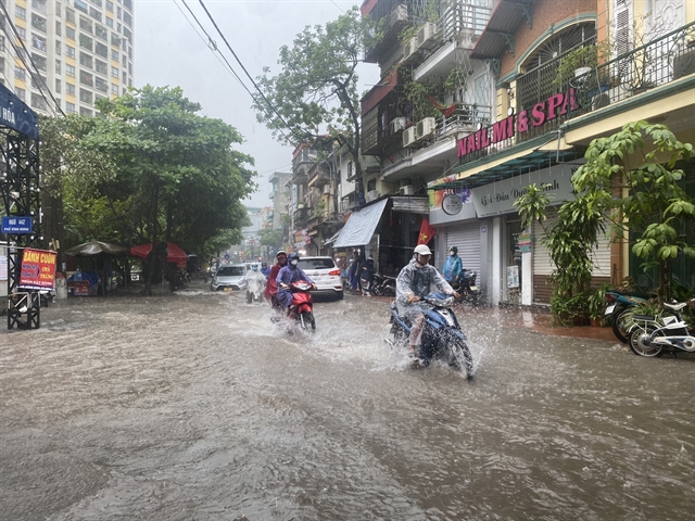
HÀ NỘI – A torrential downpour accompanied by severe thunderstorms, with booming thunder lasting nearly two hours, has caused congestion in several areas of Hà Nội on Wednesday morning.
Earlier on Wednesday morning, the National Centre for Hydro-Meteorological Forecasting issued a warning about heavy rainfall, thunderstorms, whirlwinds and lightning in the inner-city areas.
Satellite images, lightning location data and weather radar detected developing convective clouds causing rain in the areas of Ứng Hòa, Phú Xuyên, Thanh Oai, which are moving and expanding into the inner-city areas.
Experts warned that this rainfall could potentially cause flooding on many inner-city streets, with common depths ranging from 15-25cm.
 |
| Vehicles face significant difficulties navigating the Lý Thường Kiệt - Phan Bội Châu intersection. VNA/VNS Photo An Đăng |
Notably, some streets could experience deeper flooding, with depths from 20-40cm, including Thụy Khuê, Trích Sài in Tây Hồ District; Đội Cấn, Đào Tấn, Liễu Giai, Ngọc Khánh, Cao Bá Quát in Ba Đình District; Minh Khai, Vân Hồ, Nguyễn Công Trứ, Bà Triệu Intersection, Lò Đúc in Hai Bà Trưng District; Vương Thừa Vũ, Quan Nhân, Nguyễn Tuân, Nguyễn Trãi, Bùi Xương Trạch, Cự Lộc, Triều Khúc, Lương Thế Vinh, Nguyễn Huy Tưởng, Định Công in Thanh Xuân District.
.jpg) |
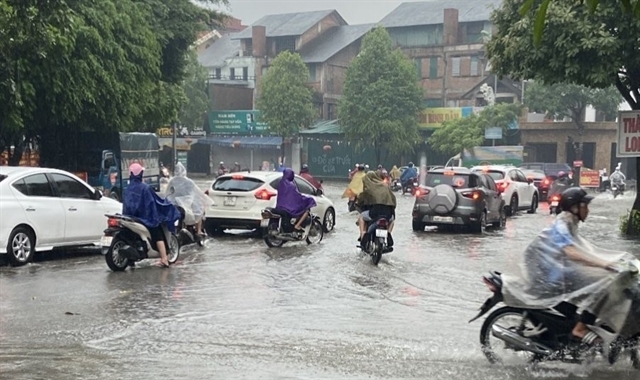
| Flooding on Võ Thị Sáu Street affects traffic. VNA/VNS Photo Hoàng Hiếu |
 |
| Many streets in the Tân Triều area are experiencing looding. VNA/VNS Photo |
During this rainfall, streets will only be flooded during periods of heavy rain and will drain completely within 30-60 minutes after the rain stops.
 |
| Vehicles have trouble moving through the Vĩnh Hưng area in Hoàng Mai District. VNA/VNS Photo Phạm Tuấn Anh |
Traffic on flooded streets will be affected, with difficulties in movement potentially causing traffic jams.
Vũ Anh Tuấn, deputy head of the weather forecasting department at the National Centre for Hydro-Meteorological Forecasting, said the northern region will continue to experience heavy rain and thunderstorms, with rainfall ranging from 40 to 120mm and, in some places, exceeding 200mm.
Residents in these areas should be on alert for potential flash floods, landslides in mountainous regions and flooding in low-lying areas. Heavy rain is expected to decrease gradually from June 7.
On Wednesday morning, the Hà Nội Drainage Company Limited deployed workers to clean drainage inlets and remove debris, focusing on operating pumps and lowering water levels in the main rivers and regulating lakes to ensure the safe operation of the drainage system.
To ensure effective flood prevention and drainage, the company is ready to deploy emergency response teams, manage drainage operations and efficiently operate the Yên Sở, Đồng Bông 1, Đồng Bông 2, Cổ Nhuế and DPS pumping stations to reduce water levels in the system.
Experts advise that during thunderstorms, residents should turn off circuit breakers, unplug electrical devices, stay away from windows and doors, avoid using electrical appliances and keep away from damp areas like bathtubs and water tanks. It is also crucial not to use mobile phones.
Outdoor electrical wires are highly susceptible to lightning strikes, so it is advisable to stay at least a metre away from them.
Lightning often appears frequently during the early rainy season, following a period of hot and dry weather. Việt Nam is located in the Asian thunderstorm zone, one of the three major thunderstorm zones in the world, with intense thunderstorm activity.
The thunderstorm season in Việt Nam is relatively long, with an average of 100 thunderstorm days and 250 thunderstorm hours per year.
Each year, the country endures up to 2 million lightning strikes. – VNS


