 Environment
.jpg)
Vietnam Airlines expands forest restoration programme with 72-hectare target
1.
 |
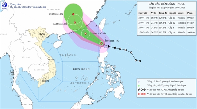
| The forecast track of the tropical depression in the coming days. — Photo nchmf.gov.vn |
HÀ NỘI — A tropical depression over the northern part of the East Sea (internationally known as the South China Sea) is expected to strengthen into a storm late Friday night or early Saturday morning, bringing strong winds and heavy rain to central Việt Nam.
The National Centre for Hydro-Meteorological Forecasting reported that by early Friday, the depression’s centre was located about 300km east-southeast of the Hoàng Sa (Paracel) Islands, with maximum sustained winds of 39–61km/h and gusts up to 88km/h.
The system was moving westward at around 10 km/h.
Forecasters warned that the depression could intensify into a storm by 1am on Saturday, packing winds of up to 74km/h, with gusts reaching 102km/h, over the northwestern waters of the Hoàng Sa Islands.
At that point, the northern and central East Sea, including the Hoàng Sa area and offshore waters from Nghệ An to Huế, would begin to feel its impact.
The storm is projected to move further into central coastal waters and make landfall before weakening. Provinces and cities from Nghệ An to Huế are expected to be directly affected.
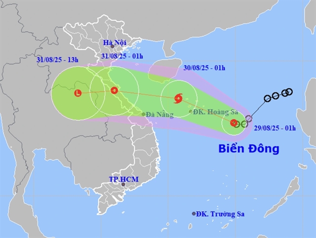
Strong winds of 39–61km/h will cover much of the northern East Sea, rising to 74km/h near the storm’s centre, with waves between 3–5m and rough seas.
Conditions will worsen from Friday night in offshore areas between Nghệ An and Huế, where winds could also reach 74km/h.
On Saturday, rough seas and high winds are forecast across the northwestern East Sea and coastal waters from Thanh Hóa to Huế.
The northern Gulf of Tonkin may see winds up to 49km/h, while further south, areas from Khánh Hòa to HCM City and around the Trường Sa (Spratly) Islands will experience southwest winds of 39–61km/h, with stronger gusts.
Heavy rain is expected inland from Friday night through Saturday.
Northern midland and delta provinces, as well as areas from Thanh Hóa to Đà Nẵng, could receive 50–100mm of rainfall, with localised totals above 200 mm and in some places more than 350mm.
Meteorologists warned that totals could reach 100–200mm in the north and Đà Nẵng, with isolated amounts above 400mm.
The heaviest rainfall is forecast from Thanh Hóa to Huế, where 150–350mm is likely, and some areas could see over 600mm. — VNS
Environment
 Environment
 Environment
 Environment
 Environment
 Environment
 Environment
 Environment
 Environment
 Environment
 Environment
 Environment
 Environment
 Environment
 Environment