 Society

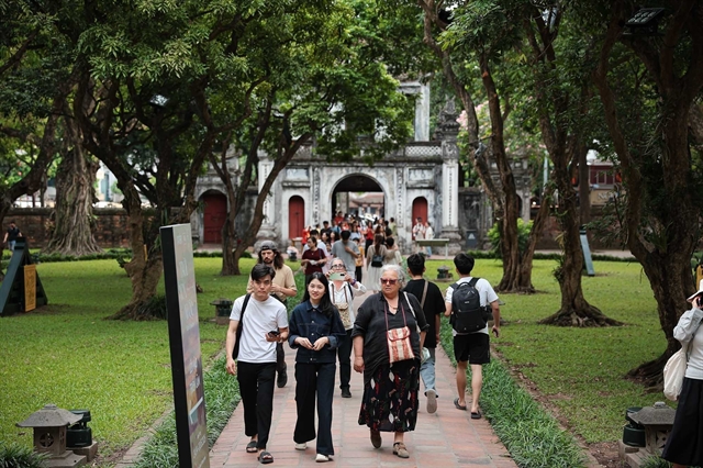
European arrivals surge as Việt Nam welcomes nearly 14 million foreign visitors in seven months
1.
Local authorities in the Mekong Delta are taking serious measures to prevent flooding caused by high tides during the annual flood season in the area.
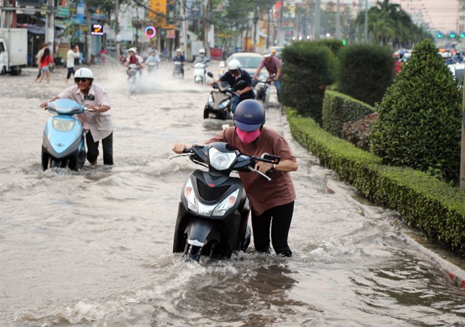 |
| Mậu Thân Street in Cần Thơ City in the Mekong Delta flooded during high tides. — VNA/VNS Photo Thanh Liêm |
HCM CITY — Local authorities in the Mekong Delta are taking serious measures to prevent flooding caused by high tides during the annual flood season in the area.
The delta’s provinces, and especially Cần Thơ City, have been severely affected by high tides over the past few days.
Many roads in the inner city have been flooded with record-high tides of 2.21m measured at the Hậu River station, which surpassed the alarm level three by 0.31m.
The peak tide is forecast to reach 2.2 to 2.25m (higher than alarm level three by 0.3-0.35m) soon. The official alarm level for natural disasters caused by high tides could reach the third level.
Flooding has also occurred in Vĩnh Long and Sóc Trăng provinces. National Highway 1A (Cần Thơ - Vĩnh Long, Hậu Giang - Sóc Trăng sections) was seriously flooded, affecting the lives of tens of thousands of local people.
Within a few days, floods caused overflows at 134 dredging dykes and embankments measuring a total length of more than 93,000m.
In the region, as many as 54 dykes with a total length of 837m have overflowed, while 23 dykes at least 151m long in total have been damaged.
More than 650ha of fruit orchards have been flooded, and more than 41ha of vegetables submerged in water.
As many as 45ha of fish ponds were flooded, with estimated losses of VNĐ3.4 billion (US$151,000).
Floods have caused damage to 113m of embankments in Cần Thơ this year, affecting 37ha of rice fields and 91ha of vegetables and cash crops, reducing yields, according to the city’s Steering Committee for Natural Disaster Prevention and Control, Search and Rescue.
High tides also caused 8.5 tonnes of fish and other aquatic species in ponds to escape into rivers and canals, according to local authorities.
Đào Anh Dũng, vice chairman of Cần Thơ City People’s Committee, said the historic peak tide of 2.25m was unprecedented. The highest previous tide level in Cần Thơ was 2.15m.
He said the city did not have effective solutions to prevent heavy flooding.
Flooding in Cần Thơ will not be resolved until 2021, when the Cần Thơ Urban Development Resilience Project for Việt Nam is expected to be completed.
The project has a total investment of $322 million, of which $250 million comes from a World Bank loan, $10 million from a non-refundable loan from the State Secretariat for Economic Affairs (SECO) - a Swiss Government Agency, and the remaining from reciprocal capital from the Vietnamese Government.
The project has three components, including flood control and environmental sanitation control; urban development; and urban management to adapt to climate change.
It also includes construction of embankments and culverts.
Embankments
Experts attributed flooding in urban areas to rising flood waters in the upstream section of the Mekong River, causing high water levels in the downstream region, including in Cần Thơ City and Hậu Giang, Vĩnh Long and Tiền Giang provinces.
In addition, excessive exploitation of groundwater has caused severe subsidence in the Mekong Delta.
According to a study by Utrecht University in the Netherlands, the Mekong Delta has subsided by an average of 18cm over a 25 year period (from 1991 to 2016).
Subsidence of over 30cm in Sóc Trăng and Long An provinces has occurred.
According to Nguyễn Hữu Thiện, an independent researcher on Mekong Delta ecology, an extensive system of dykes exist in the middle parts of the Delta such as Cần Thơ, Hậu Giang, Vĩnh Long and Tiền Giang provinces.
Most of the rivers in this area, including small rivers and canals, have two roadways on both sides of the river with two dykes.
This huge amount of water cannot be discharged to fields or ponds, and, as a result, flooding in the city and urban areas occurs.
Thiện said that from 2000 to 2011 the storage capacity of the Long Xuyên Quadrangle fell by 4.7 billion cu.m due to construction of a closed dyke and embankment system covering more than 1,000sq.km in the area.
Trần Hoàng Tựu, vice chairman of Vĩnh Long People’s Committee, said that, of nearly 2,000km of dykes and embankments, about 50km of dykes had been damaged and more than 100 landslide spots discovered in the province.
He said the province would seek ways to bring water into rice fields.
“This is a very important issue, which requires neighbouring provinces to find solutions to store water during the flood season,” he said. “The reality is that this year the floods are not that high, but dykes are built everywhere to protect production. Water cannot enter the field for cultivation. This can cause flooding outside the dyke.” — VNS
Society
 Society
 Society
 Society
 Society
 Society
 Society
Doctors from Đà Nẵng-Hoàn Mỹ Hospital have successful operated on a five-month-old baby with congenital heart disease. The child is now fully recovered 10 days after surgery.
 Society
First piloted on downtown streets of Trần Hưng Đạo and Lý Thường Kiệt in Hoàn Kiếm District, the iParking service is now being deployed at 156 spots in seven urban districts.
 Society
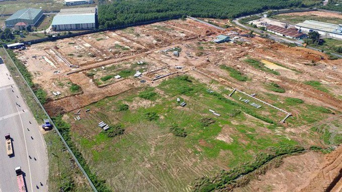
Site clearance for the construction of the new Long Thành International Airport in the southern province of Đồng Nai remains slow, according to authorities.
 Society
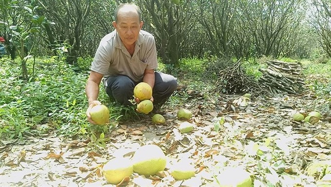
Many Năm Roi grapefruit gardens in Bình Minh Town in the southern province of Vinh Long are damaged after being submerged by the highest tide seen in the last 40 years.
 Society
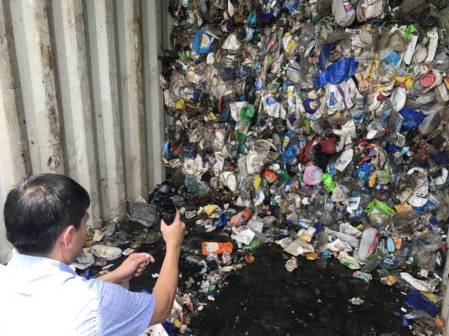
The Finance Ministry has asked the Ministry of Transport not to grant business licences to shipping lines that transport scrap that includes waste and pollutants to Việt Nam.
 Society
The deadline for entries to the photo contest ‘For the health of Vietnamese people’ has been extended until October 31.
 Society
The People’s Court of Quảng Ninh on Monday sentenced four Chinese citizens to a combined 20 years in prison after they were found guilty of "using computer networks, telecommunication networks and electronic means to commit acts of appropriating property".
 Society
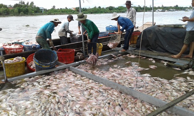
More than 160 tonnes of fish raised in floating cages on Cái Nhỏ River in Tân Thanh Commune in the Mekong Delta Province of Tiền Giang have died over the past few days, incurring an initially estimated loss of up to dozens of billions of đồng.
 Society
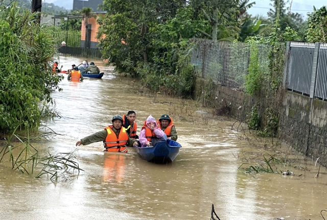
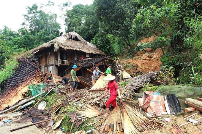
Prolonged heavy rain and flash floods in the northern province of Hà Giang have killed one person while another remains missing as of Monday, according to the People’s Committee of Quang Bình District.


