 Society

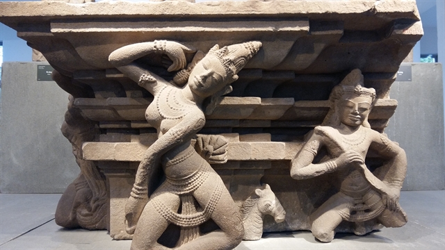
Đà Nẵng's iconic Chăm sculpture museum works to digitise its offerings
1.
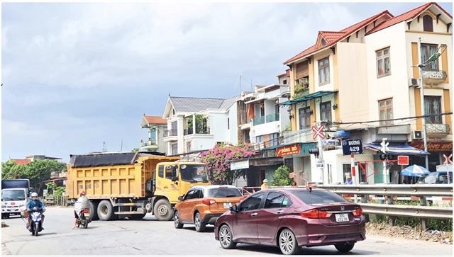 |
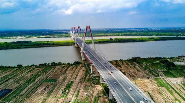
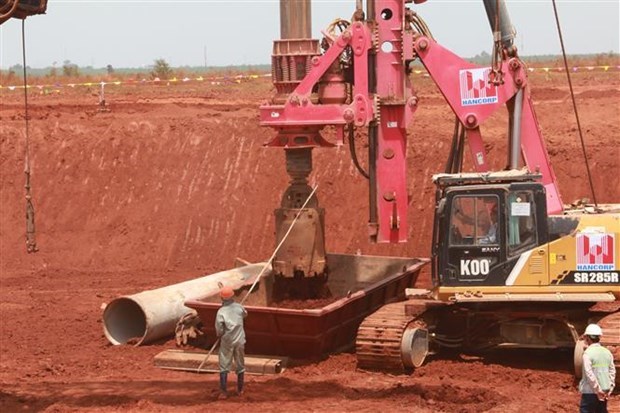
| The North of Phú Xuyên satellite urban area borders provincial road 429. Photo vietnambiz.vn |
HÀ NỘI – Hà Nội authorities have decided to reduce the number of satellite urban areas from five to two, under the project adjusting the Capital's general planning to 2045, with a vision to 2065.
Accordingly, there will be two urban areas: Sơn Tây, a cultural, historical and tourism urban area; and Phú Xuyên, an industrial urban area, transportation and transshipment of goods hub.
The general planning of Hà Nội to 2030 with a vision to 2050 approved by the Prime Minister in July 2011 determined the urban development structure of Hà Nội, including a central urban area and five satellite urban areas and towns connected by ring roads and radial axis roads linking to the regional and national transport network.
According to vice president of the Việt Nam Planning and Urban Development Association, architect Đào Ngọc Nghiêm, this is a model that has been successful in many developed countries and is suitable for Hà Nội's characteristics.
However, the implementation results show continued slow development of the satellite urban areas.
The satellite urban areas, including Hòa Lạc, Sóc Sơn, Phú Xuyên, Xuân Mai and Sơn Tây, have the potential to solve problems such as central area population expansion, regional integration and economic development.
But after more than 10 years, the satellite urban areas have not developed due to lack of policy mechanisms, facilitation and attraction of businesses.
“One of the core reasons why Hà Nội’s satellite urban areas have been slow to develop in recent times is traffic connection,” said architect Phan Đăng Sơn, president of the Việt Nam Architects’ Association.
“If we have enough connections from the inner city to the urban areas with high-speed public transportation systems, those areas will certainly develop very well,” Sơn said.
“Therefore, in this planning orientation, it is necessary to emphasise which type of transport is the development focus, and not to invest rampantly,” he said.
Vice chairman of the People’s Committee of Sơn Tây Township, Phùng Huy Vinh said that up to now, satellite urban area of Sơn Tây had been lagging behind the development planning despite strong efforts during last years.
The main reason was that the criteria and standards for urban development were not clear, and there were no resolutions, implementation plans or policies to attract investment in the satellite urban areas.
Director of the Hà Nội Department of Planning and Architecture Nguyễn Trọng Kỳ Anh said that given the shortcomings in the development of the satellite urban area model over the past time, the city had reviewed and redefined the model and roadmap for the urban areas.
So far, the city is still determined to build Hà Nội as a multi-centre area including the central city, two "cities within a city" in the north of Red (Hồng) River and in the west of Hà Nội, and satellite urban areas, Kỳ Anh said.
However, the satellite urban areas of Xuân Mai and Hoà Lạc merged into Hà Nội’s western city, and the satellite urban area of Sóc Sơn merged into the northern city, so there would be only two satellite urban areas of Sơn Tây and Phú Xuyên.
The two satellite urban areas and eco-towns would be studied more specifically, associated with the capital's development requirements in the coming period, Kỳ Anh said.
Two satellite urban areas
According to vice director of the Hà Nội Planning and Construction Institute, Nguyễn Đức Hùng, the satellite urban area of Sơn Tây will be expanded from current Sơn Tây Town to the west connecting with Ba Vì and Suối Hai areas, and become the tourism service support centre of Hà Nội’s northwest region.
Sơn Tây will become a gateway urban area to the northwest of the capital.
Sơn Tây urban area, with a long history of urban development and tourism destinations such as Đường Lâm ancient village, Sơn Tây ancient citadel and Và Temple, and attractive ecological landscapes, will develop as a tourism centre in the northwest of Hà Nội.
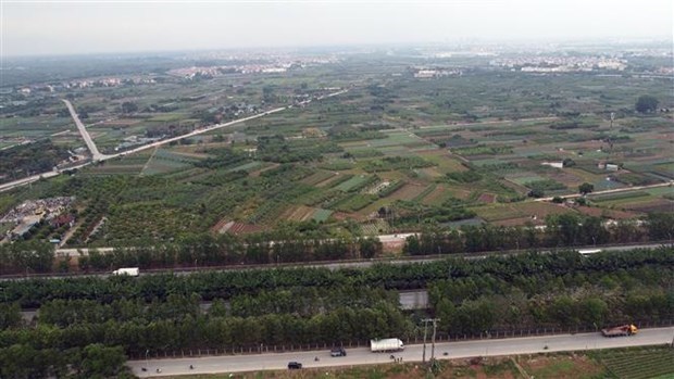
Regarding the development of Phú Xuyên satellite urban area, Phú Xuyên is considered one of the potential urban areas because of its close connection with South Hà Nội airport, high-speed railway and monorail transportation systems along the banks of the Red River, and waterway transportation systems.
"It is suitable to form a southern gateway city, logistics service centre and agricultural product loading centre from the southern region for supply and export," Hùng said.
With the successful formation of the One Commune One Product (OCOP) model, Phú Xuyên is suitable to form the largest OCOP research, application and exhibition centre in the region.
Phú Xuyên Urban Area will become an industrial urban area, a traffic hub, goods transit hub and a hub of national traffic corridors.
In the urban area, construction of housing areas to serve industrial park workers will be a priority.
Urban functional and ecological service works organically linking the public spaces along the Nhuệ and Red rivers will be built.
All public spaces and residential areas will have access to modern transportation systems.
Thường Tín-Phú Xuyên Industrial Park will include agricultural and food processing industries, light industry, export processing, and port, warehouse and freight forwarding systems.
In addition, this area is also oriented to develop as an urban area, with many lakes and canals to suit the characteristics of low-lying areas and cope with floods along the rivers flowing through the area. VNS
Society
 Society
 Society
 Society
 Society
 Society
.jpg) Society
Society
 Society
 Society
 Society
 Society
 Society
 Society
 Society
 Society