 Travel
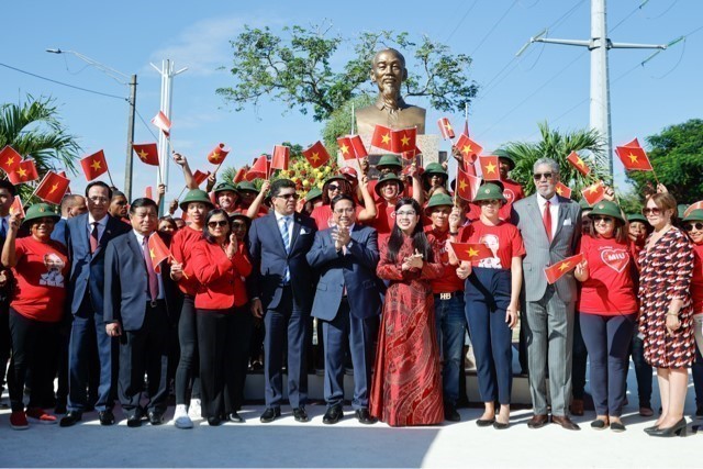
PM attends inauguration of upgraded statue of President Hồ Chí Minh in Santo Domingo
1.
Located 1,000m above sea level, Hồ Thầu Commune in the northern mountains has cool weather all year round and breathtaking landscapes.
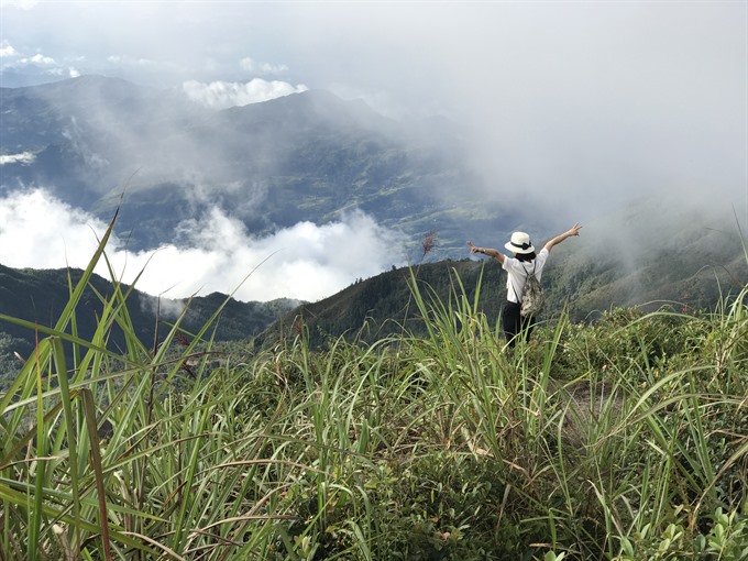 |
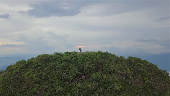
| Close to heaven: A tourist takes photos from Chiêu Lầu Thi Peak, a mountain retreat. VNS Photo Lê Hương |
By Hương Vân
Located 1,000m above sea level, Hồ Thầu Commune in the northern mountains has cool weather all year round and breathtaking landscapes.
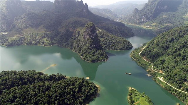
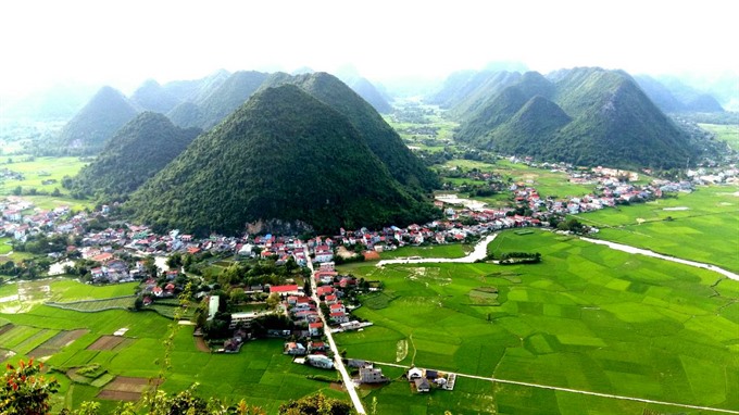
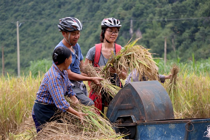
The commune, with thousands of hectares of terraced rice fields and topped with the “grey hat” of Chiêu Lầu Thi Peak, is considered the capital of the Red Dao ethnic group, which numbers about 450,000 people in Việt Nam alone. The area is also the starting point for the Chảy River, which runs like a giant snake through the mountains and forests.
It takes half a day riding on motorbikes to reach Tân Phong Village in Hồ Thầu Commune from Thông Nguyên Commune through a 35km distance of terraced fields, forests and grass fields surrounding other Red Dao villages, Nậm Khỏa, and Nậm Ai.
 |
| End of day: Watching sunset from Chiêu Lầu Thi Peak is a rewarding moment after a tiring walk. VNS Photo Lê Hương |
Then we feasted our eyes on the green mountain forests surrounding yellow terraced rice fields shining in the sun. Our rest was marked by relaxing talks with local farmers, who were busy harvesting their fields.
After long hours of bumpy travel, we finally had lunch in a homestay in Tân Phong Village, which had a spectacular view over a valley. Trương Công Định, chairman of Hồ Thầu Commune, said the focus was on developing ecological tourism, even risky tours of Chiêu Lầu thi Peak, while preserving the cultures of tribal people.
“To further promote tourism, the authorities use financial resources from the province and districts to advertise local destinations, pay for train tourism and encourage households to open homestays,” he said. “Hoàng Su Phì District authorities have called for investors to open more restaurants, hotels, hold motorbike races and establish trekking routes from Chiêu Lầu Thi peak to nearby primitive forests.”
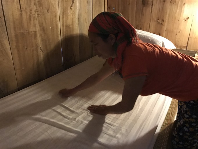 |
| Cosy: Triệu Mùi Mủi, owner of Homestay Chán Mủi, prepare a bed for tourists at her home. VNS Photo Lê Hương |
Triệu Mùi Mủi, owner of Homestay Chán Mủi, one among two experimental homestays in a project titled Improving the Livelihood of Ethnic Minorities through Community-Based Tourism sponsored by Swiss-based Helvetas Intercooperation and the Centre for Rural Economy Development, said her family had received hundreds of tourists in the past year.
“It makes us busier, but happier, to offer guests a close look at a Red Dao family,” she said, “The guests often stay one or two nights with us, have meals and enjoy traditional singing and dancing by locals. Since we stay far from the centre of the district, we often pay more to buy goods and food from the plain because it takes more time to transport them here,” she said.
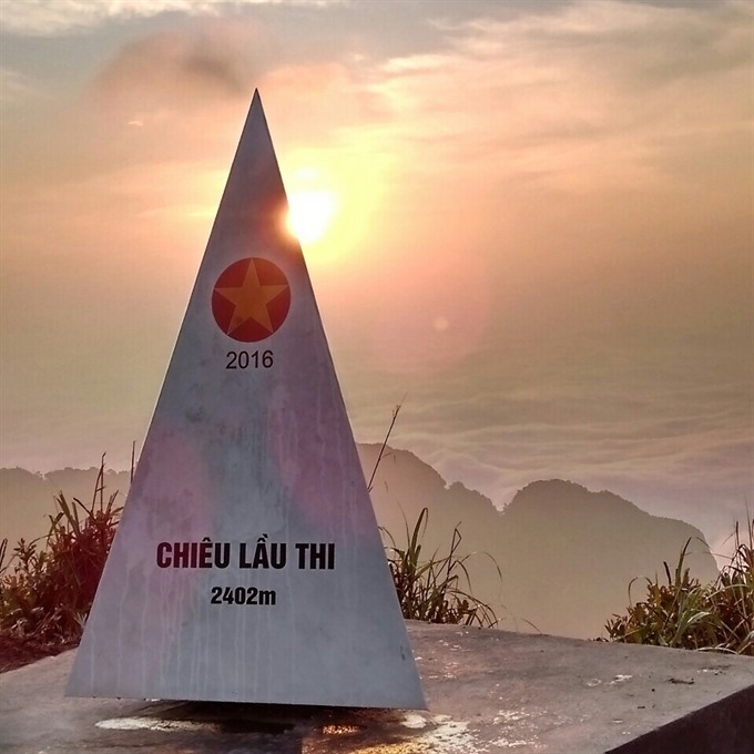
From Tân Phong, we rode to Chiêu Lầu Thi Mountain, which peaks at 2,402m above sea level. Chiêu Lầu Thi in local language means nine ladder layers.
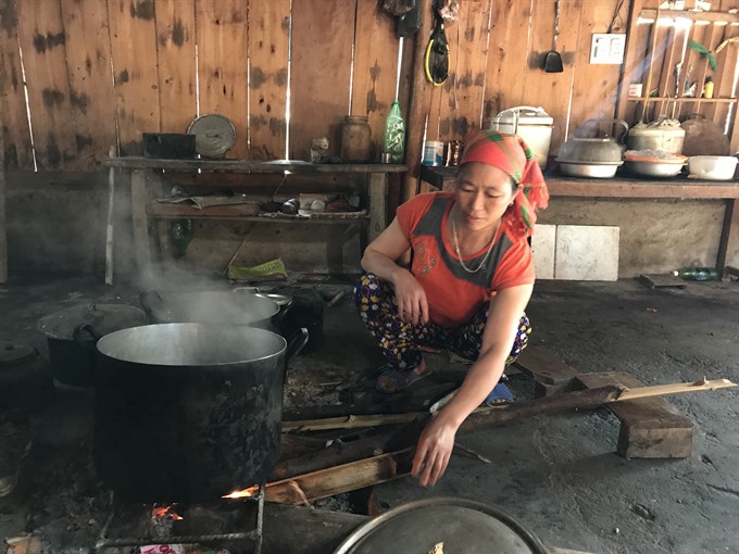 |
| Yum: Triệu Mùi Mủi, owner of Homestay Chán Mủi, prepares breakfast for guests. VNS Photo Lê Hương |
The 12km road was covered with mud and rocks and rain-caused erosion. Our bikes bumped up and down over the rocks like wild horses. In some places, they did not seem to touch the road, but seemed to fly over the rocks. Many times we had to walk so as not to fall down steep cliffs.
But the surrounding scenery was great, with mountains after mountains stretching forever, huge rocky hills with red moss that glowed inn the sunlight - and wild orchids in many colours. Higher up the mountains were pine forests like those in Europe. Streams trickled and gushed down the hillsides. Birds sung in the trees.
We sometimes saw farmers’ timber houses, ideal spots for resting and taking photos of magnificent scenery over the valleys.
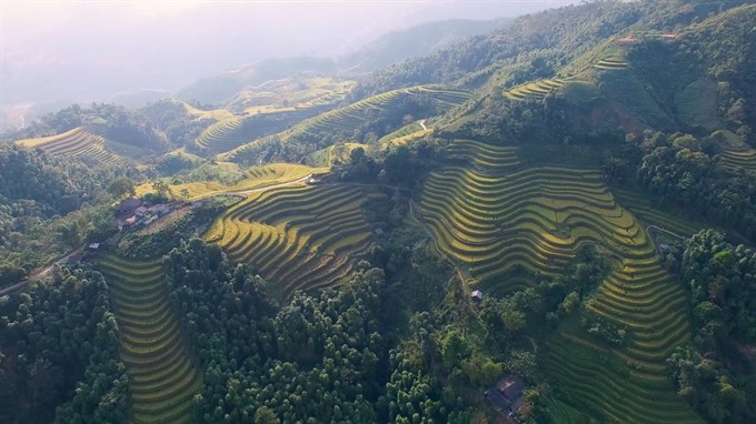 |
| Hill farming: A view over terrace rice fields on mountains in Hoàng Su Phì District, Hà Giang Province. VNS Photo Nguyễn Nam |
From the peaks, the sky seem to be closer with so many clouds to nurture the imagination.
After nearly three hours, we reached a height of 2,000m and then trekked 400m to the peak. We had to hurry as it got dark quickly and we had to return before night set in and the roads became too horrible to navigate.
It was colder here. I put on another jacket, but got hot again as the steep climb and moist air made it hard to breathe. We had to walk slower and take deeper breaths.
Our xe ôm drivers were useful guides, willing to carry our bags and help us by hand through hard-to-climb places. “The best weather for climbing is in winter,” said Bàn Tà Liều, my driver. “At that time, both the roads for biking and the paths for trekking are drier and easier to climb.”
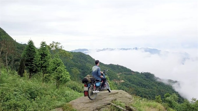 |
| Above the clouds: A young man poses on his bike on the way to Chiêu Lầu Thi Peak. VNS Photo Nguyễn Nam |
Many tourists choose to stay overnight at a homestay at the 2,000m high stop so that they can climb up early in the morning to meet the first sunlight hitting the peak.
“Winter and spring are a better time to see clouds at the peak,” he said. “In summer, clouds are more beautiful in the afternoon. Winter offer nice views of maple forests, while summer has đỗ quyên (Rhododendron) flowers in full bloom. In May and June, locals water their terrace rice fields while in autumn, September and October, they harvest their crops.
We passed 100-year-old tea trees with moss all over their trunks. That was Shan Tuyết tea that grows at a height of more than 2,000m above the sea level. The tea leaves get wind and fog for four seasons, sprouting valuable leaves used for people’s health.
 |
| Challenge: Conquering Chiêu Lầu Thi Peak is a challenge. VNS Photo Nguyễn Nam |
After nearly one hour trekking, we reached the peak, where a triangle stated that it was 2,402m high. We took many photos while watching clouds hanging in the middle of other peaks and a zigzagging road that we travelled on two hours ago. In the far distance, there were terrace rice fields. I felt I was so small in front of Mother Nature herself. I admired the locals who have toiled hard to make a living from this land.
Chiêu Lầu Thi and Tây Côn Lĩnh (2,427m), located in the northwest of Hà Giang Province, are two highest peaks in the northeast of the country. Many trekkers try their strength conquering them - without the help of chair lifts! — VNS
Travel
 Travel
 Travel
 Travel
 Travel
 Travel
 Travel
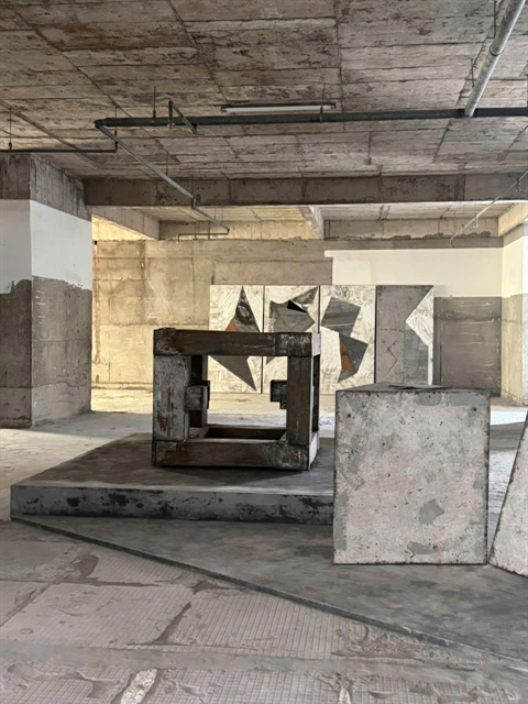
Thanh Thủy Village in the central province of Quảng Ngãi ís proud of its unspoiled nature,which is eflected in a recent art project.
 Travel
The early morning sun shines all around. Clouds hang on mountains near and far. Villages dot the paddy fields, mingling with the sea of green rice fields.
 Travel
The Centre for Rural Economic Development (CRED) recently held a 100km bike tour linking Quảng Uyên and Trùng Khánh districts in Cao Bằng. A total of 21 cyclists took part, 18 of them foreign professionals — and the rest Vietnamese.
 Travel
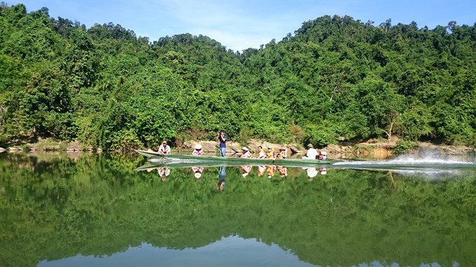
A boat trip on the Giăng River inside Pù Mát National Park, one of the richest and most diversified ecosystems in Việt Nam, can really provide an adventure.
 Travel
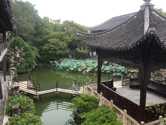
Yangzhou city on the southern bank of China’s Yangtze river, the longest river in Asia, is home to many historical sites. The city, once a political, economic and cultural hub during the Ming and Qing dynasties, is one of the largest and best-preserved ancient cities in eastern China.
 Travel
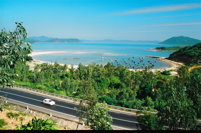
In the central province of Phú Yên, tourists rarely ignore Xuân Đài Bay with its unique islet – Nhất Tự Sơn – which is shaped like the old calligraphy style word for one - một.
 Travel
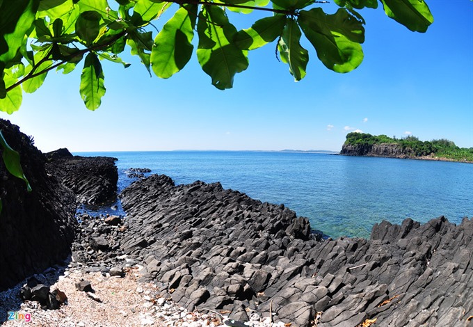
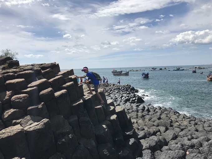
A church and ancient basalt stepping stones are the major symbols of the central coastal province of Phú Yên.
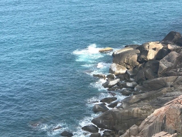 Travel
The central coastal province of Phú Yên attracted more visitors after the launch of Victor Vũ’s movie Yellow Flowers on Green Grass in 2015.
 Travel
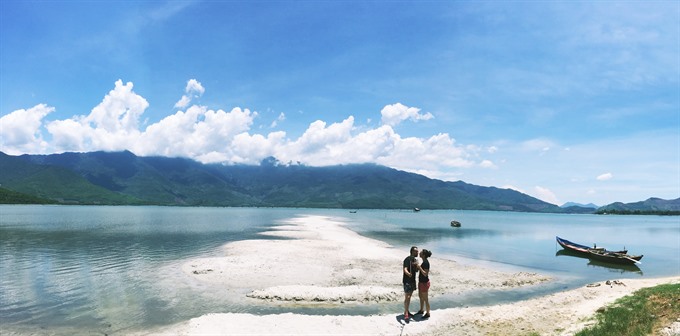
Huế City has long allured travelers with its poetic Hương River, juicy street food, proud imperial city and untouched Lăng Cô beach. Yet without Lập An Lagoon, a trip there is incomplete.