 |
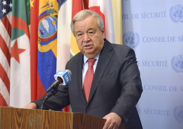
| The United Nations Secretary-General António Guterres. — VNA/VNS Photo |
NEW YORK — The United Nations Secretary-General has officially announced that Việt Nam has completed the deposit of a chart and a list of geographic coordinates of points regarding the baseline for measuring the breadth of its territorial sea in the Gulf of Tonkin.
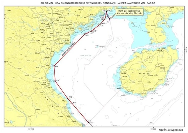
According to the UN Secretary-General’s announcement to member states dated March 12, 2025, Việt Nam on March 7, 2025 deposited with the UN Secretary-General, pursuant to Article 16, paragraph 2 of the 1982 United Nations Convention on the Law of the Sea (UNCLOS), the chart showing straight baselines and outer limits of the territorial sea, as well as a list of geographic coordinates of points regarding the baseline for measuring the breadth of the territorial sea of the mainland territory of Việt Nam in the Gulf of Tonkin.
On March 14, the UN website published detailed information about Việt Nam’s submission at www.un.org/Depts/los.
The announcement also stated that the Vietnamese Government’s February 21, 2025 statement on the baselines for measuring the breadth of the territorial sea in the Gulf of Tonkin will be published in the next issue of the UN’s 'Law of the Sea Bulletin.' — VNS
 Politics & Law