 Life & Style

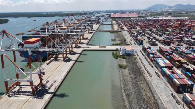
HCM City prioritises logistics infrastructure to raise direct import-export throughput above 80%
1.
By Thúy Hằng
An Giang, a province in the Mekong Delta region, occupies a vast area in southwestern Việt Nam. The province renowned for its stunning natural landscapes, including sprawling waterways, majestic mountains, verdant cajuput forests and extensive rice fields.
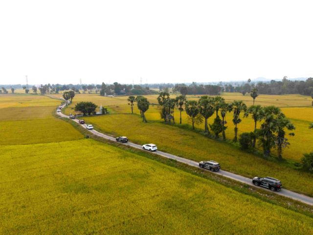
The journey 'Ford Territory – Exploring the Mekong Delta, Heritage in Motion' led us to numerous destinations where we immersed ourselves in the beauty of the scenery, while uncovering the rich cultural identity and historical depth of this distinctive region. Below are some highlights that we explored during our adventure:
Jamiul Azhar Mosque
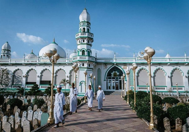 |
| Jamiul Azhar Mosque. Photo btgcp.gov.vn |
Nestled in Châu Phong Commune, Tân Châu Township, Jamiul Azhar Mosque, built in 1959, is among the oldest and most beautiful mosques in An Giang. It serves as a spiritual symbol for the local Chăm Muslim community. The mosque stands out dramatically against the sky with its elegant combination of white and jade green hues.
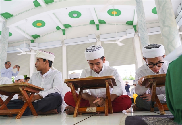 |
| Children are taught to read the Quran at the Jamiul Azhar Mosque. VNS Photo Thúy Hằng |
Visitors are greeted by a modest cemetery with stone slabs bearing the names of the deceased at the entrance. Inside the mosque’s grounds, one is captivated by the intricate architectural design, featuring expansive domes, ornately patterned windows and the iconic crescent moon symbol of Islam. Interestingly, visitors might also observe classes where children, of all ages, are taught to read the Quran.
Tà Pạ rice fields
 |
| The vast Tà Pạ rice fields with their winding pathway. Photo courtesy of Ford Vietnam |
Situated in Núi Tô Commune, Tri Tôn District, the Tà Pạ rice fields present a uniquely poetic charm with their vibrant patches of colour dotting the landscape. Throughout this picturesque expanse, towering sugar palm trees – symbolic of An Giang – rise gracefully against the horizon. The winding paths through the fields reveal scenes of farmers diligently working and children joyfully playing, crafting an idyllic rural tableau.
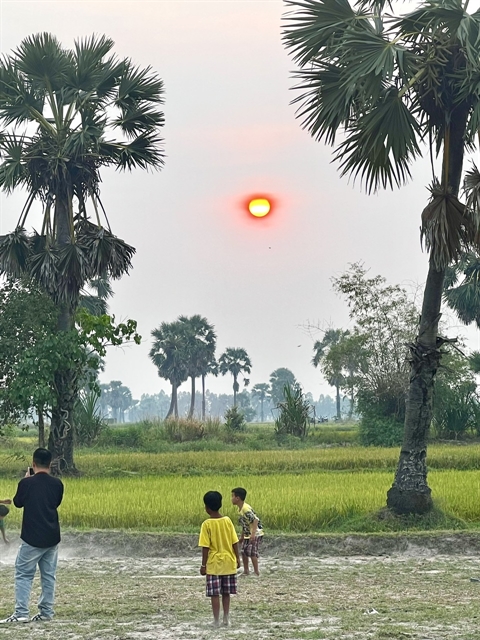 |
| Children play against the sunset background at Tà Pạ rice field. VNS Photo Thúy Hằng |
The most enchanting times to visit the Tà Pạ rice fields are at dawn, when the first light graces the landscape, or at sunset, when the sun dips behind the mountains. Visitors can soak in the vivid tones of the fields under the golden light and relish the cool, refreshing atmosphere. The gentle breeze and clean air create an unparalleled sense of tranquillity.
O Thum Lake
O Thum Lake, found in O Lâm Commune, is a jewel of the Tri Tôn area, formed a decade ago to aid agricultural irrigation. Nestled at the base of the mountains, this small yet picturesque lake boasts crystal-clear waters, making it a beloved emerging destination for visitors to the Thất Sơn (Seven Mountains) region.
According to locals, O Thum Lake is at its most spectacular during the rainy season, when the water spills over the rocky banks, transforming the area into an untamed, pristine haven. Lining its shores are sugar palms, a well-known emblem of An Giang. Visitors can enjoy boat rides on the lake, often complimentary when dining at nearby restaurants.
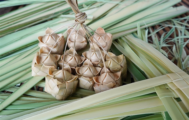 |
| Cà tum – the Khmer traditional sticky rice cake. Photo baoangiang.com.vn |
One must-try delicacy here is grilled chicken with chúc leaves, a dish originally from Cambodia. Its aroma, enhanced by chúc leaves and lemongrass, is truly unique. Served alongside roasted garlic and a chúc leaf dipping sauce, it’s a culinary highlight. The chúc plant, considered a specialty in the local region, thrives in the Tri Tôn and Tịnh Biên Districts. Additionally, vendors along the road to O Thum Lake offer fresh sugar palm fruits and beverages, perfect for souvenirs. Another treat to sample is cà tum, a Khmer traditional sticky rice cake symbolising abundance and prosperity.
Vĩnh Tế Canal
An engineering marvel of the feudal era, Vĩnh Tế Canal has played a pivotal role in the southwestern region of An Giang since the 19th century. This nearly 100km-long, 40m-wide canal, dug 200 years ago, runs parallel to the Việt Nam-Cambodia border, starting at the west bank of the Châu Đốc River in An Giang and ending at the Giang Thành River in Hà Tiên City, Kiên Giang.
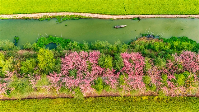 |
| A section of Vĩnh Tế Canal is adorned with the gentle pink colour of blooming ô môi flowers every March and April. Photo baoangiang.com.vn |
The canal, an extraordinary achievement of the Nguyễn Dynasty, holds immense economic and defence significance for the nation’s southwestern border. Serving as both an irrigation system and a waterway defensive line, it has witnessed numerous heroic resistance movements, cementing its place in history.
Rô Pagoda
Located in An Cư Commune, Tịnh Biên District, Rô Pagoda is not only an architectural masterpiece of religious significance, but also a cultural hub for the local Khmer community. Distinctive of Khmer Theravāda Buddhist architecture, the pagoda is adorned in bright orange and yellow tones, accentuated by a towering, pointed spire that gleams against the sky.
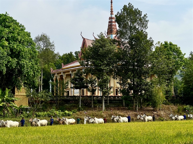 |
| Rô Pagoda is closely tied to the annual cow racing festival, a unique cultural event of the Thất Sơn region that draws both local residents and visitors in large numbers. VNS Photo Thúy Hằng |
The pagoda's design features intricate patterns and reliefs, predominantly illustrating Khmer deities and murals depicting Buddha under the Bodhi tree. Rô Pagoda is closely tied to the annual cow racing festival, a unique cultural event of the Thất Sơn region that draws both local residents and visitors in large numbers. VNS
Life & Style
 Life & Style
.jfif) Life & Style
Life & Style
.jfif) Life & Style
Life & Style
 Life & Style
 Life & Style
 Life & Style
 Life & Style
 Life & Style
 Life & Style
 Life & Style
 Life & Style
 Life & Style
 Life & Style
 Life & Style