 Society

Hà Nội authorities are determined to restart the planning for a riverside city on both sides of the Hồng (Red) River after many years of delays.

|
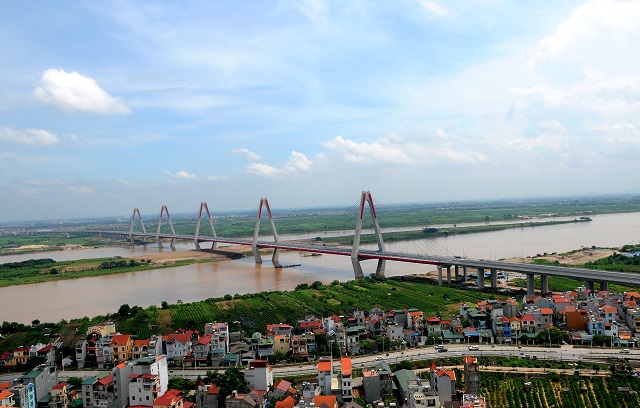
| Bridges across the Hồng (Red) River help develop the areas on two banks. — Photo ktdt.vn |
HÀ NỘI — Hà Nội authorities are determined to restart the planning for a riverside city on both sides of the Hồng (Red) River after many years of delays.
Some modern infrastructure works have been completed for the project and made a contribution to changing the urban appearance on both sides of the river, creating hope that the ambitious plans for a modern riverside city will soon be realised.
The plans to develop a modern city along the river were set by Hà Nội authorities many years ago.
Since 1954, Hà Nội has built more than 20 housing zones in the Chương Dương and Phúc Xá areas on the banks of the river.
The most obvious highlight was the plan in 1992 when the city agreed to build houses near the dyke system while maintaining flood safety.
In a plan announced in 1998, the city identified the target of developing on both sides of the river, placing the Red River in the centre of Hà Nội.
In 2011, then Prime Minister Nguyễn Tấn Dũng approved a new Hà Nội master plan, once again defining the two sides of the Red River as an important central axis of Hà Nội.
A year later, the city approved a detailed plan for building residential areas along the river.
Since 1994, there have been 11 construction projects on the banks of the river by both domestic and foreign investors.
Notably, a co-operation project between Hà Nội and South Korea's capital Seoul gathered many experts from the two countries to conduct field surveys, organised many seminars and collected community opinions.
However, so far, none of the project's ideas have been carried out.
The land potential in this area is huge, but loose management has caused problems for years.
Illegal encroachment and construction have been constant issues, while agricultural land is used without planning and apartment buildings have been built on the river banks.
The high population density of the area has led to environmental pollution and social problems.
Former Deputy Minister of Natural Resources and Environment, Prof. Đặng Hùng Võ told Kinh Tế & Đô Thị (Economy and City) newspaper that the urgent task for Hà Nội was to quickly realise the planning on the river banks.
This has important meaning not only for the rational use of land for urban development but also to restore order in the riverbank area, said Võ.
Initial progress
Municipal authorities have blamed the delays of a lack of a legal framework.
The framework requires the integration of all levels and branches of local government, with the most important thing to approve the flood drainage plan that will be the basis for approving zoning plans and related detailed plans, according to experts.
To contribute to the realisation of the riverside city, Hà Nội has recently started a number of projects on modern transport infrastructure.
Specifically, the city has approved the architectural design of Tứ Liên Bridge connecting inner-city Tây Hồ District with Đông Anh suburban district.
When completed in 2024, the bridge will play an important role in promoting the urbanisation of the Red River region and reducing population and traffic pressure reduction on the inner city.
Architect Đào Ngọc Nghiêm, vice president of the Việt Nam Urban Planning and Development, said in the master plan, the Red River was seen as the axis of the city.
This means it's important to make all regions develop evenly, Nghiêm said.
“In the coming time, some suburban districts such as Gia Lâm and Đông Anh will be upgraded into urban districts,” Nghiêm said.
“This issue required a more developed transportation system so the construction of more bridges will bring a great effect to create motivation for the northern area of the Red River for development as well as help to reduce the population in the inner city and create a new face for Hà Nội,” he said.
To renovate urban architecture along the Red River as well as upgrade the traffic system outside the riverside, the People's Committee of Hoàn Kiếm District has studied solutions to upgrade residential roads on river banks and build a road along the river to efficiently exploit the land and develop the river middle yard and alluvial ground into a cultural and tourist park.
According to experts, when the zoning plan on both sides of the river is approved, the formation of a riverside road will create a driving force for socio-economic development, population management and investment attraction helping improve local quality of life. — VNS