 Society

Three centuries on, Lê Quý Đôn's passion for learning continues to inspire
1.
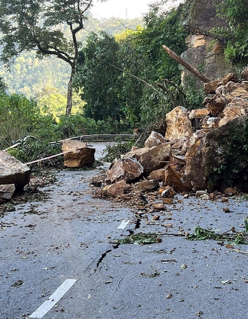
|
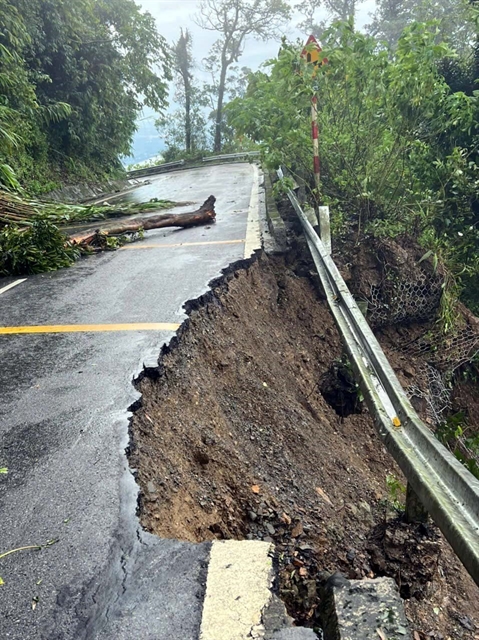
| Rocks and soil block the route to Ba Vì National Park. — VNA/VNS Photos Văn Cảnh |
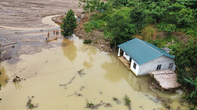
HÀ NỘI — The route leading to Ba Vì National Park in Hà Nội has reportedly eroded since early September due to the impact of Typhoon Yagi.
According to the national park’s management board, due to the impact of the typhoon, the area experienced strong winds and continuous heavy rain from September 6 to September 10, particularly on the night of September 7.
A section of the park’s internal roadway was eroded and severely damaged.
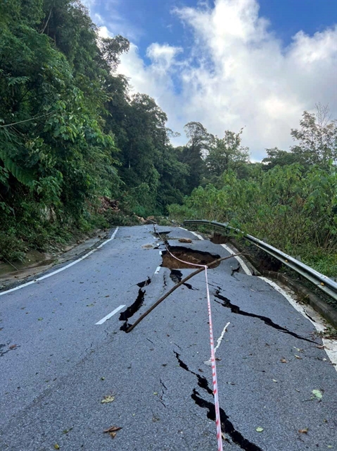
|
| A section of road cracks down due to the impacts of Typhoon Yagi. |
A medium voltage power line supplying electricity to the park also experienced some broken poles, while the roof of the information centre was blown away.
Ba Vì National Park has cut down fallen trees on the road, cleared landslides, placed warning signs and barriers and assigned forest rangers to provide traffic safety guidance to drivers.
|
| Erosion on one side of the route. Vehicles have been banned to ensure safety. |
Motorbikes and cars with less than 16 seats can now travel from the park’s gate to altitudes of 400m, 600m, 700m and 1,000m.
Observation and compliance with traffic signs are recommended.
Vehicles are still banned on sections of road from an altitude of 1,000m to the Upper (Thượng) Temple. Pedestrians are limited as much as possible, except where absolutely necessary.

|
| Fallen trees block the route leading to Upper Temple. |
Ba Vì National Park, about 60km west of Hà Nội, is a spiritual relic site located on the top of Tản Viên Mountain.
The Upper Temple is nestled on a high elevation within the park. — VNS
Society
 Society
 Society
 Society
 Society
 Society
 Society
 Society
 Society
 Society
 Society
 Society
.jpg) Society
Society
 Society
 Society