 Society

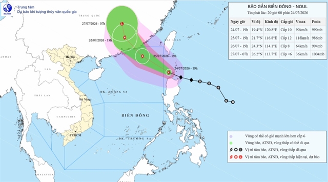
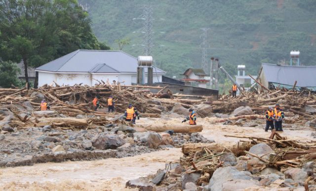
Coastal Việt Nam told to brace as Typhoon Noul nears East Sea
1.
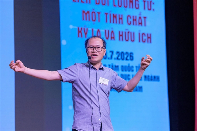
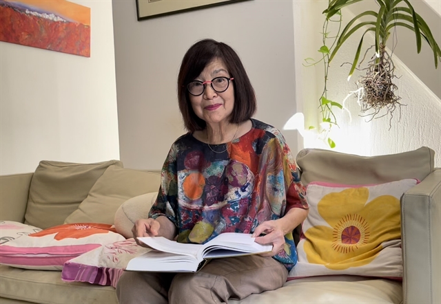 |
| Lê Toàn Thủy, an overseas Vietnamese scientist in France. — VNA/VNS Photos Thu Hà |
PARIS — Lê Toàn Thủy, an overseas Vietnamese scientist in France, has conducted three projects to monitor by satellite the status of floods, droughts and saltwater intrusion in the Mekong Delta, helping managers and farmers cultivate rice effectively over the past five years.
The projects, the GEORICE project of the European Space Agency, the GEMMES Việt Nam project funded by the French Development Agency, and the VIETSCO project implemented by the French Space Centre (CNES), were organised in collaboration with the Việt Nam Space Centre (VNSC).
The first project aims to develop a rice map with weekly satellite data to show the rice growth status in each delta area.
The second project examines the impact of saline intrusion, drought, and flood on the delta cultivated land and rice yield.
The third project is more ambitious. It is based on current data to build future simulation scenarios of climate change and human impacts, thereby predicting the effects on the delta by 2030, vision towards 2050.
Sharing with the Vietnam News Agency correspondent in Paris, France, about the reasons she chose and pursued the projects, Thủy said, first of all, the delta is one of the key rice-growing regions of Việt Nam, which needs monitoring to take measures to prevent crop damage due to climate change impacts.
Besides, the delta is her hometown, where she was born and raised.
She said: "Every time I see the places of Bạc Liêu or Vĩnh Long on a satellite map, to me, it not only has geographical meaning but also reminds me of stories my grandparents told."
Very helpful
As a partner of the third project, Vũ Anh Tuân, Deputy General Director of VNSC, said monitoring the rice-growing area and forecasting monthly yield has brought many benefits to Việt Nam.
He said the monthly rice map, which updates the area and the growth status of rice, helps them be proactive in macro management and early to prevent pests and diseases.
He said that if a natural disaster occurs, the information also assists activities in reducing damage caused by the natural disaster.
The information on the rice-growing area and yield forecast also helps local businesses be proactive in making their business plans, avoiding damage caused by market fluctuations according to rice production.
He added that the fluctuation of rice-growing area and yearly yield is also useful information for macro-planning and land-use restructuring in the context of climate change.
Vietnamese Ambassador to France Đinh Toàn Thắng said Thủy is an example of striving in scientific research and also the leading female scientific researcher of the Vietnamese community in France.
"The project has many meanings, not only in the development of Việt Nam's agriculture but also in the application of science and technology to the current development of localities," he said.
He said Thủy's projects contribute to scientific and technological cooperation and strengthen the friendly relationship between Việt Nam and France.
During a recent working visit to France, Minister of Science and Technology Huỳnh Thành Đạt also praised the projects.
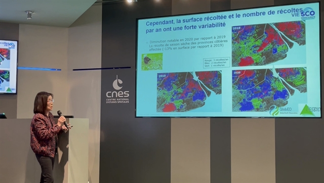 |
| Lê Toàn Thủy presents her project at the French Space Centre (CNES) in France. |
More cooperation
Thủy said she hopes to receive more attention and support from Vietnamese leaders at all levels, as well as more cooperation with domestic scientists for the next stages of the projects.
The effectiveness of the projects can be applied to other intensive farming models such as coffee and cocoa, even extending to other important application areas such as greenhouse gas reduction, forest monitoring, coastal erosion monitoring and management of sand mining in rivers, she said.
She also expects that the projects' achievements will contribute to training the future young generation of Việt Nam, and gathering more research groups in both Việt Nam and France under the framework of the global agreements to serve the community and the Sustainable Development Goals (SDGs).
Thủy is an expert in radar remote-sensing research for land-based applications. Her current projects focus on using radar Earth observation data for crops and forest lands, monitoring their role in reducing global carbon and responding to climate change.
As Co-Chair of the European Space Agency's BIOMASS Mission Advisory Group, she is also a co-leader of the Asian-Rice Initiative and a member of numerous research projects on Earth observation such as ESA's Climate Change Initiative Biomass project; CNES, JAXA Kyoto observing climate projects and the Carbon Initiative.
She is the author and co-author of many scientific publications. She also teaches Synthetic Aperture Radar (SAR) remote sensing at universities and research institutes, training many doctoral and post-doctoral students at several universities in France, the United States, Europe and Asia. — VNS
Society
 (4).jpg) Society
Society
 Society
 Society
 Society
 Society
 Society
 Society
 Society
 Society
 Society
 Society
 Society
.jpg) Society
Society
 Society