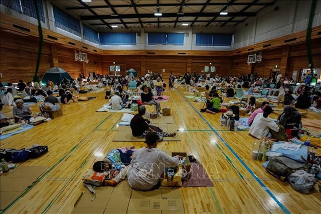
 Society

.jpg)
Ninth International Festival of Vietnamese Traditional Martial Arts opens in Gia Lai
1.
|
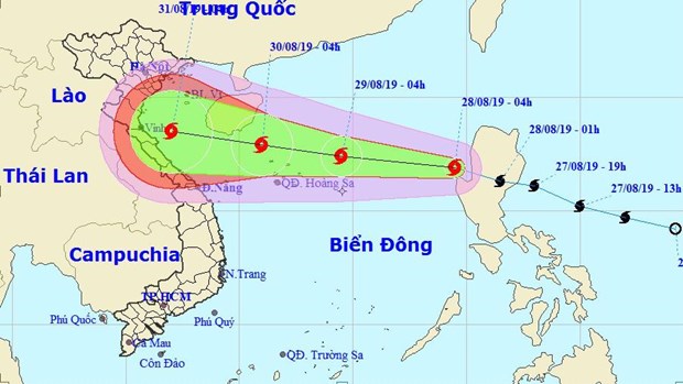
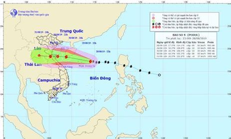
| The direction of storm Podul. Photo courtesy of the National Hydro-meteorological Forecast Centre |
HÀ NỘI — Tropical storm Podul is projected to make landfall on a stretch from central Thanh Hóa to Quảng Binh provinces at noon on Friday, bringing heavy rain to the northern and central regions, according to the latest report from the National Hydro-meteorological Forecast Centre.
The storm is moving westwards at 25km per hour and is expected to be located about 150km to the east of Nghệ An to Quảng Bình provinces by 1am of Friday, packing winds of 75-100km per hour.It is forecast to make landfall from Thanh Hóa to Quảng Bình by 1pm of Friday with wind speeds of 75-90km per hour.
The storm, the fourth of its kind in the East Sea this year, is forecast to weaken into a tropical depression after hitting the mainland.
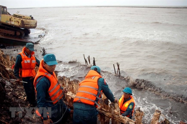
The central Steering Committee on Natural Disaster Prevention and Control has asked its sub-committees, ministries and sectors to brace for Podul.
It also sent urgent messages to 13 provinces and cities to make plans to cope with the storm.
The committee will send two missions to localities from Nghệ An to Quảng Bình on Thursday to guide preparation tasks for the storm, said Minister of Agriculture and Rural Development Nguyễn Xuân Cường, who doubles as the committee’s deputy head, at an urgent meeting on Thursday morning to discuss measures to cope with the storm.
He urged the National Center for Hydro-meteorological Forecast to regularly update the direction and progress of the storm and give warnings about possible heavy rain, high waves at seas, landslides and flash floods to help residents in those localities be prepared.
Localities were told to check and have measures to protect dyke and dam systems and make available equipment, vehicles and human resources to join rescue efforts when needed.
He asked border guards to continue informing fishing vehicles and fishermen of the storm’s development, particularly 358 vessels with 2,360 fishermen on board operating in dangerous areas.
Authorities of mountainous and lowland areas were instructed to devise plans to relocate residents in areas at high risks of floods and landslides.
The Border Guard High Command said as of 6am of Thursday, the command had provided information about the storm’s direction and progress to more than 71,300 vehicles and 316,000 fishermen. — VNS
Society
 Society
 Society
 Society
 Society
 Society
 Society
 Society
 Society
 Society
 Society
 Society
Phan Lạc Việt Hoà, seven, along with his younger brother and father were keenly sticking coloured cellophane sheets on their star lanterns made out of bamboo.
 Society
 Society
A leading domestic violence specialist in Việt Nam has said there are more and more cases of women being beaten up by their partners – with many victims too scared to complain for fear of bringing shame on their families.
 Society
The People's Committee of the southernmost province Cà Mau has proposed the Government spend VNĐ524 billion (US$22.5 million) to upgrade the sea dyke on its west coast to combat rising tides and landslides, which are seriously affecting local people.