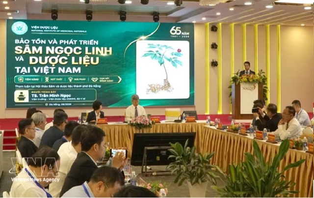
 Society

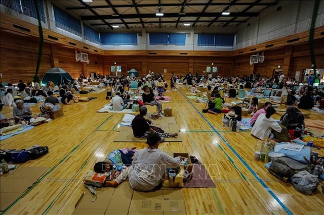
Vietnamese community in Japan gradually returns to normal after earthquake disaster
1.
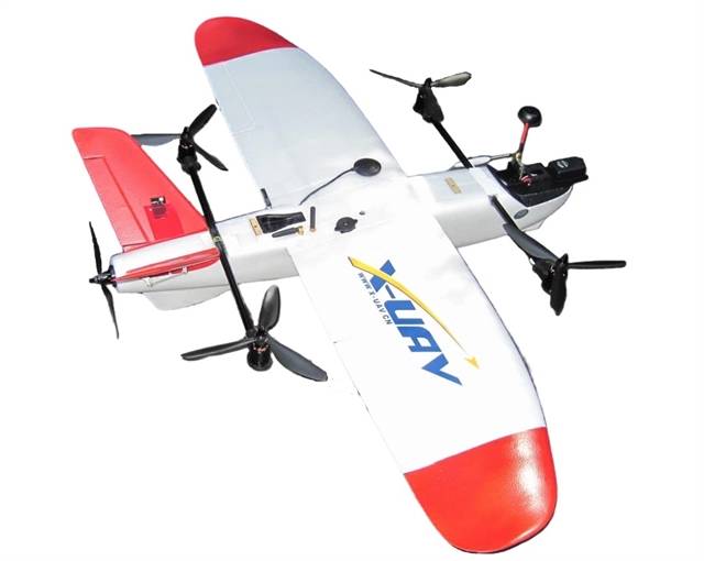 |
| The drone alerting dangerous water areas developed by a group of students at Tôn Đức Thắng University in HCM City. Photo giaoducthoidai.vn |
HCM CITY – A group of students at Tôn Đức Thắng University in HCM City has developed a unmanned aerial vehicle (UAV) based on a combination of artificial intelligence (AI), image processing, global positioning system (GPS) and environmental sensors, for marine reconnaissance applications to warn of drownings.
Lê Minh Trí, a member of the group, which is named URLAB, told giaoducthoidai.vn: “As we know, every year, Việt Nam records hundreds of drownings, largely due to a lack of information about dangerous phenomena such as rip currents.
“In poor and difficult areas that are lacking rescue staff and monitoring equipment, the situation is even more serious.
“Moreover, climate change has increased the frequency and intensity of dangerous hydrological phenomena, especially in vulnerable coastal areas,” the student said.
In many coastal areas, fishermen are often exposed to dangerous hydrological phenomena, especially when fishing close to shore.
The UAV provides information about dangerous areas, helping fishermen avoid risks and protect their lives and property.
This contributes to the economic stability of households that depend on the sea, while enhancing food security from seafood sources, he said.
Data from the UAV that is shared via digital map or mobile application will help connect difficult coastal areas with economic centres in the country.
For example, information on sea safety in a poor commune in Quảng Trị Province may be used by safeguard units in Huế or Đà Nẵng cities that helps create more effective co-ordination between regions.
The students designed the UAV integrating it with AI, image processing technology, GPS and environment sensor technology.
Specifically, the UAV is integrated with deep learning algorithms to automatically detect and classify dangerous phenomena such as rip currents and eddies.
The AI is trained on images and videos collected on Việt Nam seas, helping to identify patterns of currents under different conditions of light and weather.
This is much more advanced as compared to traditional methods based on manual observation or simple sensors.
High-resolution cameras, combined with advanced image processing software, allow the UAV to record and analyse data directly during flight.
The technology helps minimise the delay in detection and warnings, one of the important factors in responding to emergency situations at sea.
In addition, the UAV is equipped with sensors measuring wind, humidity and air pressure to support forecasting and adjusting flying in extreme weather conditions – a characteristic of the tropical monsoon climate in Việt Nam.
This ensures stable operation of the device even during the rainy season.
Simple operation, easy to use
According to student Trương Minh Triết, also from the group, one of the outstanding advantages of the UAV is that it is easy to use, making the product suitable for a wide range of users, from technical staff to people without deep expertise in technology.
The UAV control software is designed with an intuitive interface, allowing users to programme flight routes, monitor data and receive alerts, with just a few simple steps. Features such as 'tap-to-fly' or auto-patrol mode help reduce training time, Triết said.
Thanks to AI integration, the UAV can automatically detect offshore currents and swirling water, mark positions and update maps without continuous support from users, he added.
This is very useful for rescue workers who are not experienced in how to control complicated UAVs.
“Our product includes detailed instructions in Vietnamese and other popular languages, along with illustrative videos to help users easily get acquainted,” the student said.
For travellers, the smartphone app provides live hazard maps and alerts, requiring no special skills to use. Users simply download the app, turn on notifications and follow the information in real time.
The UAV can be integrated with existing digital mapping systems such as Google Maps and local GIS and connected to popular telecommunications networks of 4G and 5G.
This helps reduce initial investment costs and takes advantage of existing infrastructure in coastal areas.
Dr Trần Thành Nam, lecturer of the Department of Telecommunications, Faculty of Electrical and Electronic Engineering at Tôn Đức Thắng University highly appreciated this product.
The device can operate independently on small beaches or be deployed synchronously on a large scale with many UAVs at the same time in key tourist areas because take-off and landing do not require a dedicated airport, just a small space on the beach or a boat, he said. VNS
Society
 Society
 Society
 Society
 Society
 Society
 Society
 Society
 Society
 Society
 Society
 Society
 Society
 Society
 Society