 Society

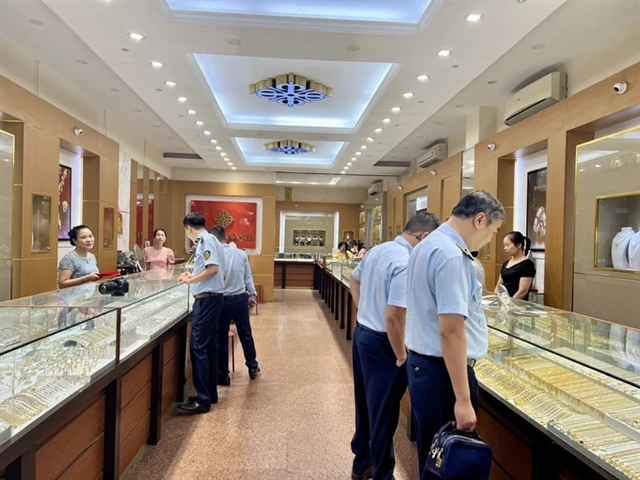
Việt Nam plans inspection of five jewellery, gemstone businesses
1.
|
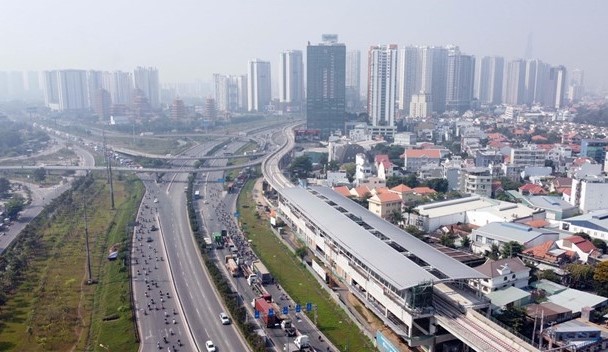
| HCM City’s first metro line, which extends between Bến Thành market in District 1 and Suối Tiên Theme Park in Thủ Đức City. The city will use public land along the first metro route for multi-functional purposes. VNA/VNS Photo |
HCM CITY — The HCM City People’s Council has approved a legal framework for the management of urban architecture, with a focus on public land in the city centre, especially near the first metro line’s Bến Thành station.
Under the framework, the city aims to ensure sustainable growth amid urbanisation, including the fast pace of construction, high population density, and environmental pollution.
The number of high-rise buildings must be controlled according to current regulations. The city will have preferential policies for conservation of land and architectural spaces in the city’s central areas.
With natural landscapes and major cultural and historical spaces, covering 930ha, the central area, including districts 1, 3, 4 and part of Bình Thạnh District, will limit high-rise developments to minimise the adverse impact on the landscape and architectural heritage.
The September 23 Park in District 1 will connect with underground space and other cultural and historical sites. In addition, the height of high-rise developments near the Notre Dame Cathedral, the HCM City Post Office and Bến Thành Market must be controlled to strictly preserve the historic landscape of this area.
The height of buildings on Lê Duẩn Street must also be controlled so as not to obstruct the views of Independence Palace (at one end of Lê Duẩn Boulevard) and the Botanical Gardens (at the other end of the boulevard).
Along the Saigon River’s western bank, stretching from Saigon Bridge to Tân Thuận Bridge (about 248.34ha), the urban space will be open to the river. Part of Tôn Đức Thắng Street (the section along Bạch Đằng Wharf park) will be reserved for pedestrians.
The city will also preserve the area along the banks of the Saigon River to ensure its natural landscape.
It will also improve other areas, including the Cần Giờ mangrove biosphere reserve, Cần Giờ sea encroachment urban area, and Hiệp Phước port urban area, among others.
First metro line
The city will exploit public land along the first metro route, which extends between Bến Thành market in District 1 and Suối Tiên Theme Park in the new Thủ Đức City. The land along the metro line will be developed into multi-functional and specialised service centres.
The city will control the development of high-rises near the Bến Thành metro station to ensure they will not cause traffic congestion or high density in the area.
As many as 10 urban development projects will be built along a portion of the first metro line that stretches 14.8 km through 11 wards in Thủ Đức City, according to the Department of Planning and Architecture.
Experts said the metro line should be the main mode of transport with bus routes connecting its stations with residential areas, industrial parks, universities and research institutes.
They said the city should earmark more public land along the route for urban beautification in line with the plan to develop Thủ Đức City, and that public transport should be predominant.
With a total investment of more than VNĐ43.7 trillion (US$1.91 billion), the 20-km metro line has three underground stations and 11 elevated stations.
More than 90 per cent of the metro line has been completed. The completion date, originally slated for the year end, was moved up to the end of 2023 or early 2024 due to the impact of the fourth COVID-19 wave. — VNS
Society
 Society
 Society
 Society
 Society
 Society
 Society
 Society
The Prime Minister has assigned the Ministry of Planning and Investment to draft strategies and policies on development cooperation with foreign donors in order to improve the efficiency of using official development assistance (ODA) and concessional loans.
 Society
A 12-year-old boy in Hà Nội fell to his death from an apartment building, sparking concerns over children’s mental wellbeing and parents’ negligence on the matter, especially during the COVID-19 pandemic.
 Society
President Nguyễn Xuân Phúc visited and presented gifts to the Hanoi Archdiocese and the Committee for Solidarity of Vietnamese Catholics (CSVC) in the capital city on Thursday.
 Society
 Society
 Society