 Life & Style

By Trần Mai Hưởng
HÀ NỘI — Lũng Pô Peak in the northern province of Lào Cai is an alluring destination for those who like discovery, where the Hồng (Red) River enters Vietnamese territory.
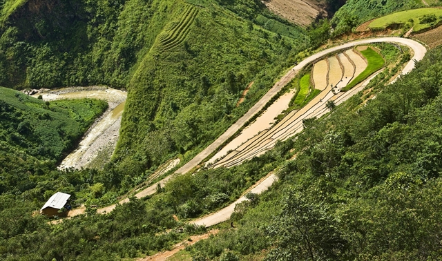
It’s around 70km from Lào Cai to Lũng Pô – a hard road that zigzags through beautiful villages and lush greenery.
The road from Bát Xát Town to Bản Xèo - Dền Sáng is bumpy and rugged. The Mường Vi stream flows below, through deep cracks between cliffs before pouring into the Hồng River in Vược Village. Drivers are advised to drive steadily and slow.
|
| The zigzag road runs 70km from Lào Cai to Lũng Pô through very beautiful villages. — Photo triphunter.vn |
The road gradually rises and zigzags through the hills. Some sections are particularly steep, with high cliffs on either side.
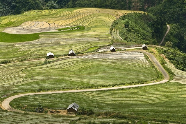
At the foot of the mountain are immense valleys, with green fields carpeting the ground.
|
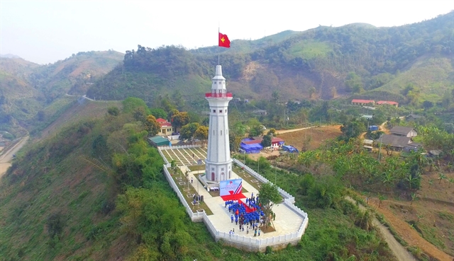
| Lũng Pô Flag Pole, an important symbol of the border area. — Photo ththcscocmy.pgdbatxat.edu.vn |
One will reach Y Tý, a commune at 2,660m above sea level, within a few hours.
There are various ethnic minority groups in the area, including the Hà Nhì, Mông and Dao. From here, the road gets even more treacherous. Yet, as compensation, the scenery is beautiful. Wild flowers cover the mountain sides, which sparkle in the sun. Bushes of chrysanthemum liven up the landscape, and in the far distance are hills of corn and bananas with houses as small as matchboxes on mountain peaks. Mature valleys mingle with peaceful villages.
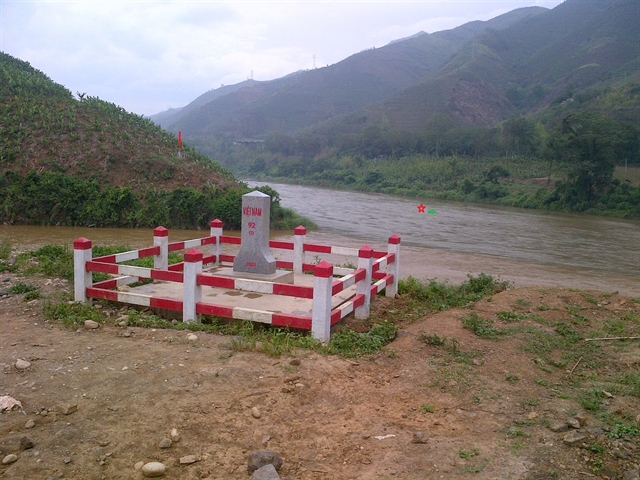
Lũng Pô Flag Pole is near A Mú Sung Border Station, next to Milestone No 92. A big tree marks the natural border between Việt Nam and China.
|
| Milestone No 92. — Photo triphunter.vn |
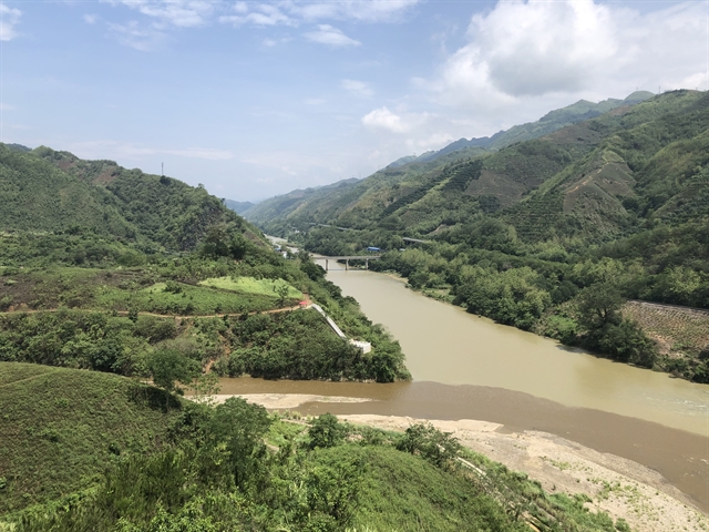
Down there is a sandy place in the conjunction between the small stream flowing from A Mú Sung Mountain and the Hồng River flowing from the north.
That’s the very place where the Hồng River starts its 510km journey into Việt Nam, through 9 provinces and cities before pouring into the sea at Ba Lạt River Mouth in the northern province of Nam Định.
|
| Green fields run down the valley. — Photo triphunter.vn |
On a nice morning, the river junction is full of bright sunlight. Standing on the flag tower, one can see mountains and clouds in the far distance. Lũng Pô Village is full of tranquil houses and a road runs beside the river all the way to the plain.
Lũng Pô Flag Pole is the symbol of this area, which was built using individual donations in December 2017.
The tower is 41m in height. The flag hung on top is 25sq.m, which symbolize the 25 ethnic groups in Lào Cao Province.
“Standing by this flag pole, I remember Lũng Cú Flag Pole in the northernmost pole that I have visited,” said Bùi Kim, a visitor from Hà Nội. “In my memory also appears roads to Xín Cái-Mèo Vạc Guarding Peak or border points in Cao Bằng in the early 1980s, where the fight to protect the northern border was fierce.
“In any circumstances, border lands have brought along special feelings to patriots,” he said.
A Mú Sung Border Station manages the flag pole and 27km border in two communes of A Mú Sung and Nậm Chạc. The area covers more than 1,000 people of various ethnic groups including Mông, Dao, Giáy, Hà Nhì and Kinh.
|
| The river junction is the very place where the Hồng River starts its 510km journey in Việt Nam, through 9 provinces and cities before pouring into the sea at Ba Lạt River Mouth in the northern province of Nam Định. — VNS Photo Trần Mai Hưởng |
Forty soldiers and officers at the station fulfill many tasks like controlling the border; preventing smuggling and supporting economic development.
They have spent many days volunteering for the locality and each of them spares VNĐ100,000 each month to support six needy children in the locality. Three of the children live with them at the station.
Over 30 poor families have received piglets to raise as gifts from the station.
“Lũng Pô has received more and more visitors,” said Đào Văn Ninh, head of Lũng Pô Border Station. “Lũng Pô is just next to Y Tý, which is like a small tourism-hub Sa Pa of Bát Xát District.”
“Many tourists come to the site at holidays,” he said. “I hope local authorities will soon draft a plan on a large-scale tourism site here, which may bring along new advances in economic development for the whole area.”
A night out by a bonfire at Lũng Pô Peak to get up early to see the sunrise at the source of the Hồng River may be a fresh experience for adventurers. — VNS


